
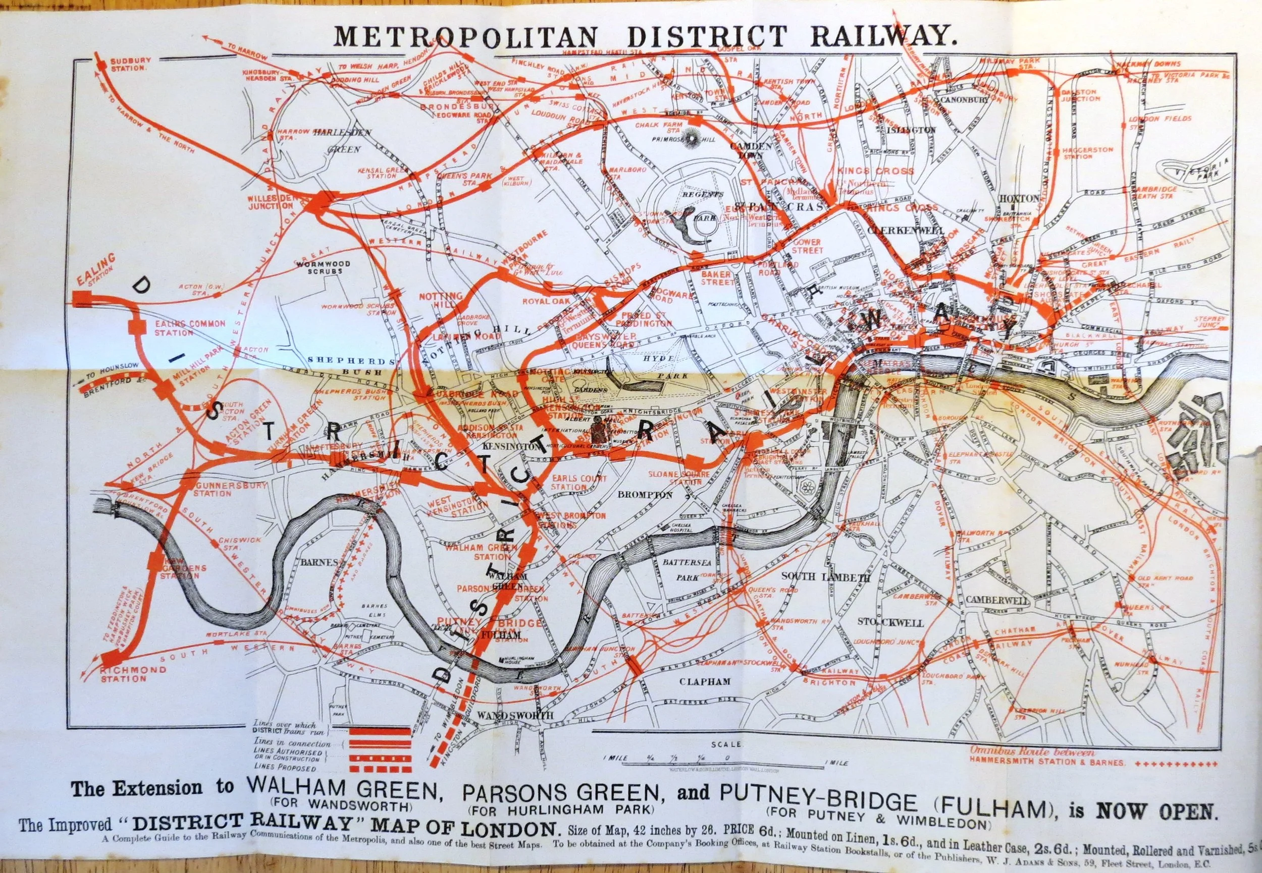

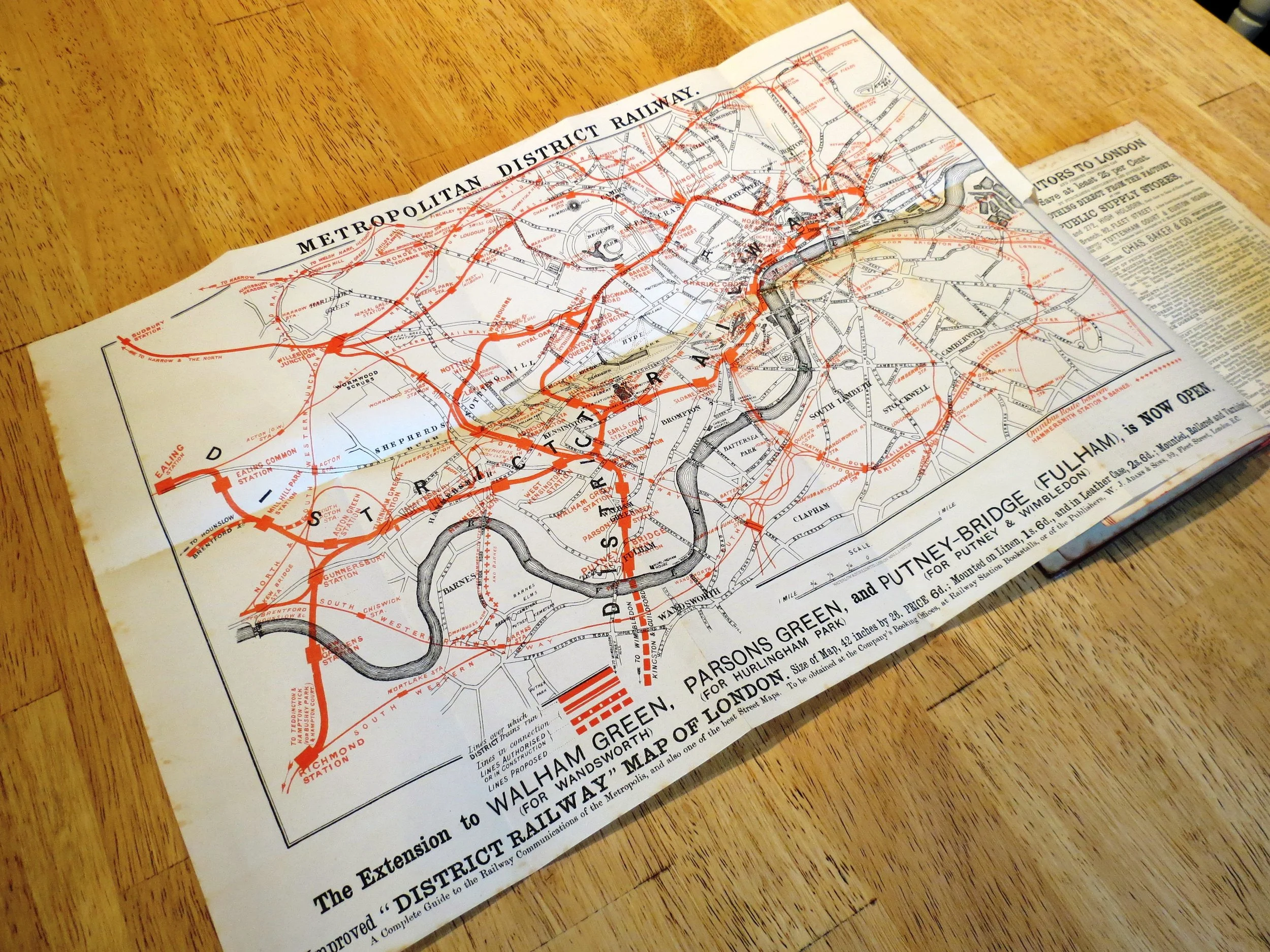
1880 Metropolitan District Railway Map
Metropolitan District Railway Map c.1880
Lithograph on paper. Two-colour lithograph. Folded paper map, map of London on verso. Attached to guide book dated 1878.
Third revision of the earliest known pocket-sized map published by the Metropolitan District Railway (MDR - later known as simply the ‘District Railway’). This two-colour map paper format would be used by the DR right up until 1927.
The proposed Inner Circle Completion Line is shown as a red dashed line (opened in 1884). The District Railway is now labelled with black lettering along the line to distinguish itself from the Metropolitan Railway. The text below the map announces that the line to Putney Bridge is ‘now open’ (1880) which aligns to the date of the large format map that is being advertised below (Improved issue released in 1879).
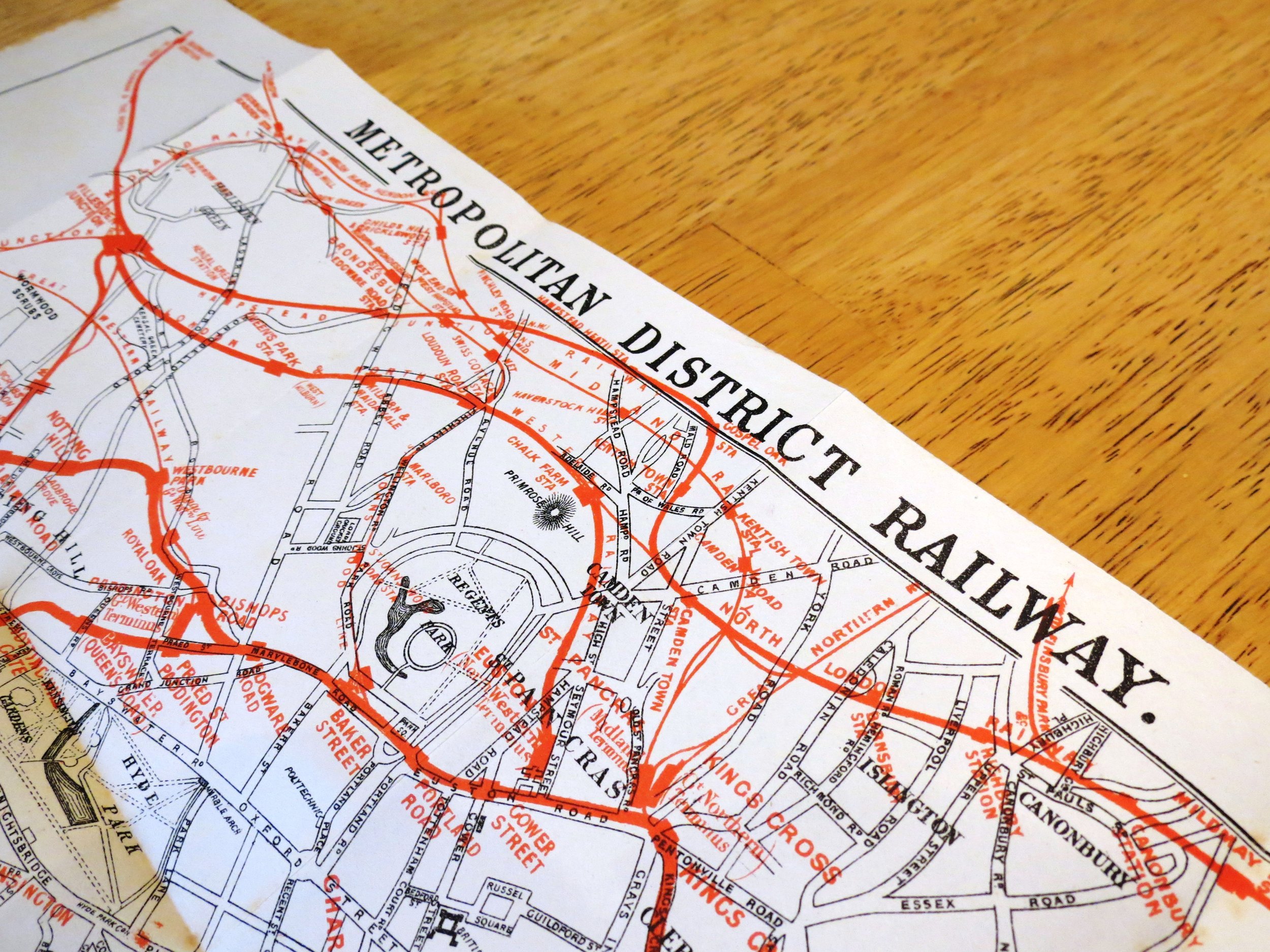
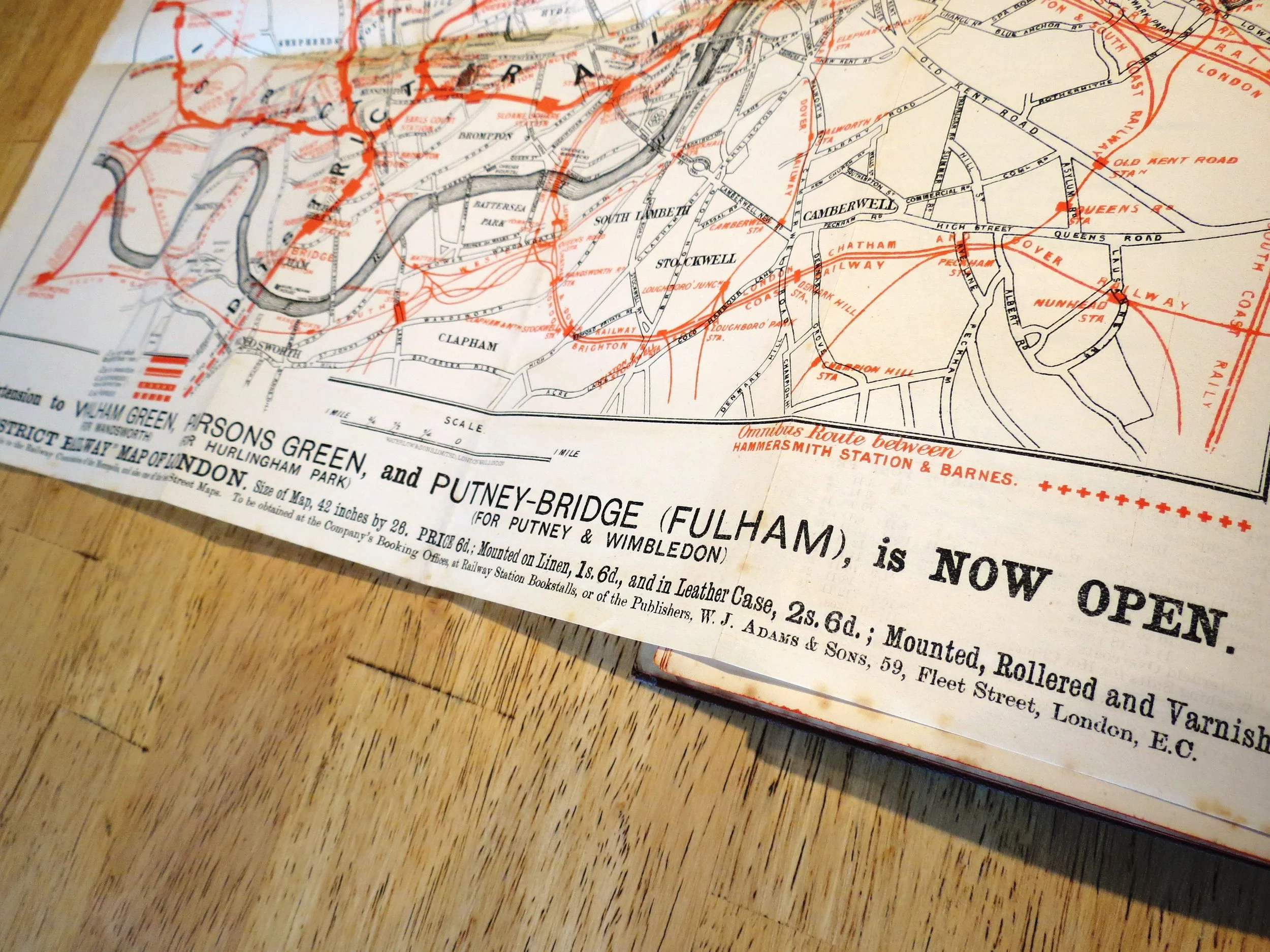
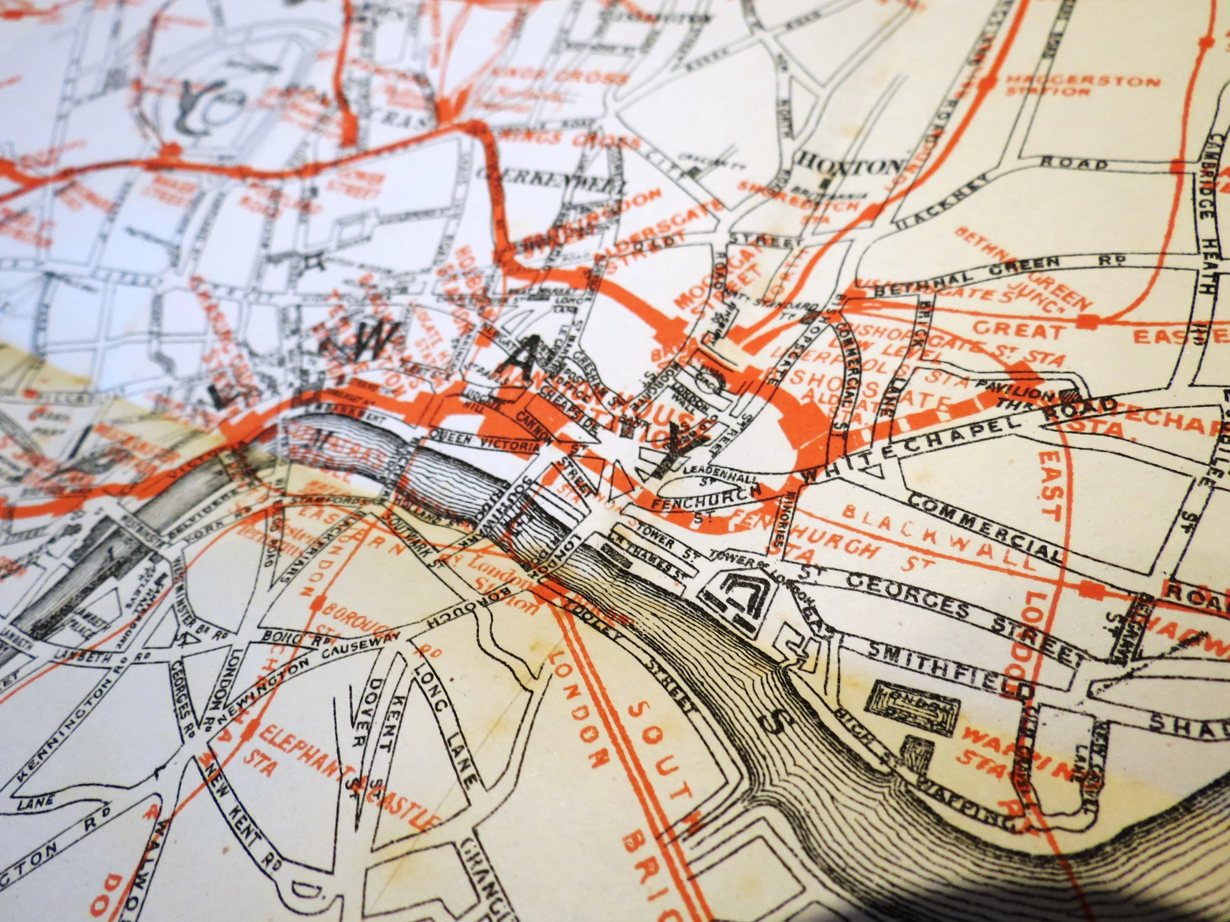
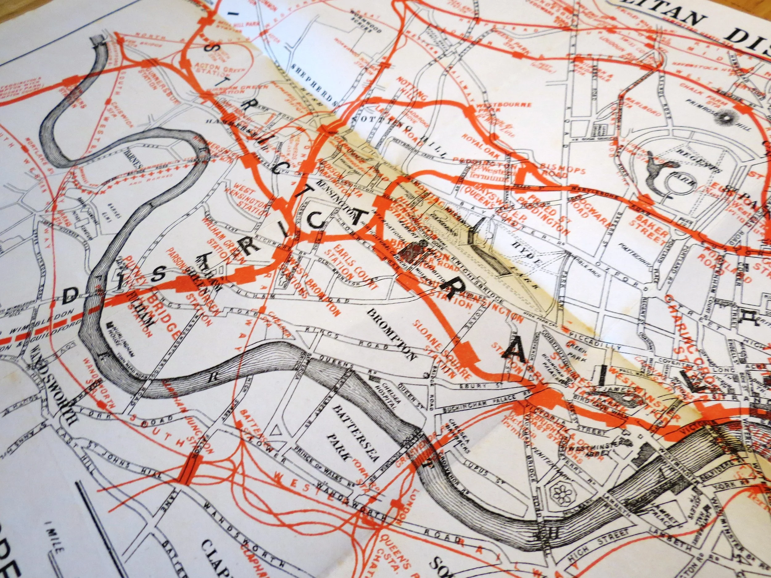