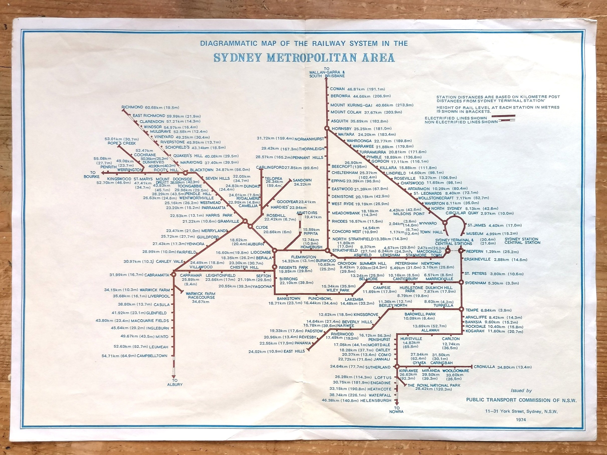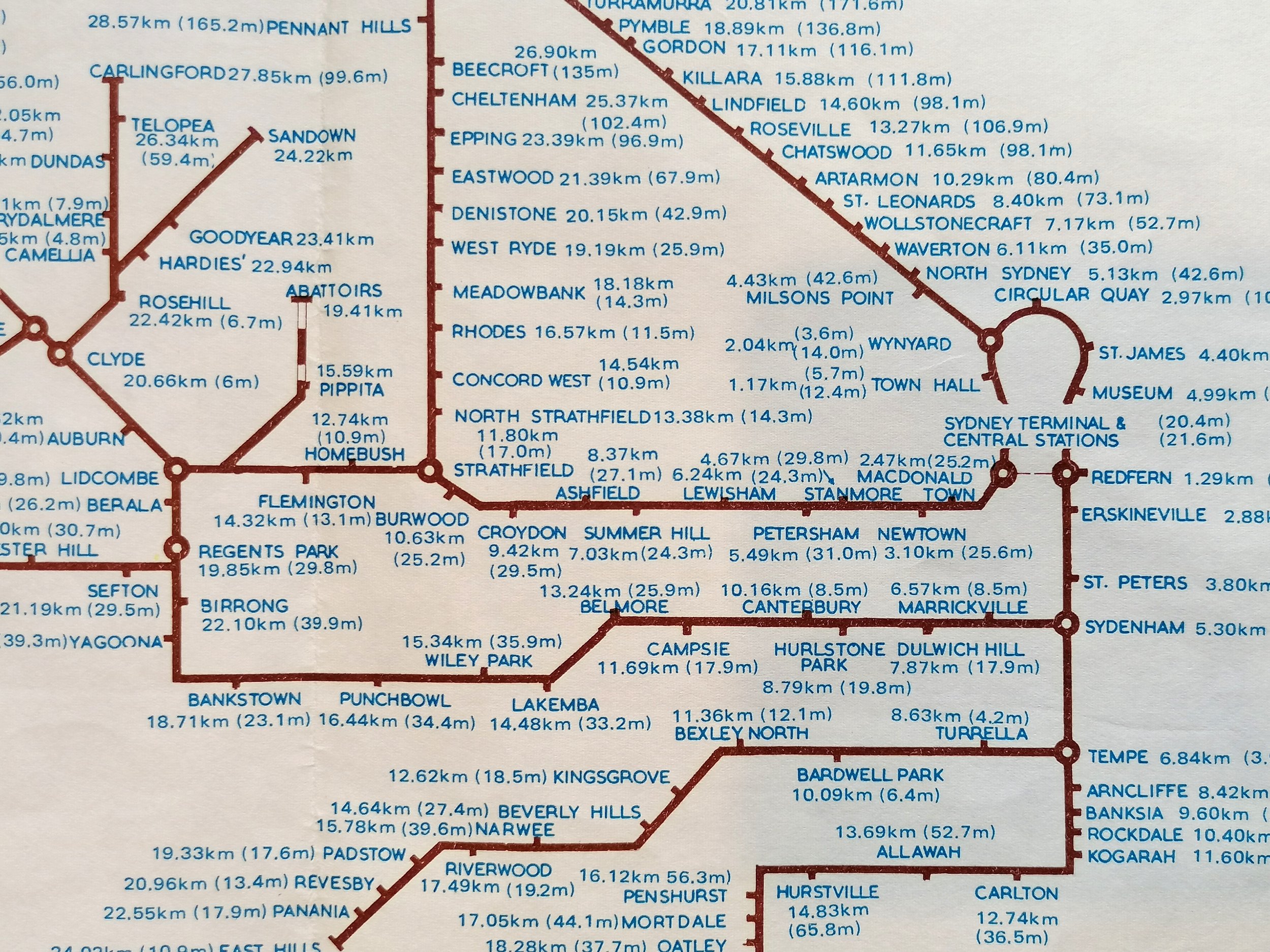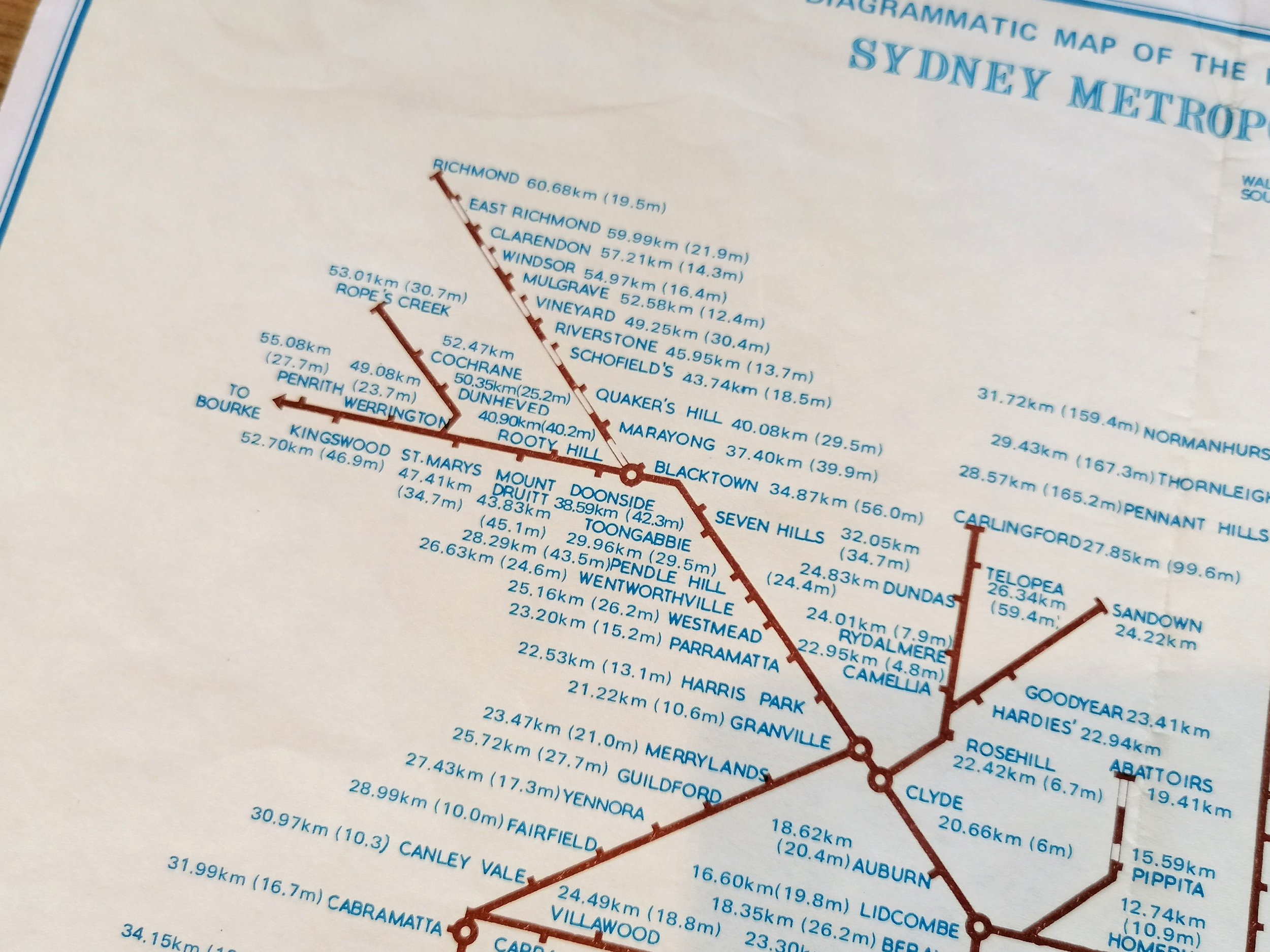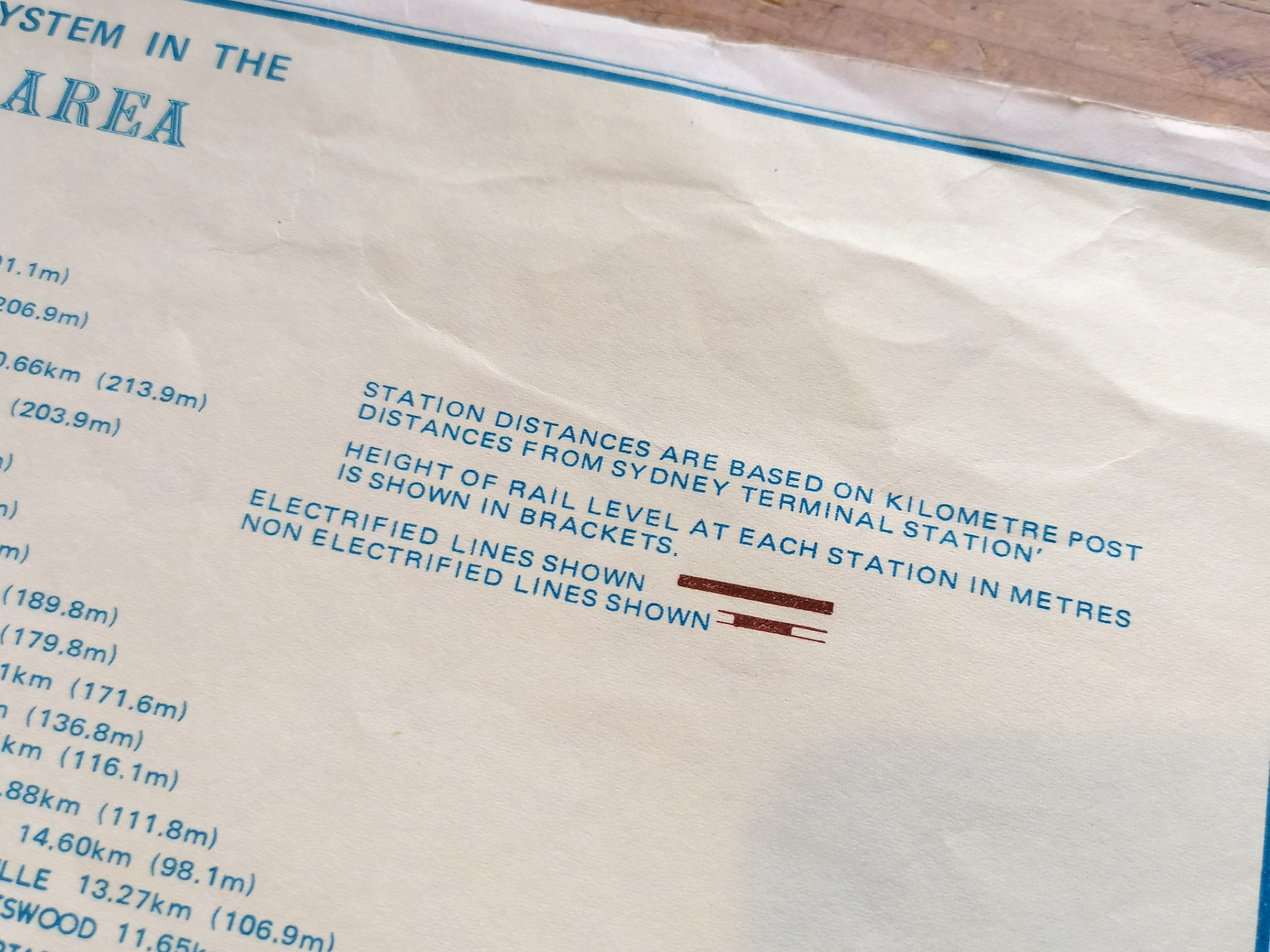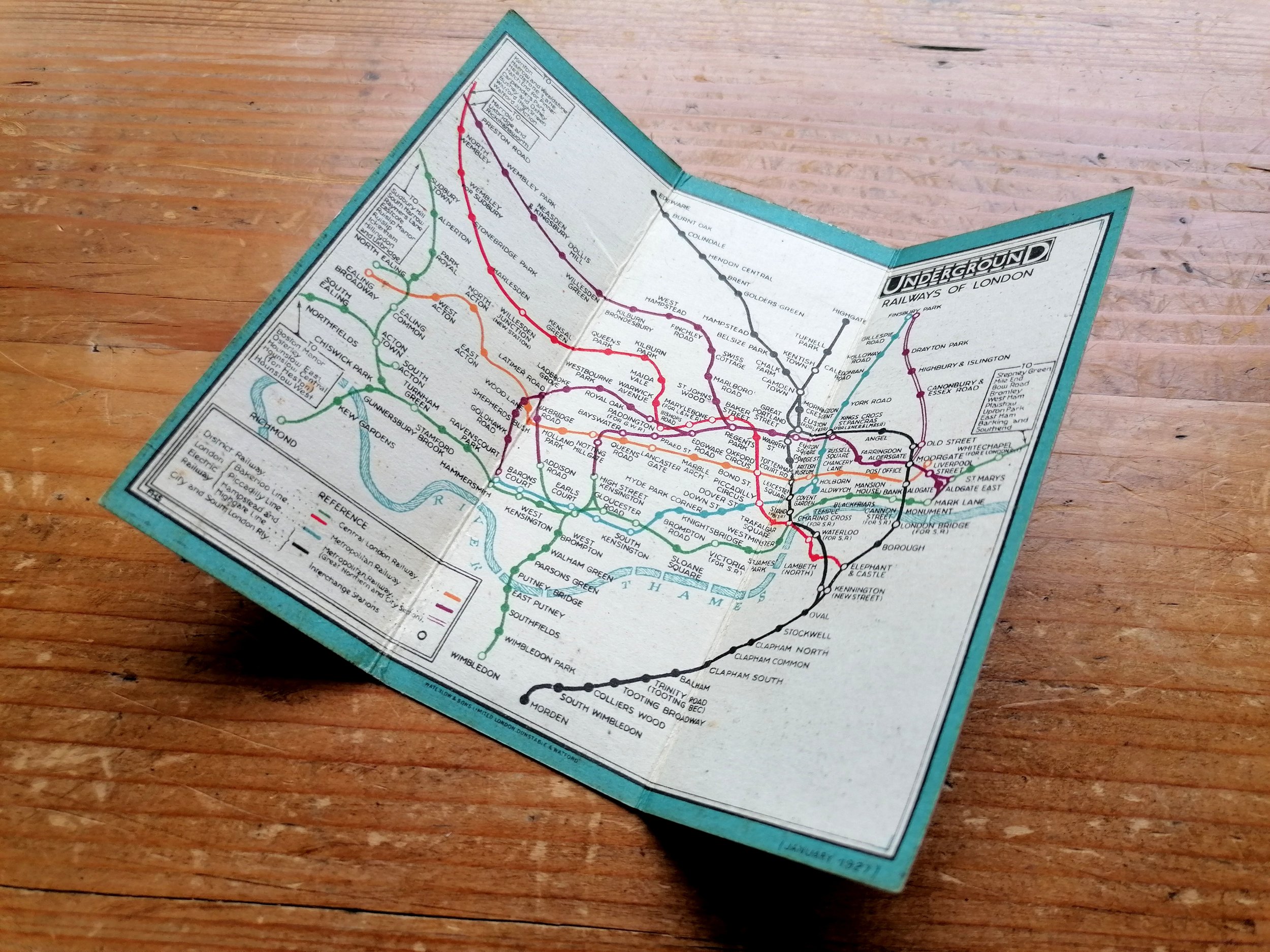


1932 London Underground 'Quad Royal' Station Map - Manuscript additions by HC Beck
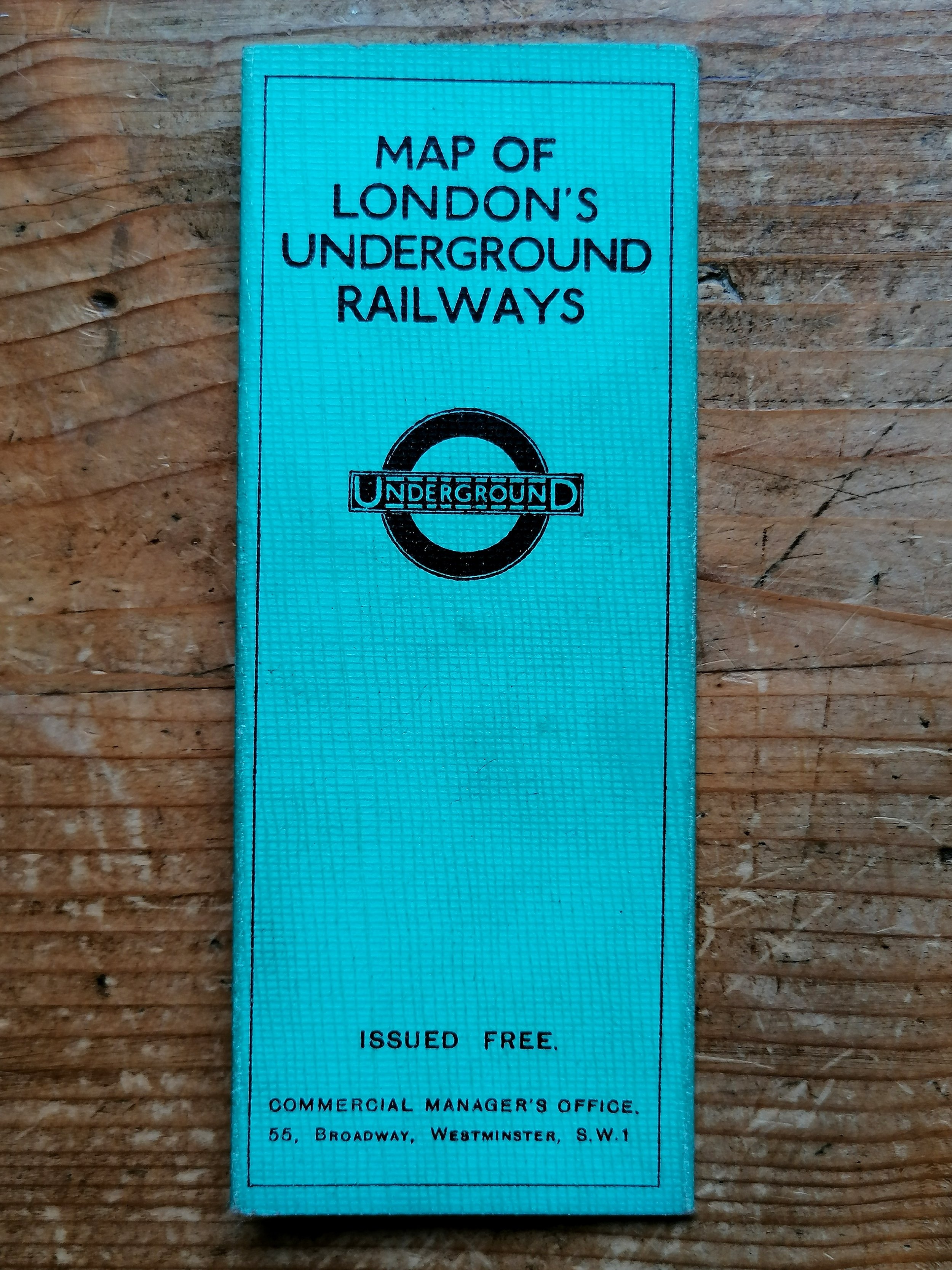
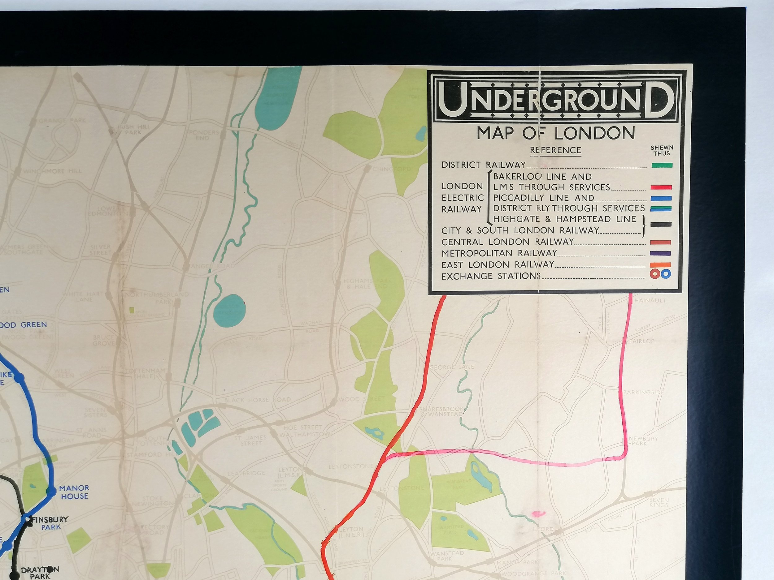
Underground Map of London
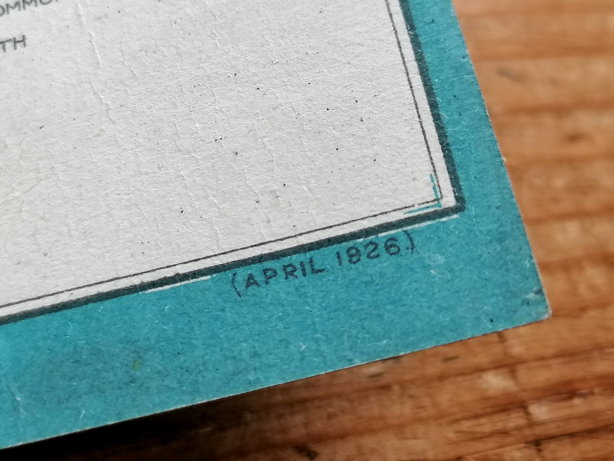
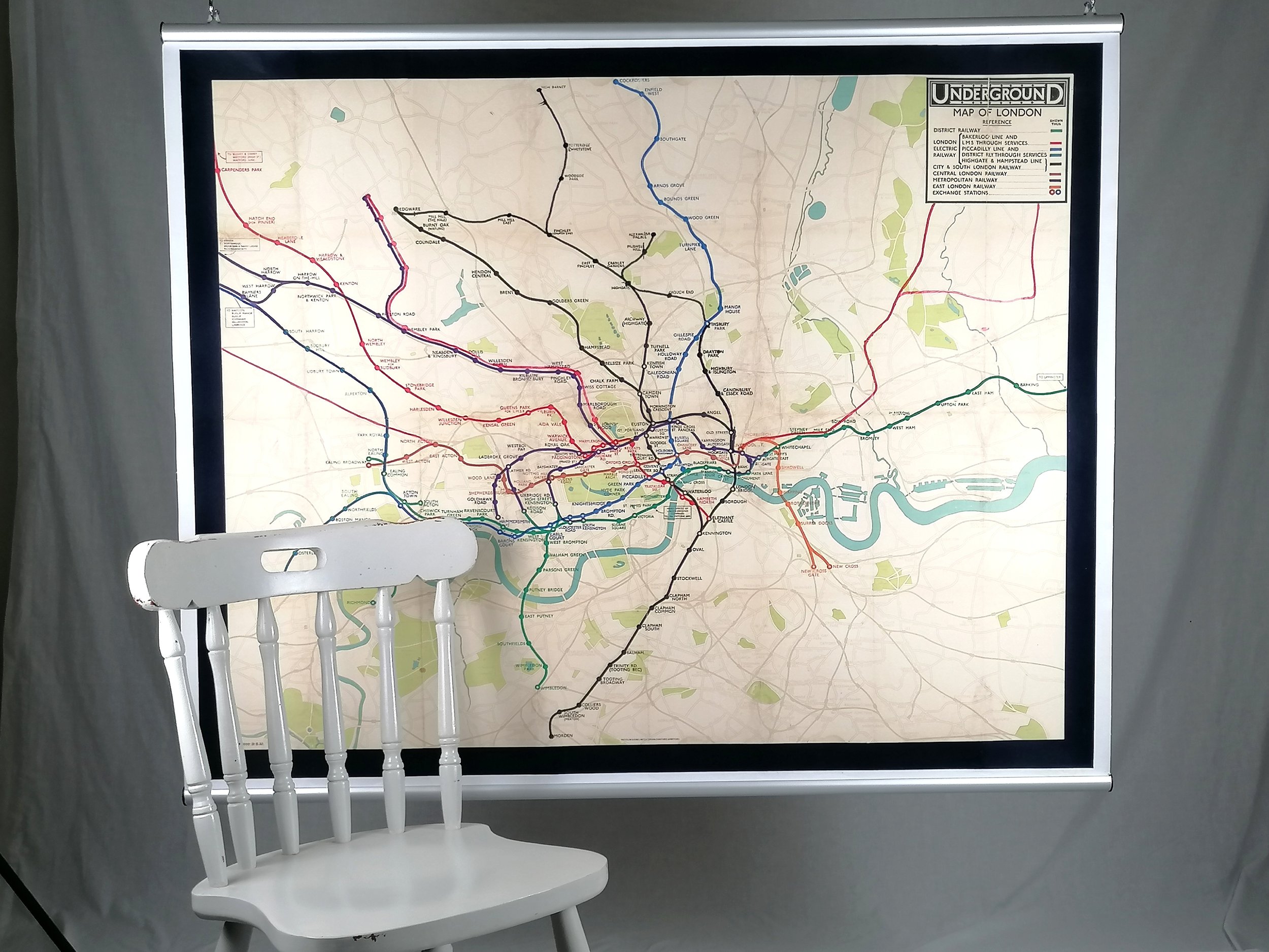
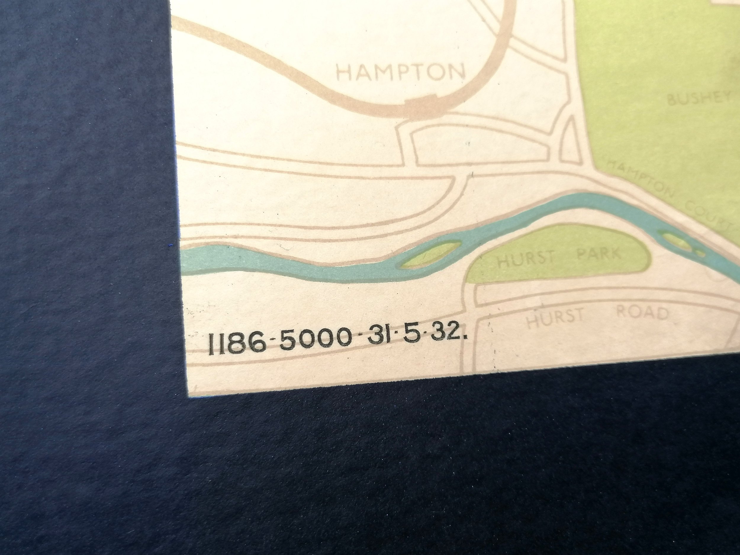
Designed by Fred Stingemore with manuscript line extensions and stations by HC Beck. Printed by Waterlow & Sons for London Underground Group. Colour lithograph on paper. Quad Royal format 50” x 40” / 127 x 101cm. Print Code 1186-5000-31.5.32. Outstanding condition following some light restoration. Backed on linen.
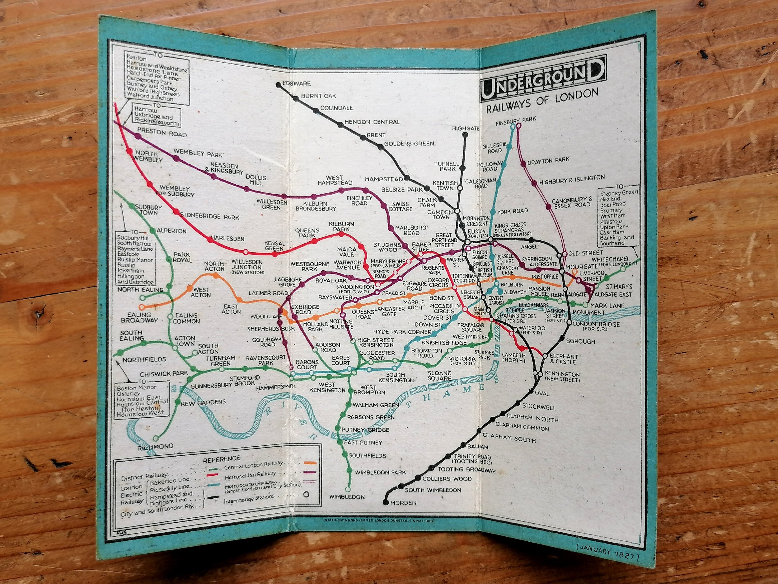
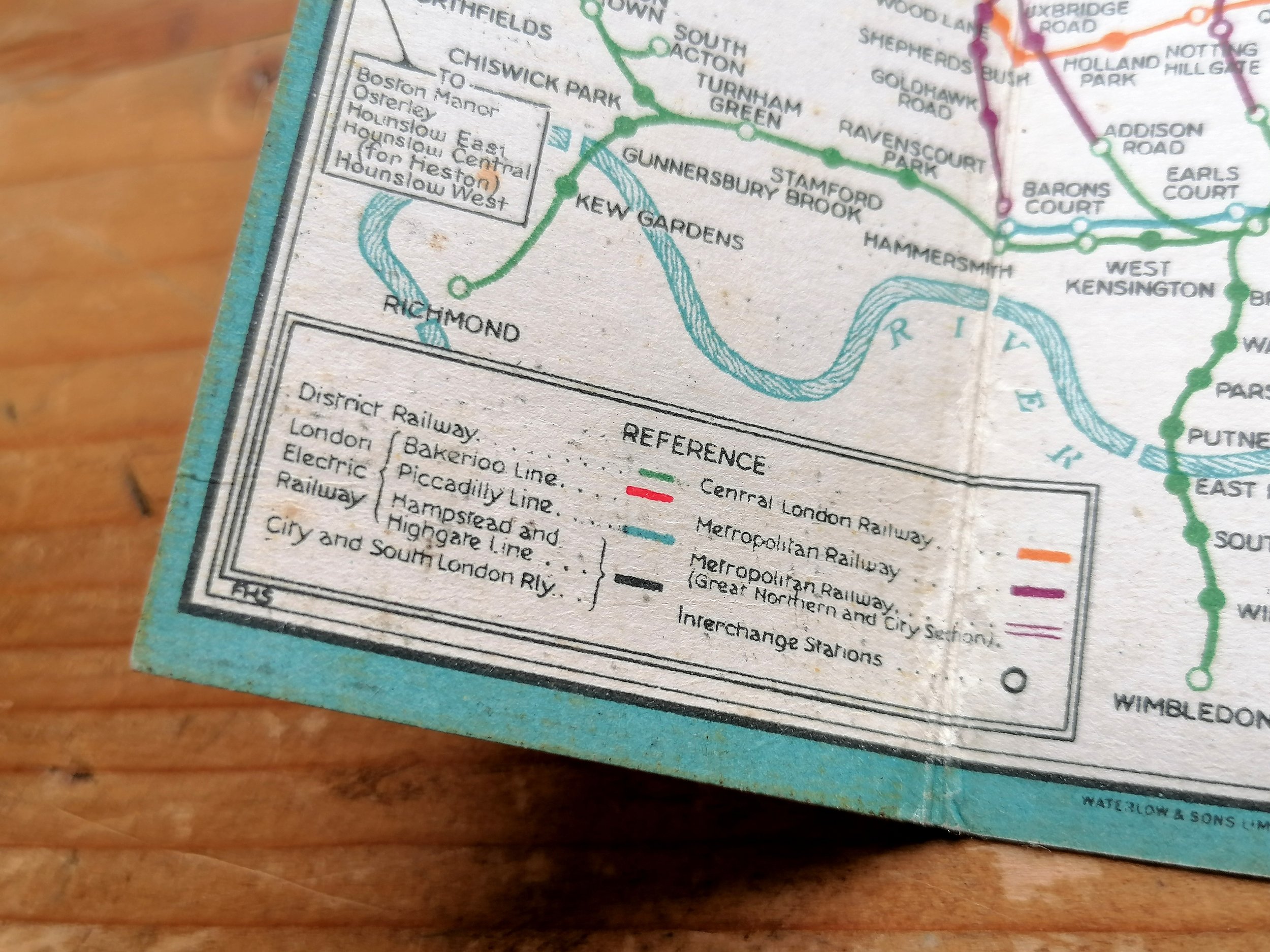
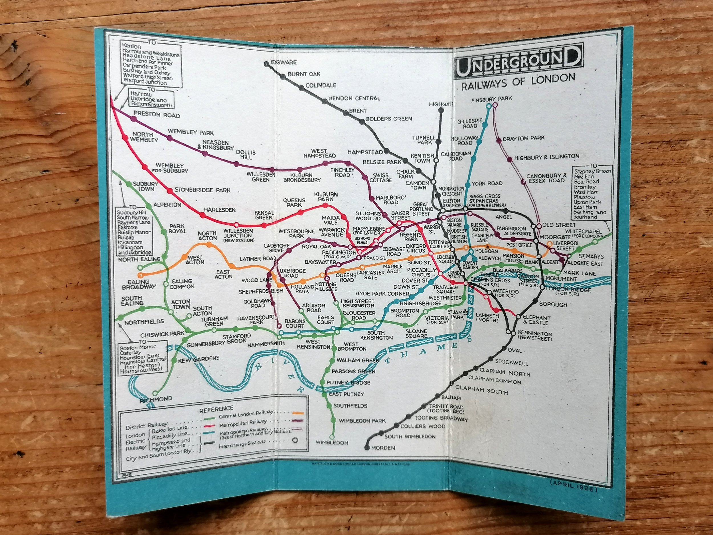
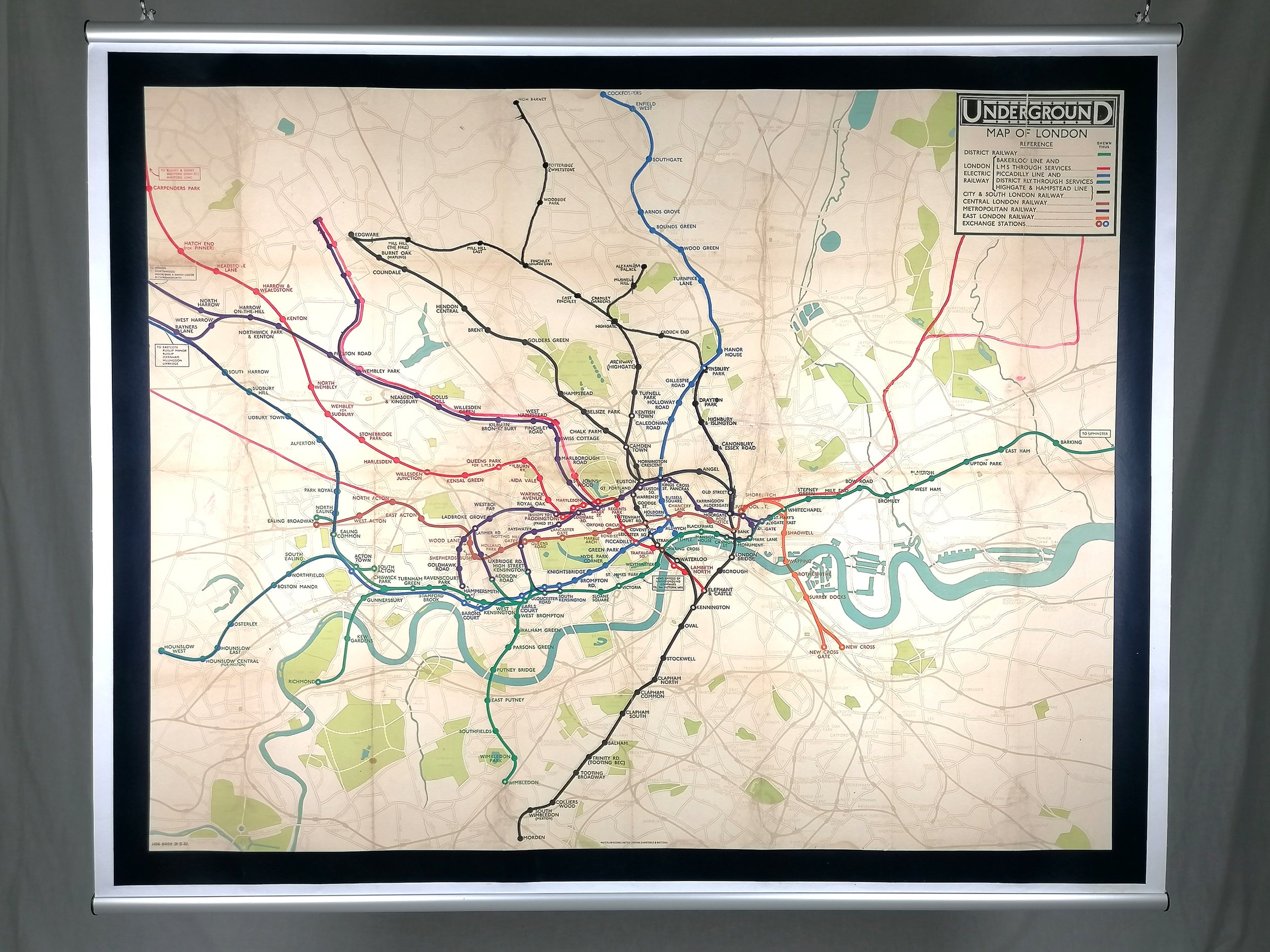
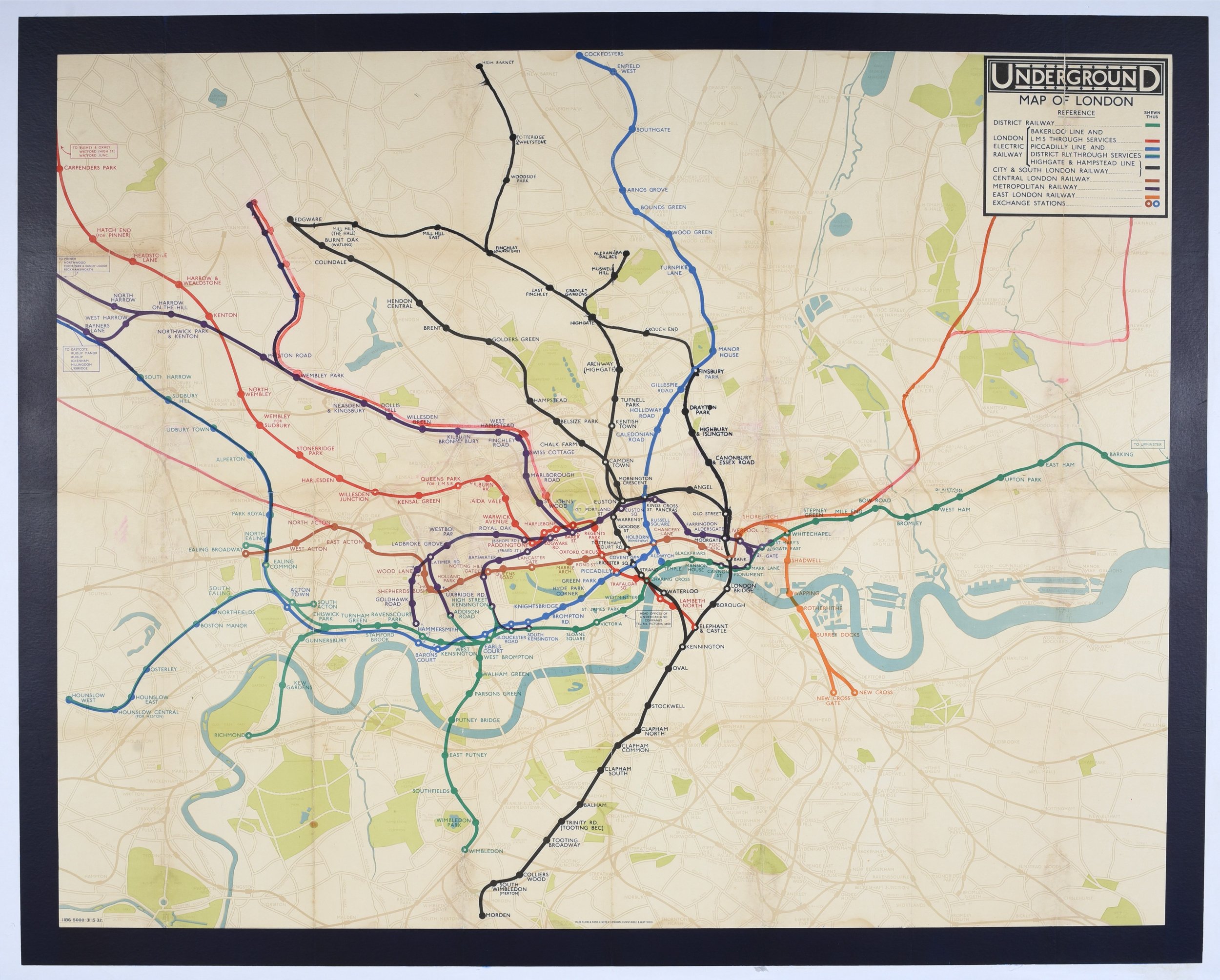
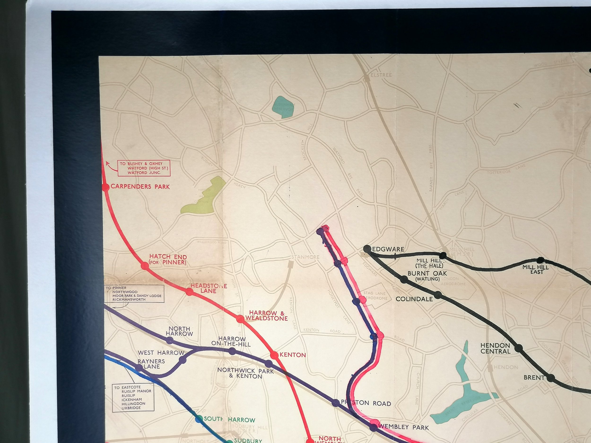
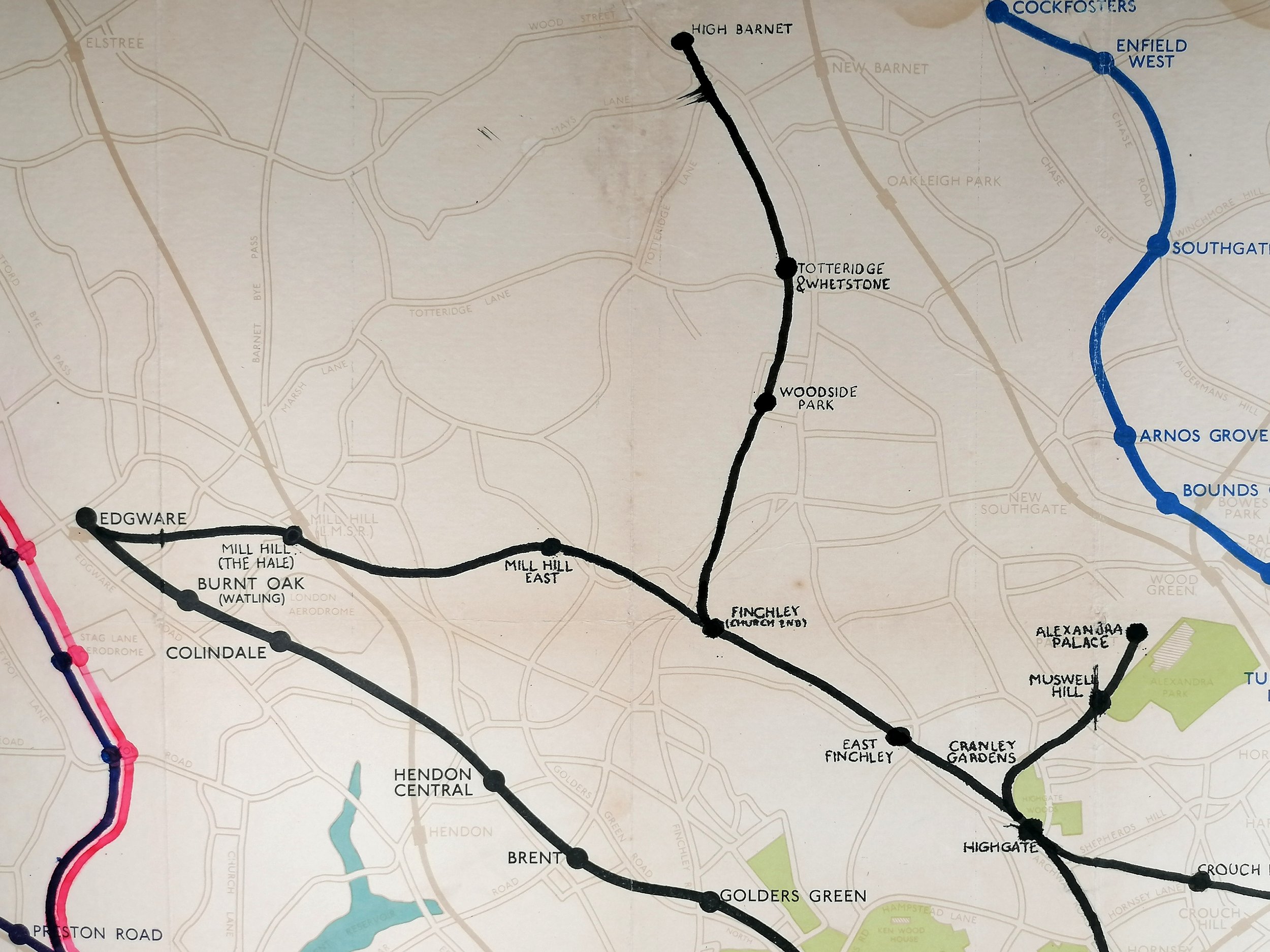
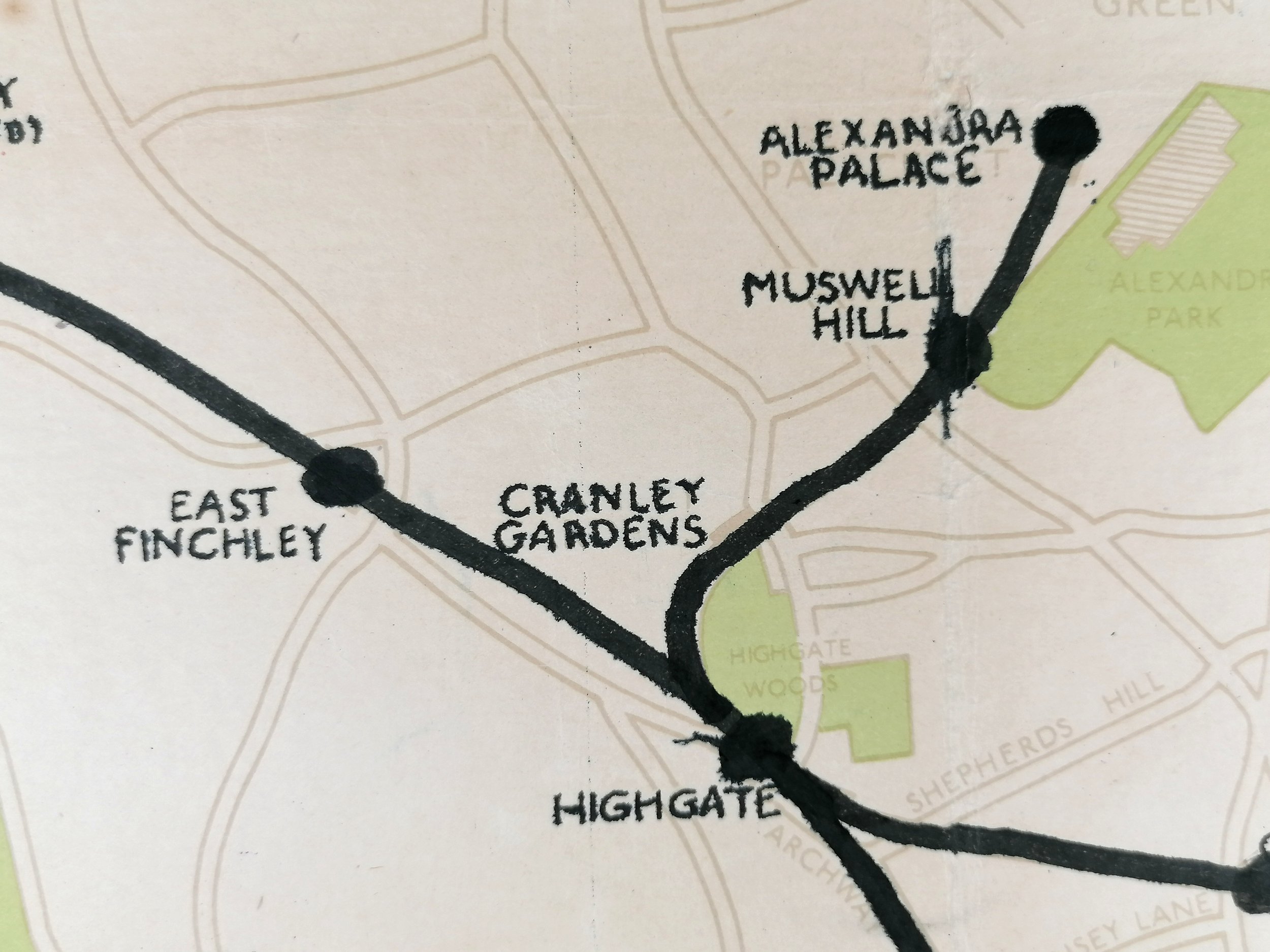
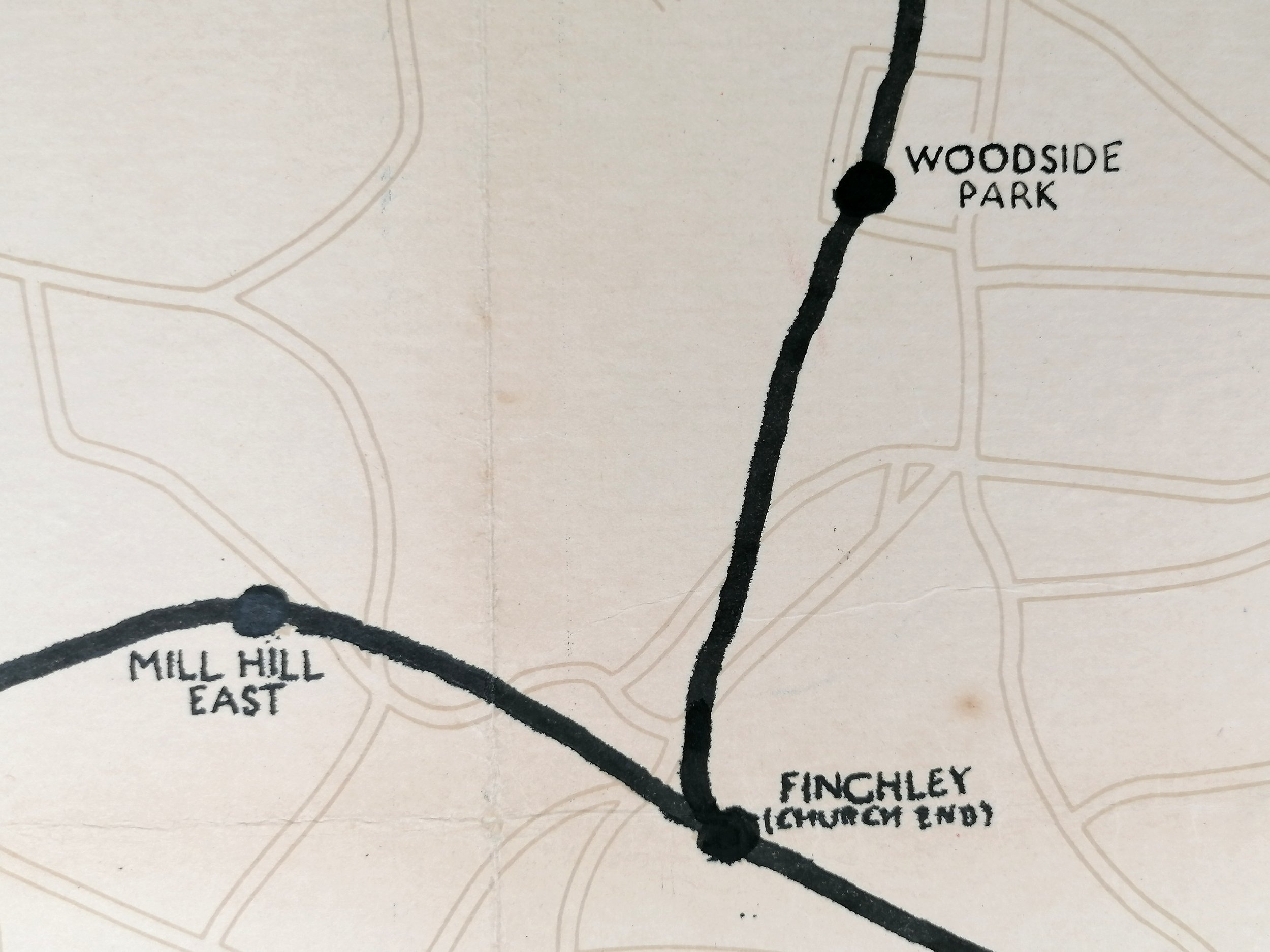
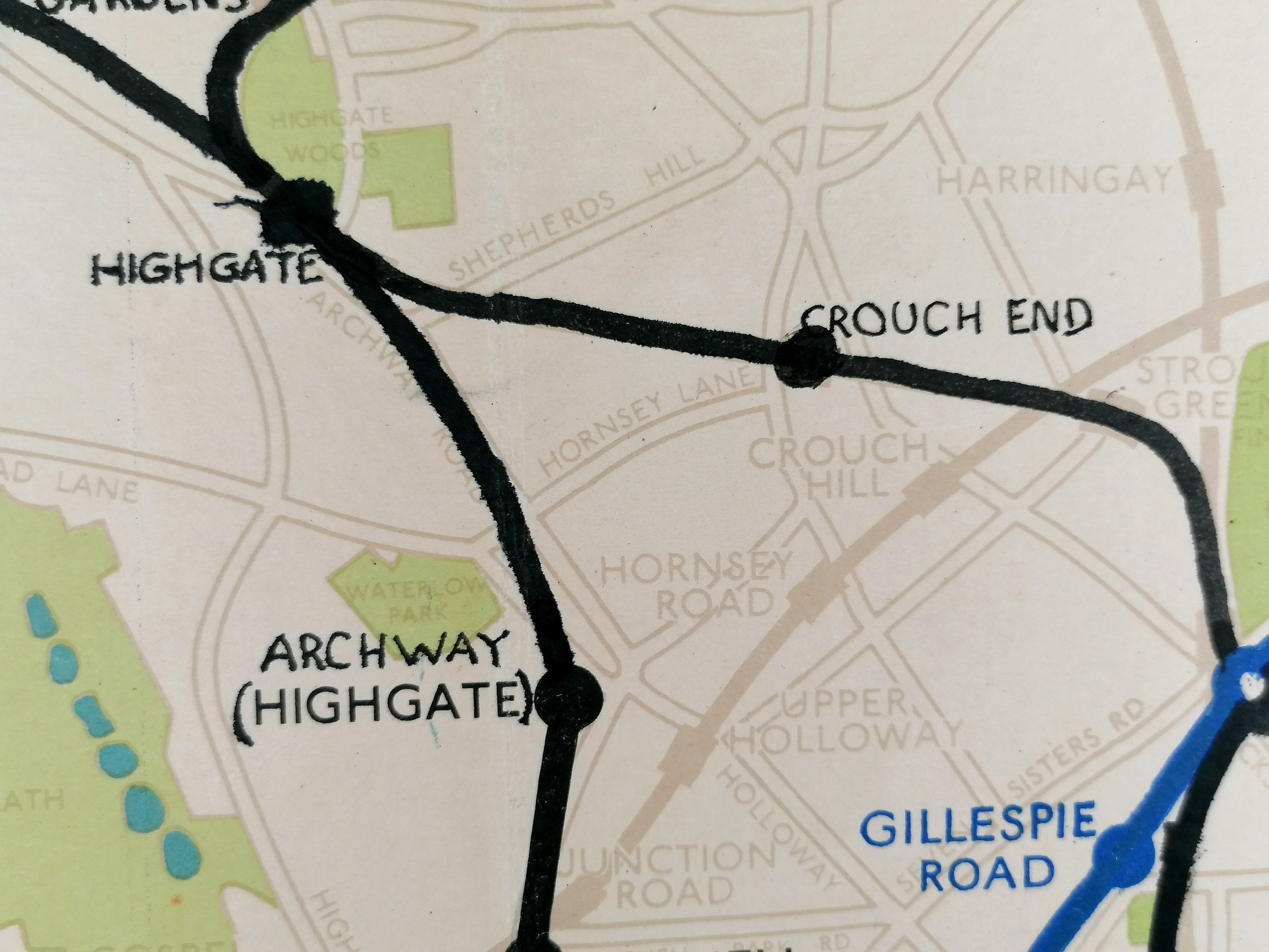
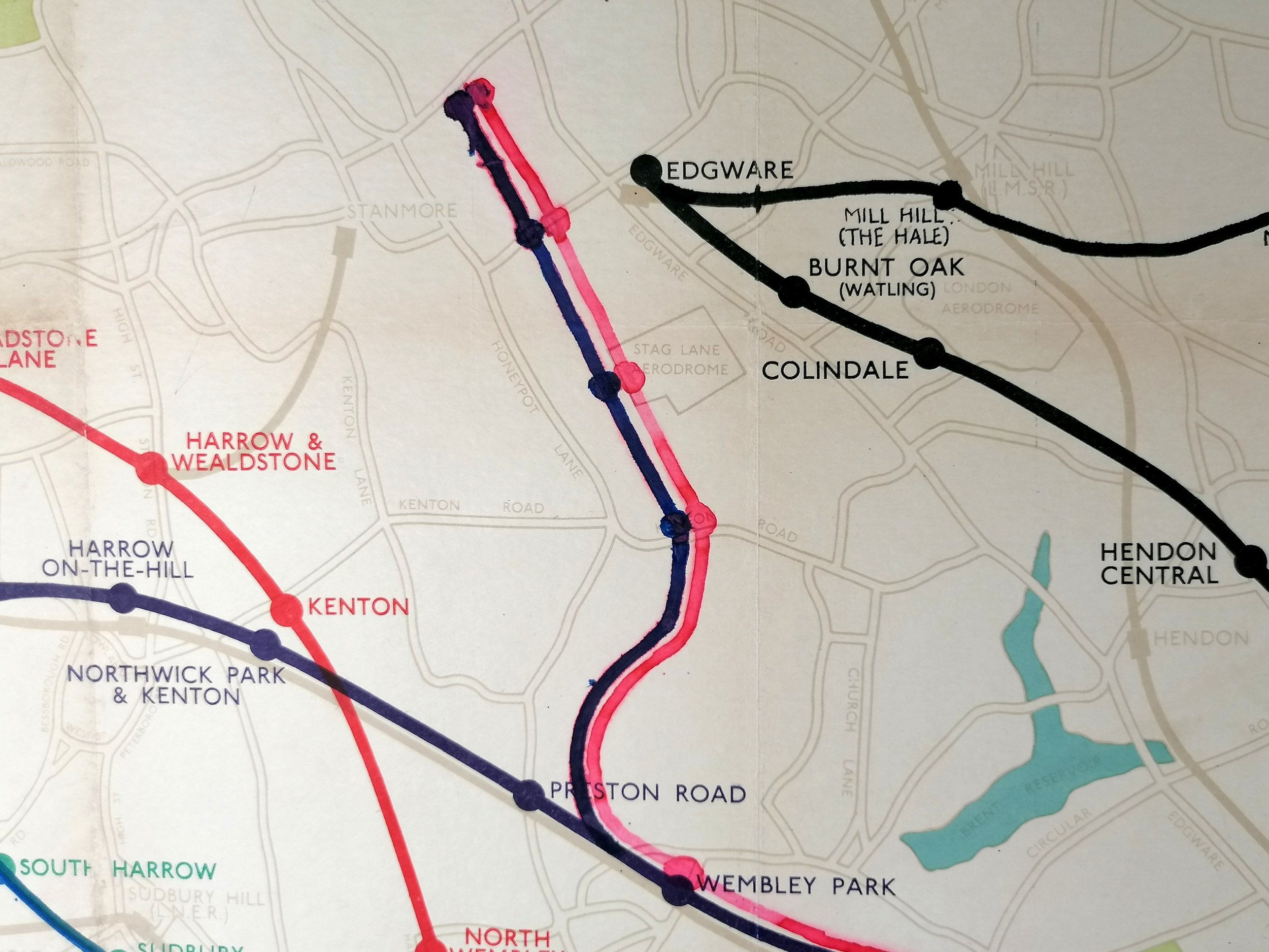
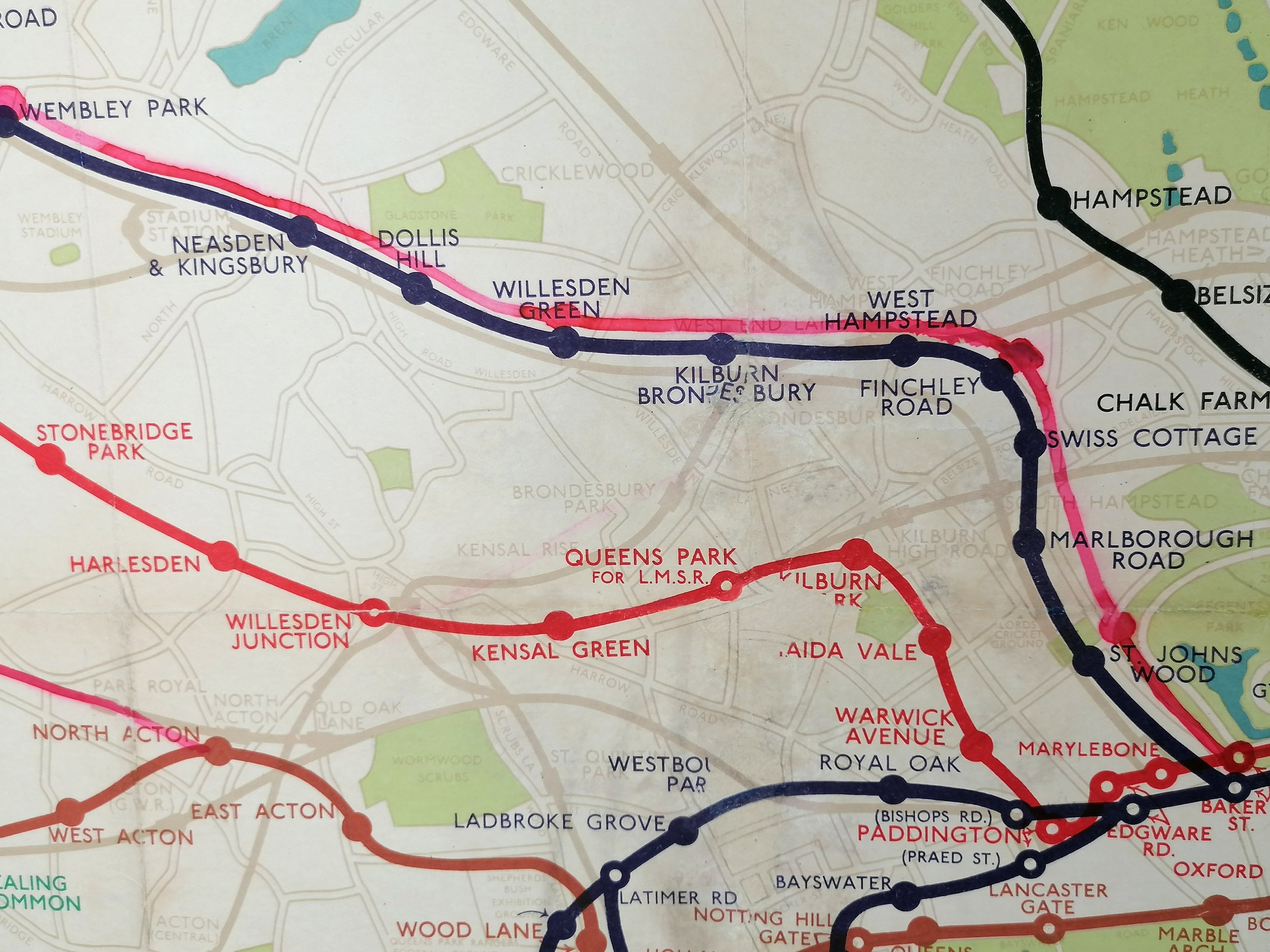
This rather special example of Fred Stingemore’s Quad Royal Underground map for 1932 features some hand-drawn line extensions relating to the 1935 New Works Programme. Through handwriting analyses, we have been able to identify the draftsman as Harry Beck, Stingemore’s colleague and creator of the iconic diagrammatic map of the Underground which was adopted just months after this map was printed (Jan 1933). A copy of this analysis is included in the sale.
Without an account from the time, we are left to speculate on when and why these draft lines were added. It is our prevailing theory that in around 1935, Beck began the process of updating his diagram to incorporate the New Works Programme extensions. Using a spare copy of Stingemore’s geographical map (which would have been in good supply around the Drawing Office), Beck drew the true path of the lines to serve as a visual aid for positioning them on his diagram. The extensions first appear as dashed lines on Beck poster-size maps from 1937.
The lines added to the map by hand are:
Northern Line (includes proposed station names): North to High Barnet (Opened 1940) with uncompleted sections Finchley to Edgeware and Hightgate to Alexandra Palace.
Bakerloo Line: North to Stanmore (Opened in 1939)
Central Line: West to West Ruislip and East to Ongar (Opened in 1948)
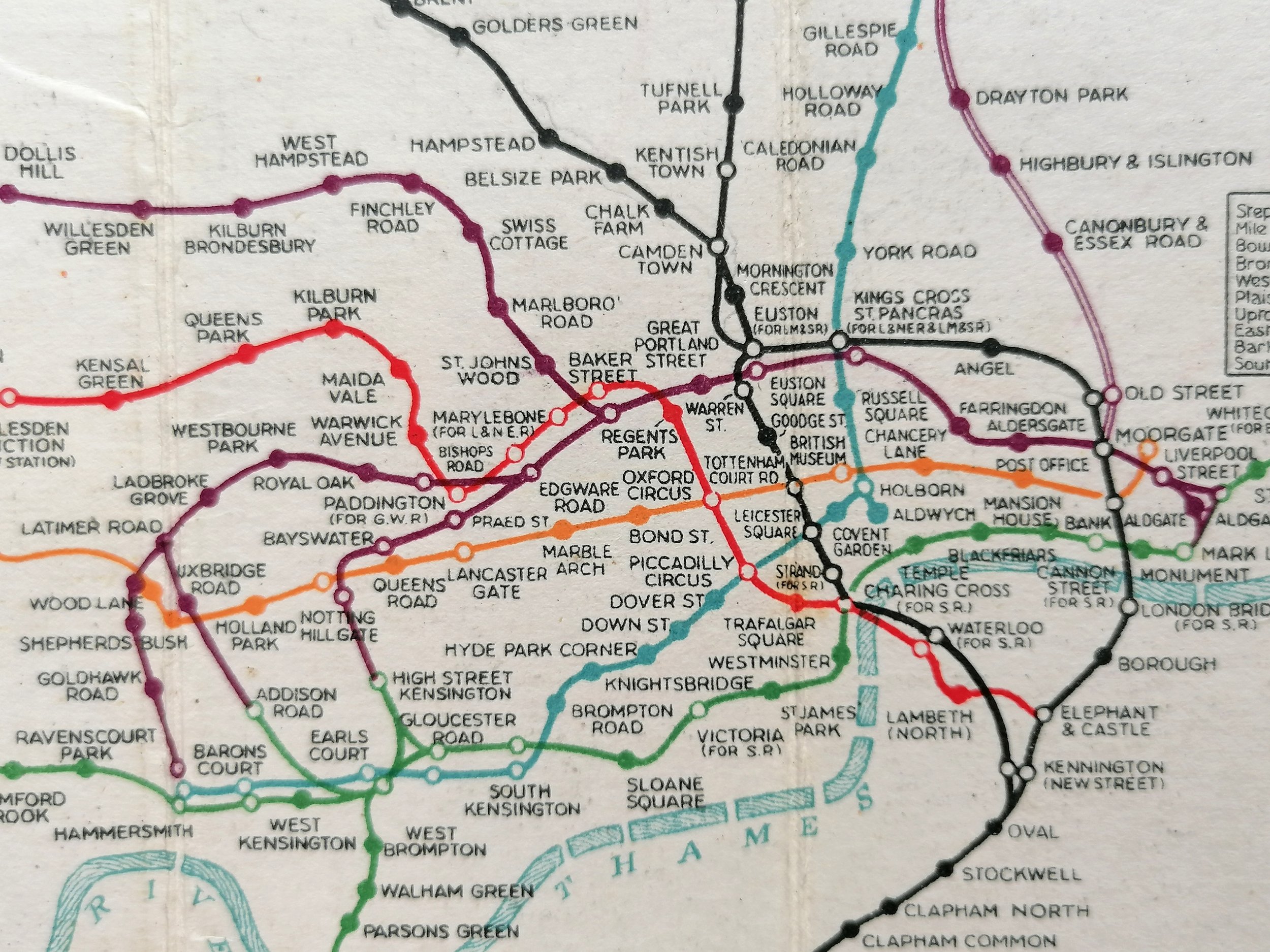
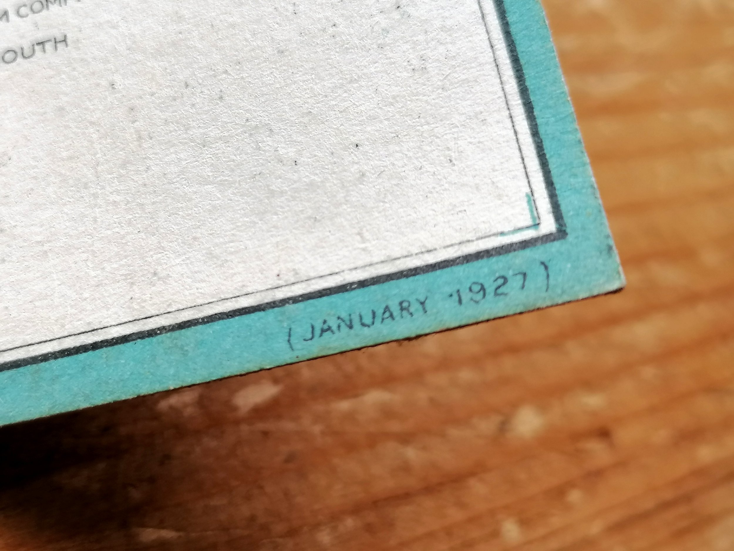
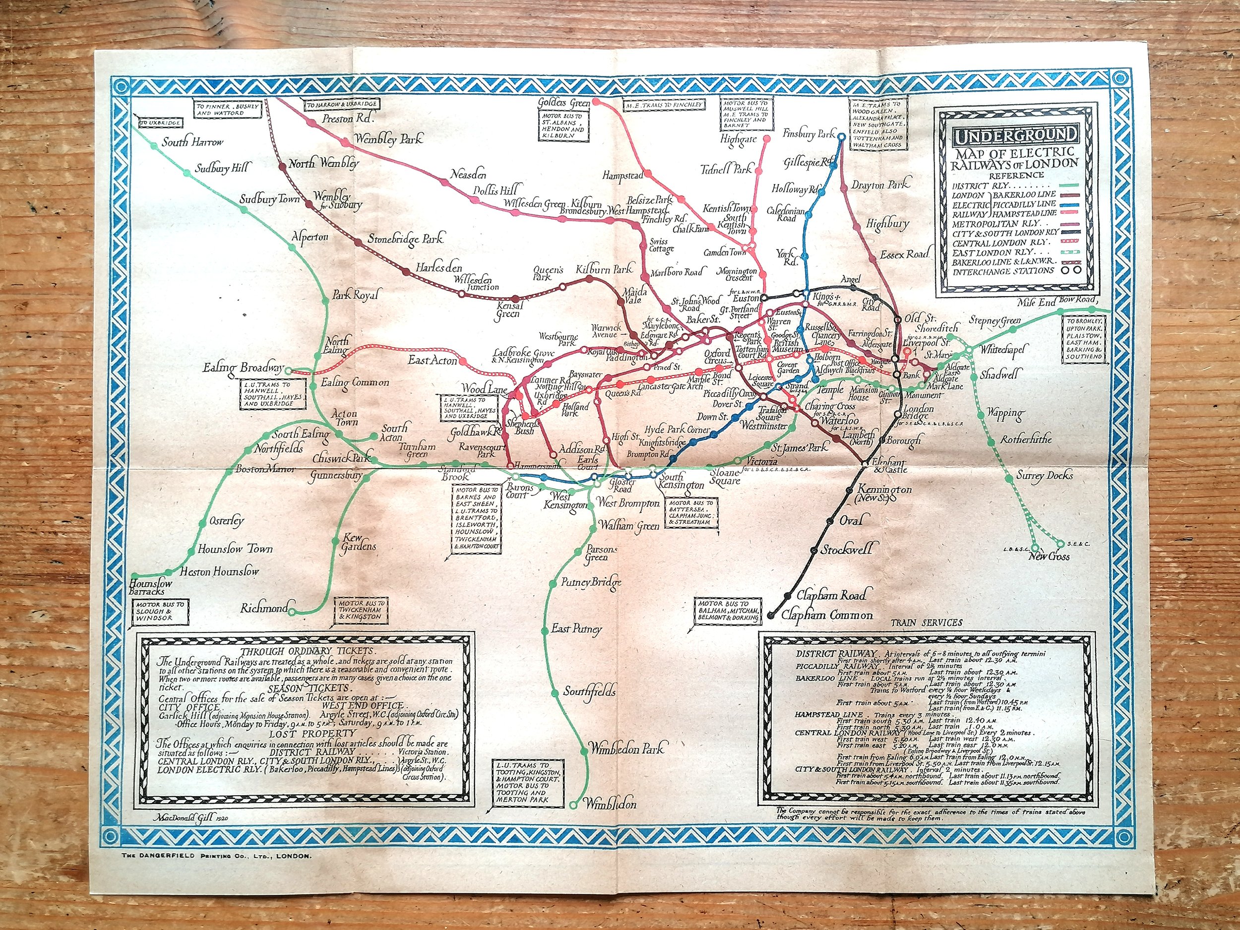
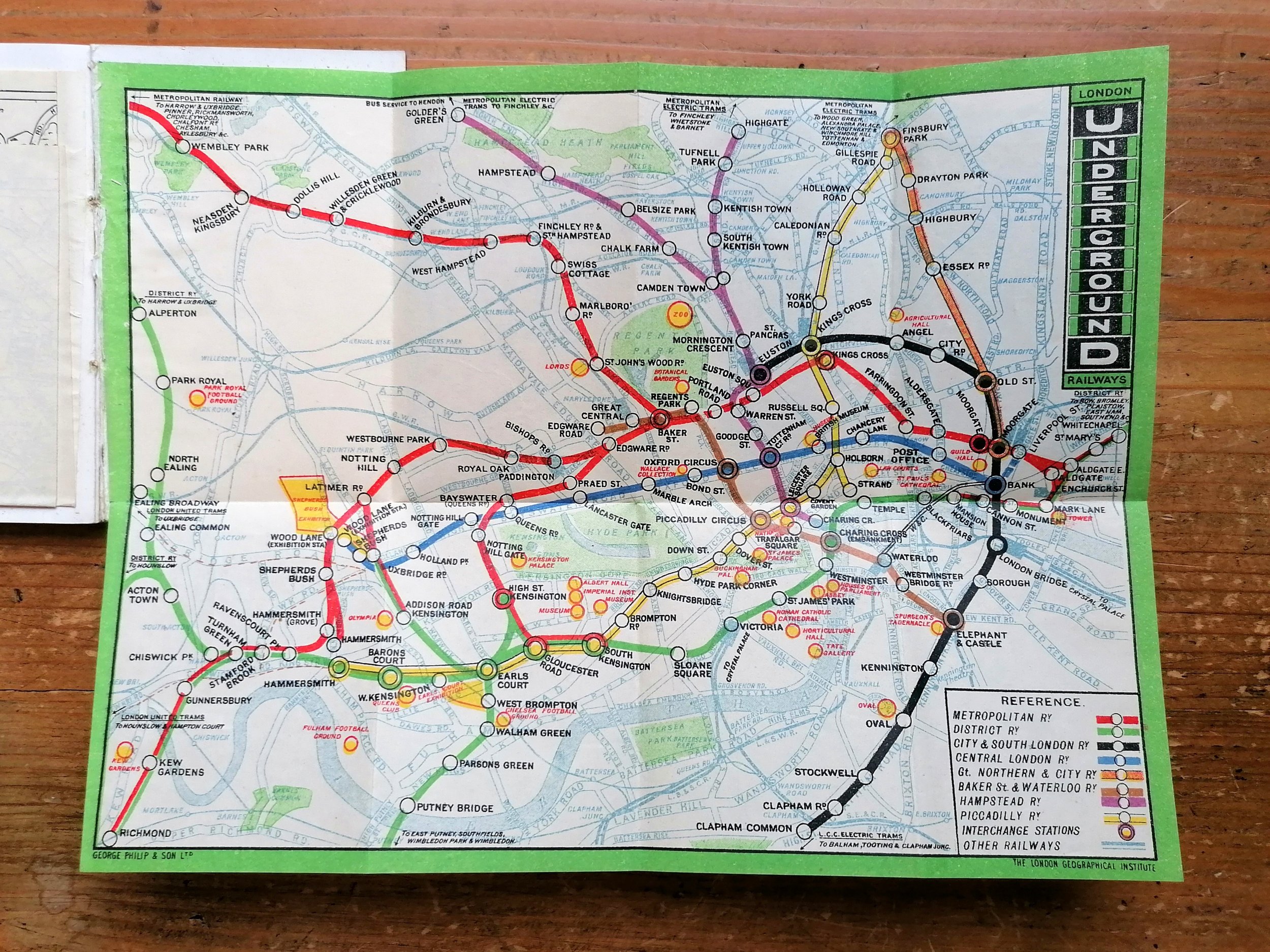
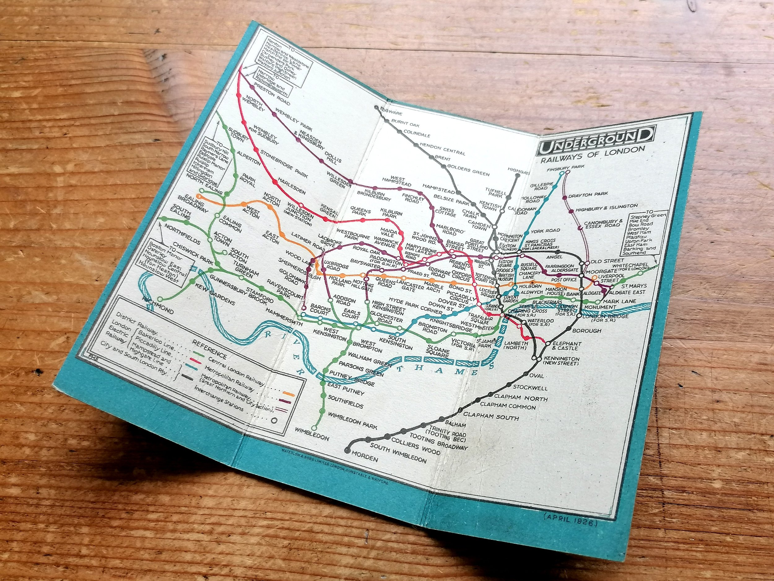
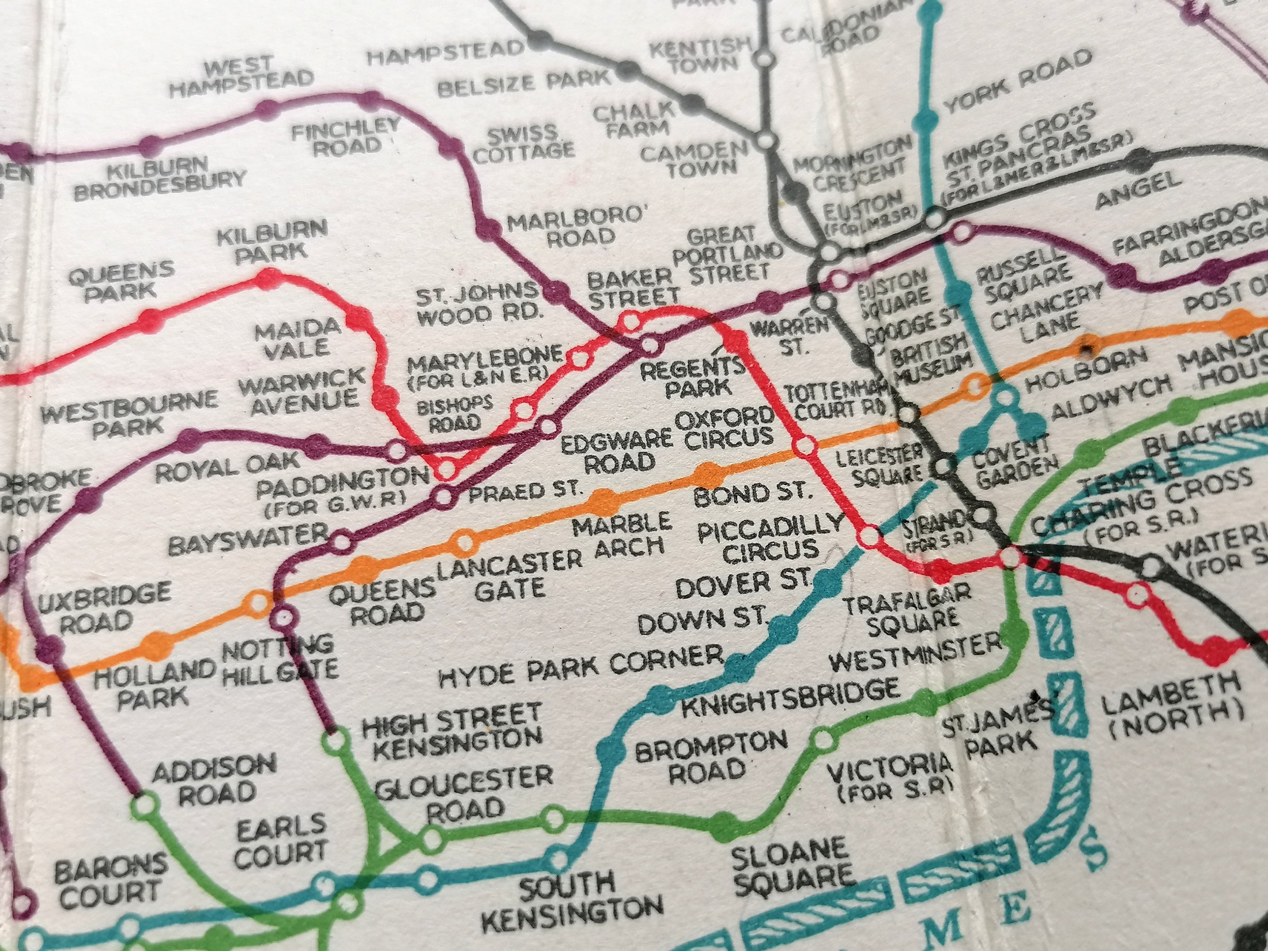
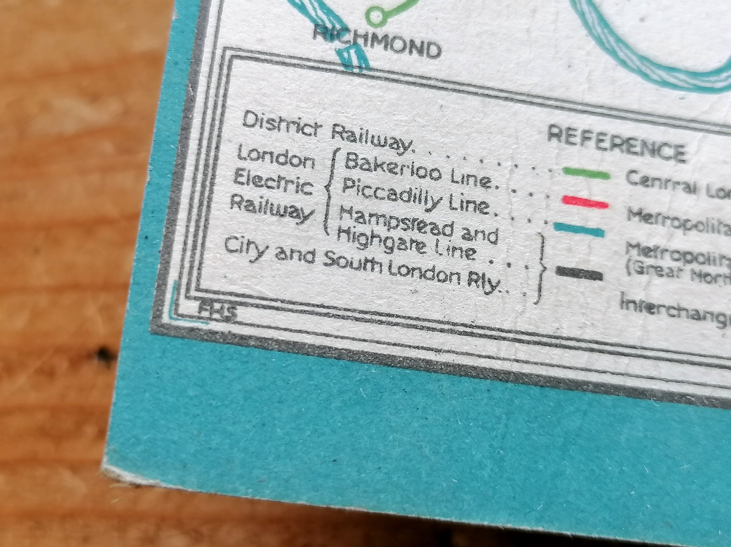
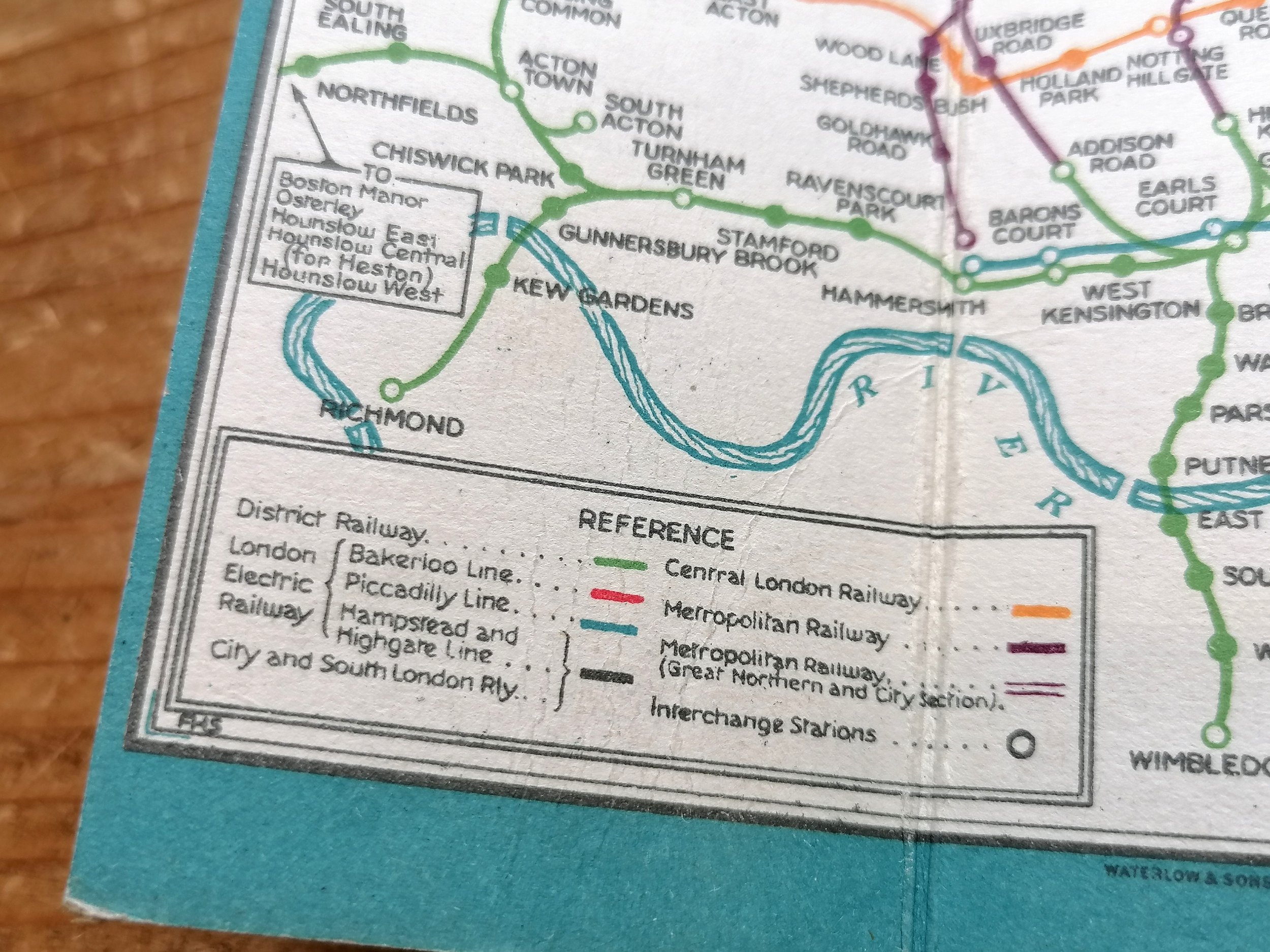
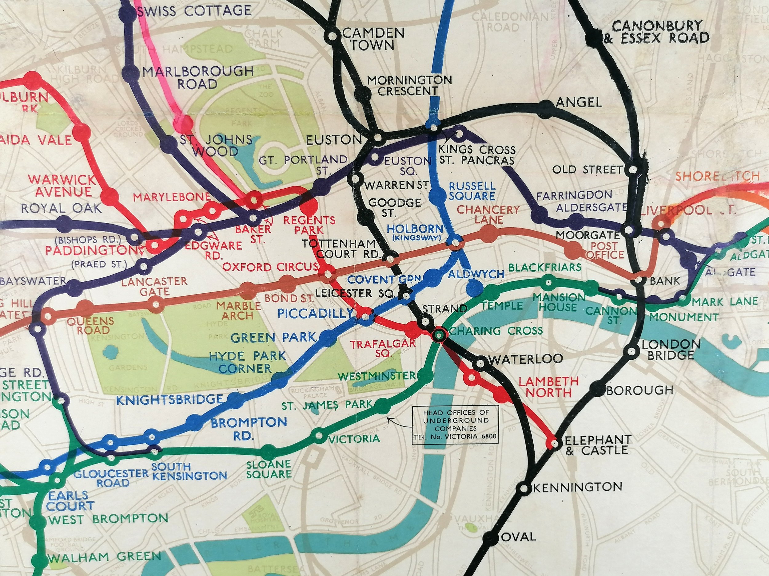
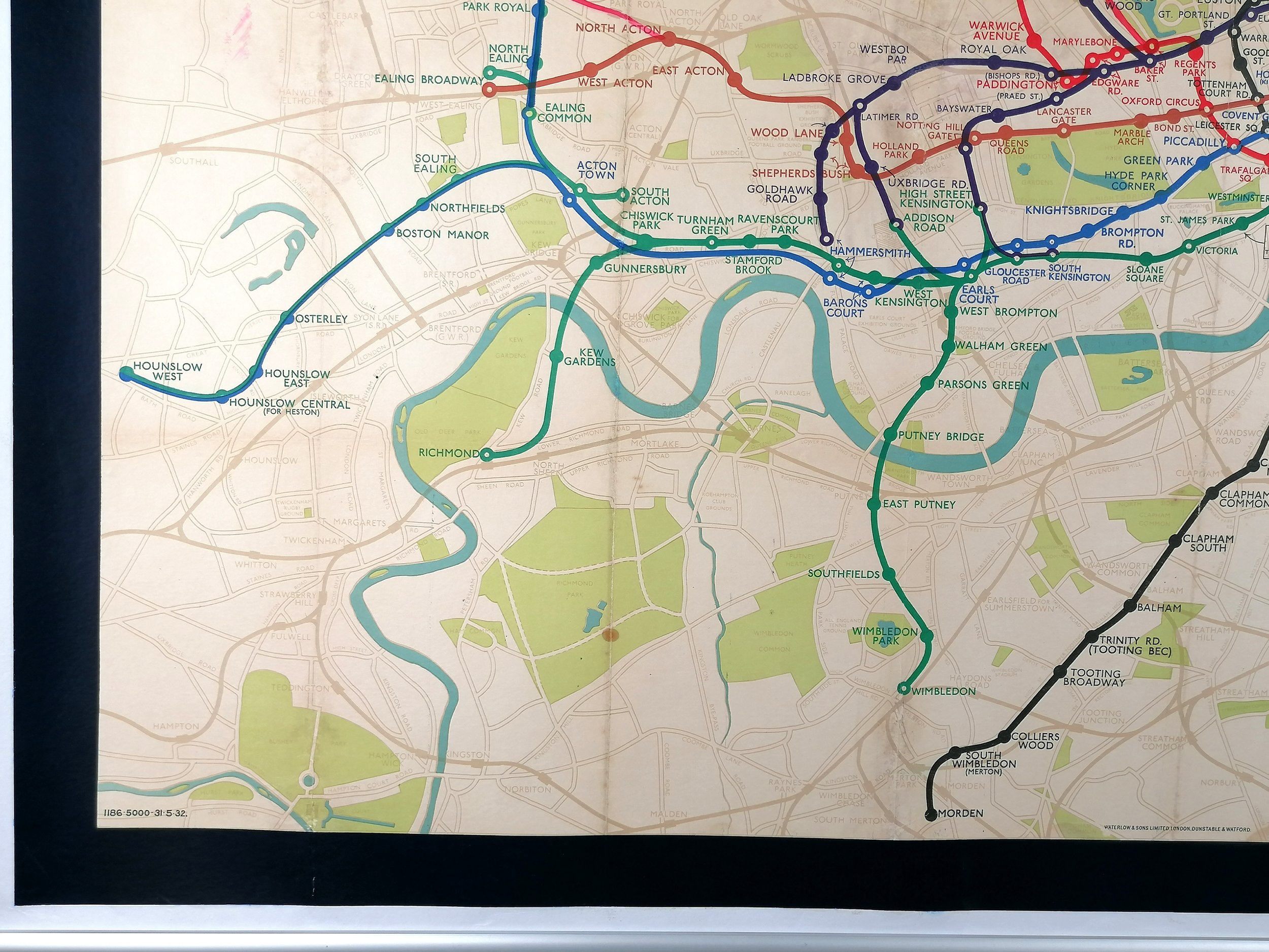
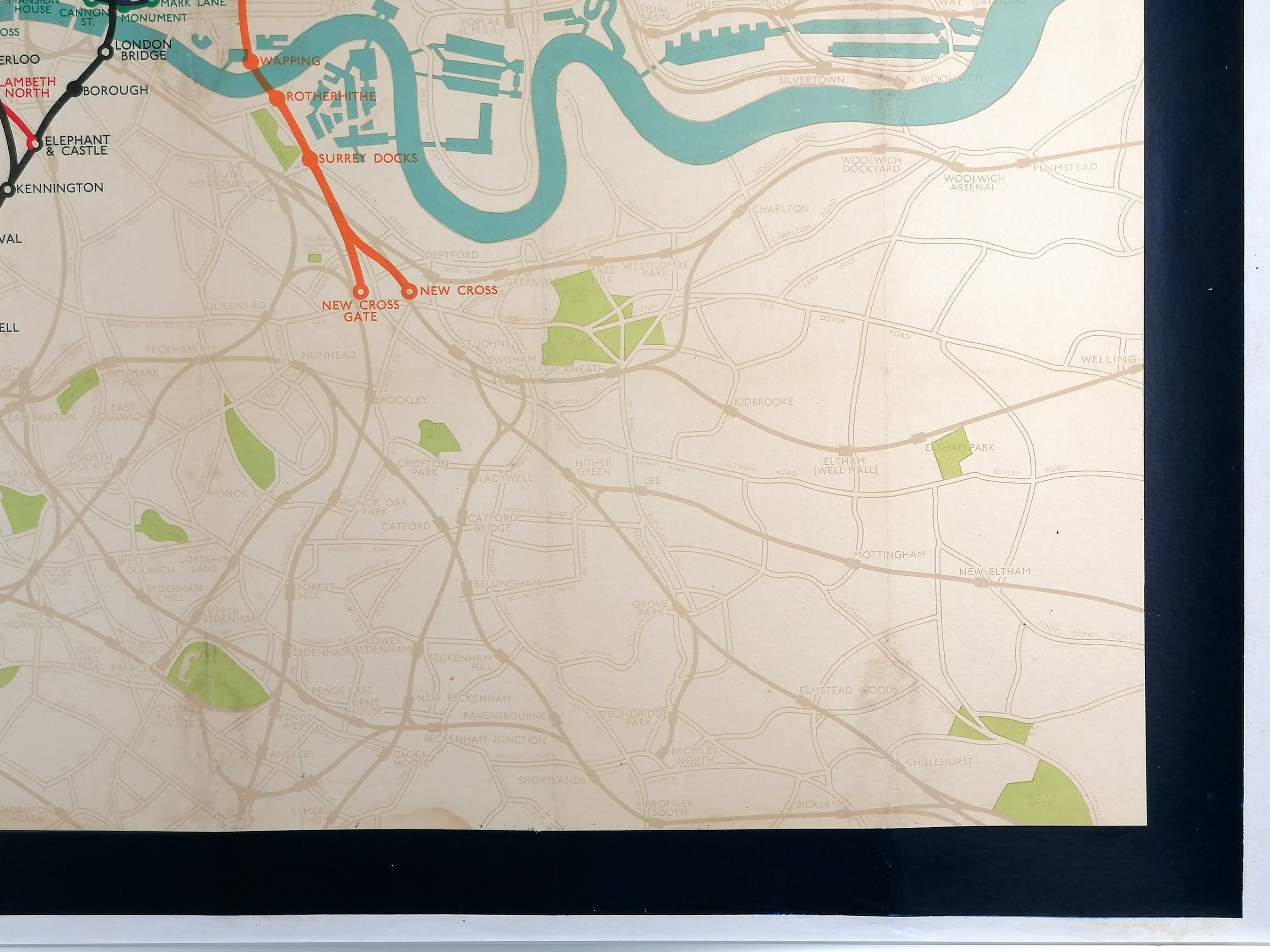
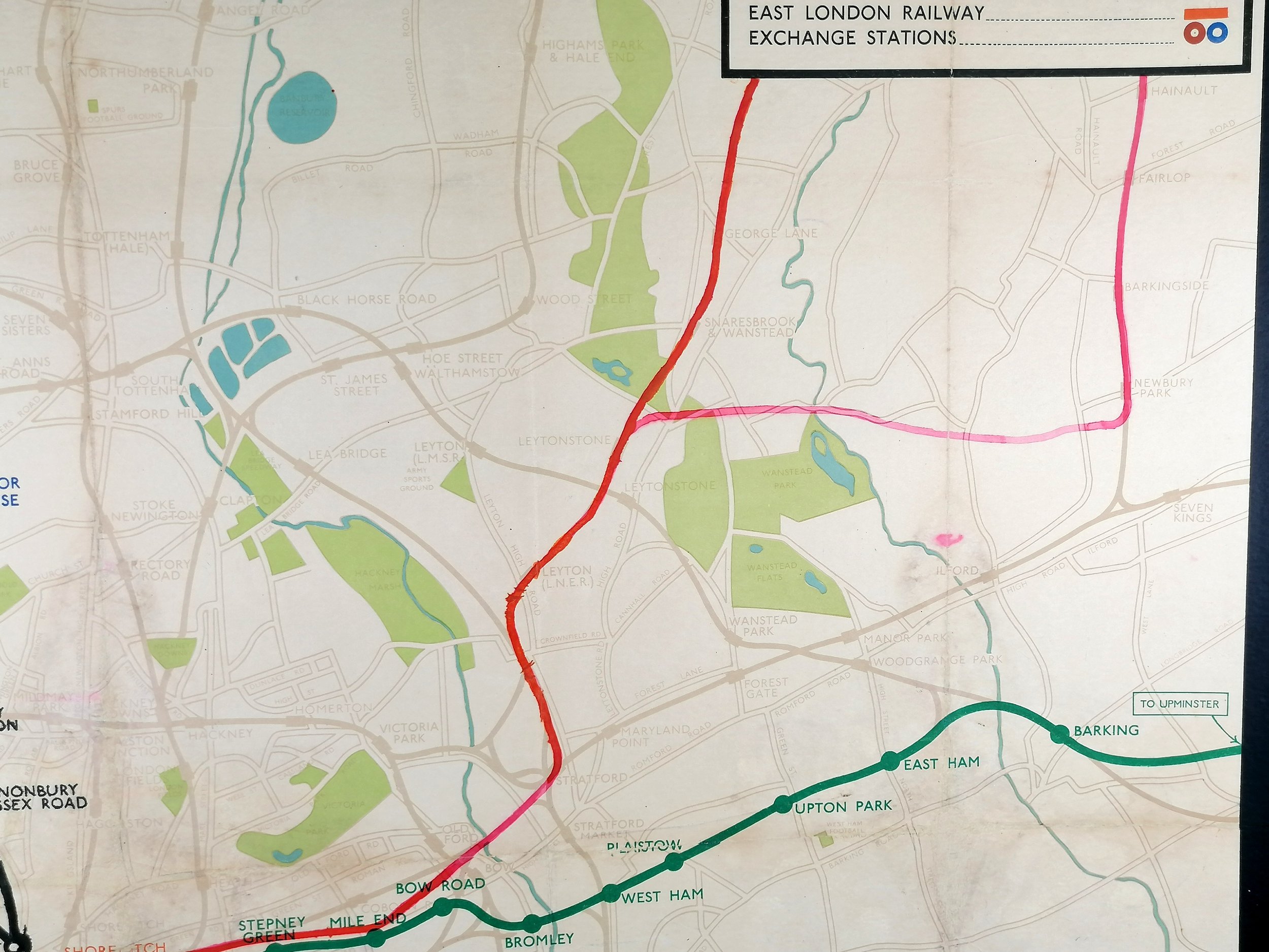
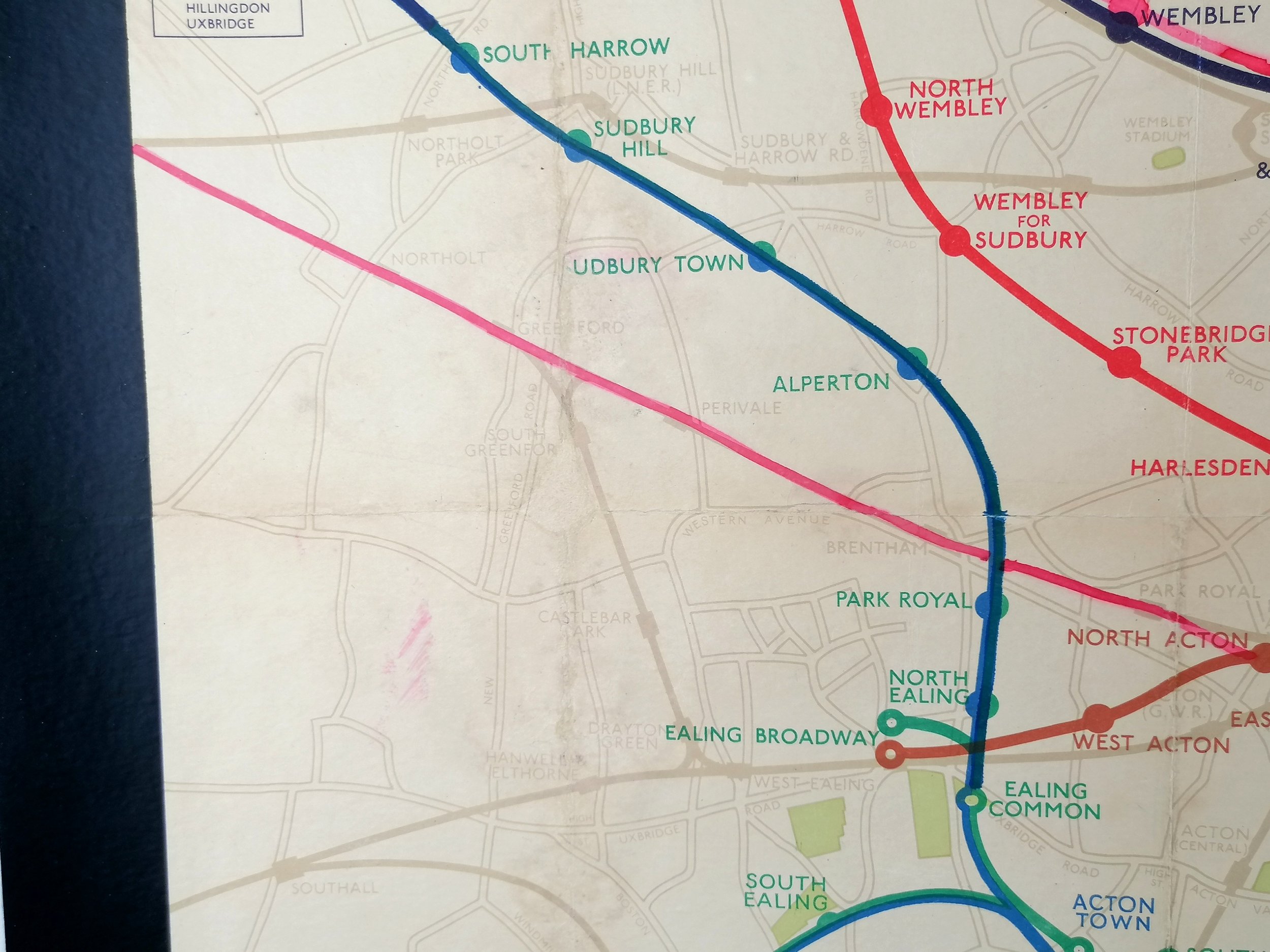
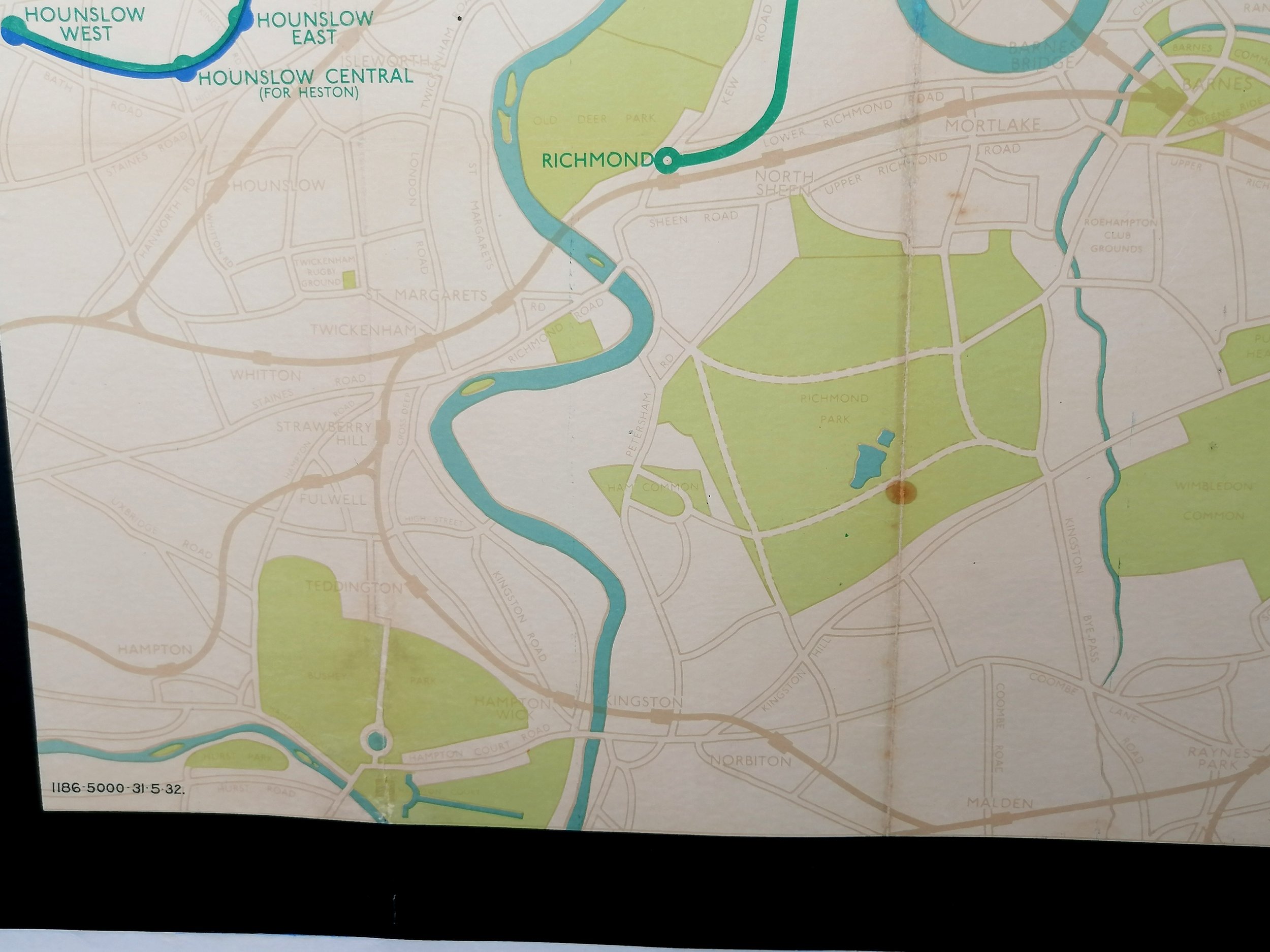
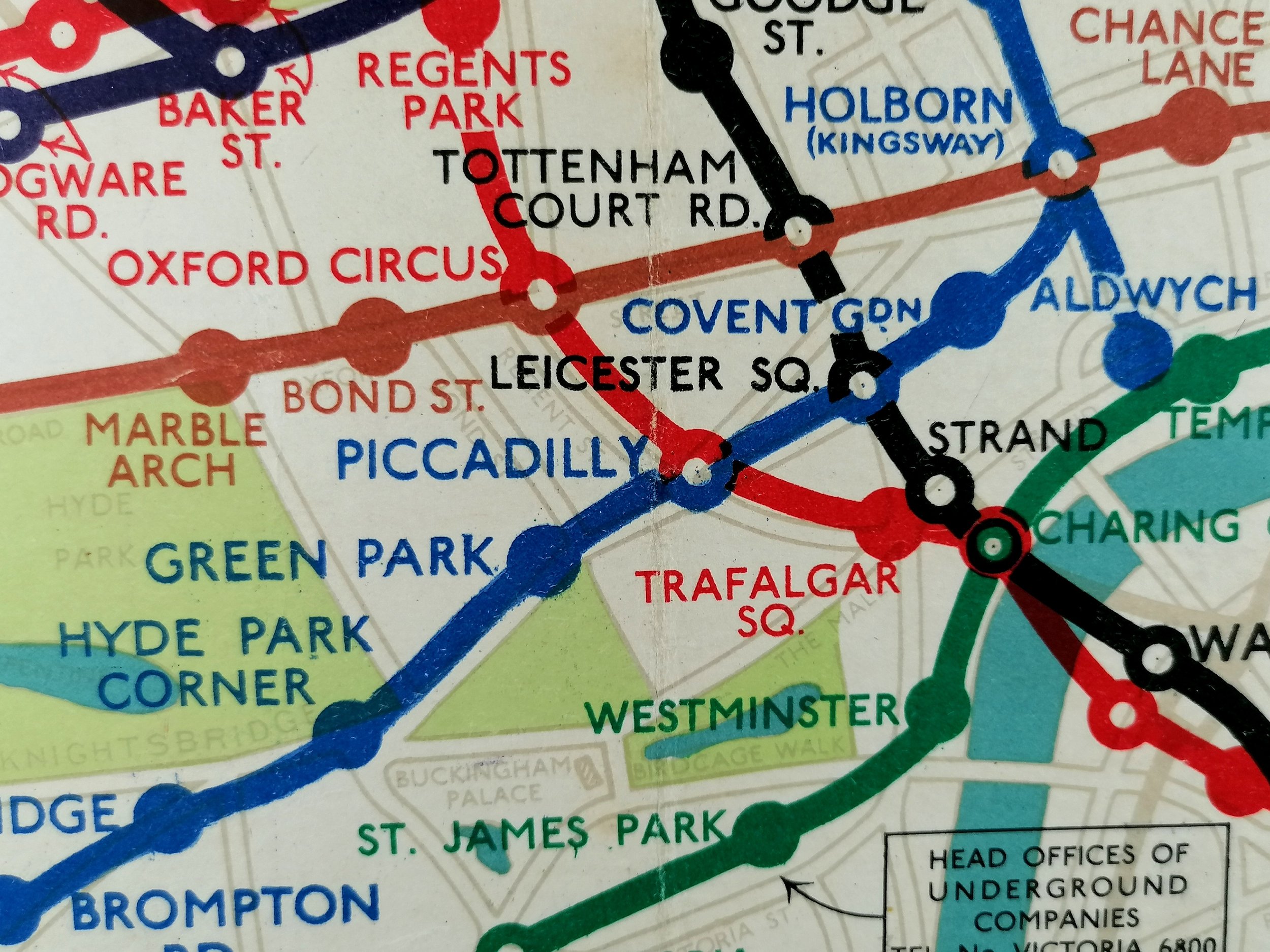
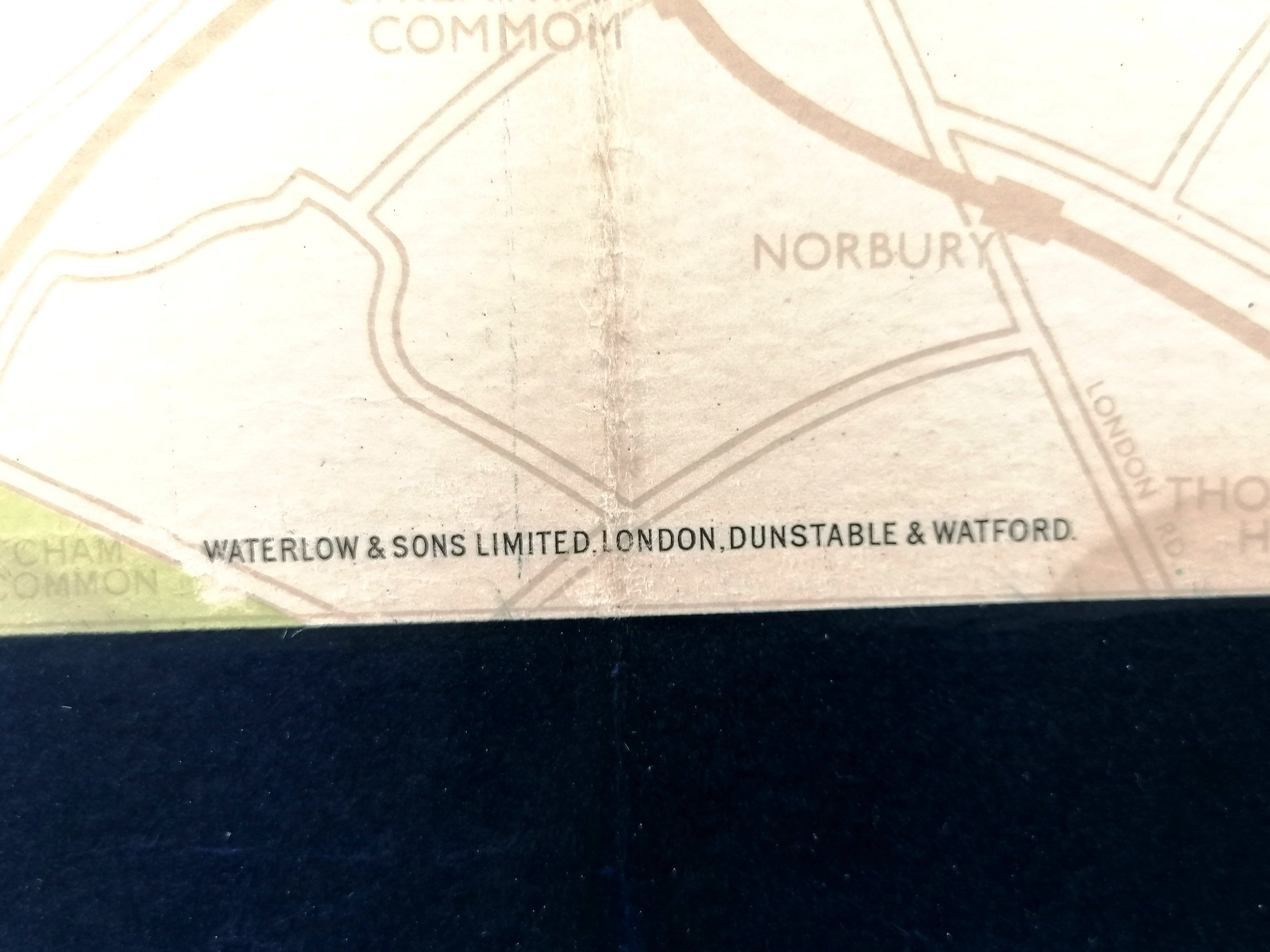
The map itself is magnificent, its print code tells us it was printed on 31st May 1932 and will have been the first to feature the newly opened Piccadilly Line extension to Cockfosters. Unlike his pocket maps, Stingemore’s large station maps were rich in background detail. The vibrant lines are shown in their respective colours, so too are the station names (a practise he introduced in 1929).
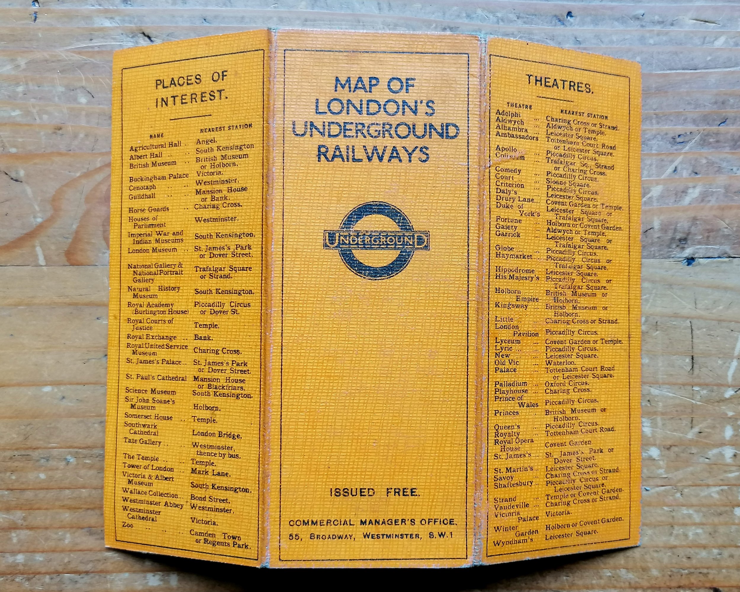
Frederick Stingemore worked in the London Underground Drawing Office for over 40 years. He designed a broad variety of maps and posters dating back to before WWI. Most notably he designed the last series of Underground pocket and poster maps (1925-1932) before Harry Beck's iconic diagram was introduced in 1933. Indeed it was Stingemore that encouraged Beck to submit his design again after it was initially rejected by Underground Executives.
Free UK Delivery. For non-UK delivery please request quotation. This is a large and very heavy item (40kg+).
Underground Map of London
Designed by Fred Stingemore with manuscript line extensions and stations by HC Beck. Printed by Waterlow & Sons for London Underground Group. Colour lithograph on paper. Quad Royal format 50” x 40” / 127 x 101cm. Print Code 1186-5000-31.5.32. Outstanding condition following some light restoration. Backed on linen.
This rather special example of Fred Stingemore’s Quad Royal Underground map for 1932 features some hand-drawn line extensions relating to the 1935 New Works Programme. Through handwriting analyses, we have been able to identify the draftsman as Harry Beck, Stingemore’s colleague and creator of the iconic diagrammatic map of the Underground which was adopted just months after this map was printed (Jan 1933). A copy of this analysis is included in the sale.
Without an account from the time, we are left to speculate on when and why these draft lines were added. It is our prevailing theory that in around 1935, Beck began the process of updating his diagram to incorporate the New Works Programme extensions. Using a spare copy of Stingemore’s geographical map (which would have been in good supply around the Drawing Office), Beck drew the true path of the lines to serve as a visual aid for positioning them on his diagram. The extensions first appear as dashed lines on Beck poster-size maps from 1937.
The lines added to the map by hand are:
Northern Line (includes proposed station names): North to High Barnet (Opened 1940) with uncompleted sections Finchley to Edgeware and Hightgate to Alexandra Palace.
Bakerloo Line: North to Stanmore (Opened in 1939)
Central Line: West to West Ruislip and East to Ongar (Opened in 1948)
The map itself is magnificent, its print code tells us it was printed on 31st May 1932 and will have been the first to feature the newly opened Piccadilly Line extension to Cockfosters. Unlike his pocket maps, Stingemore’s large station maps were rich in background detail. The vibrant lines are shown in their respective colours, so too are the station names (a practise he introduced in 1929).
Frederick Stingemore worked in the London Underground Drawing Office for over 40 years. He designed a broad variety of maps and posters dating back to before WWI. Most notably he designed the last series of Underground pocket and poster maps (1925-1932) before Harry Beck's iconic diagram was introduced in 1933. Indeed it was Stingemore that encouraged Beck to submit his design again after it was initially rejected by Underground Executives.
Free UK Delivery. For non-UK delivery please request quotation. This is a large and very heavy item (40kg+).