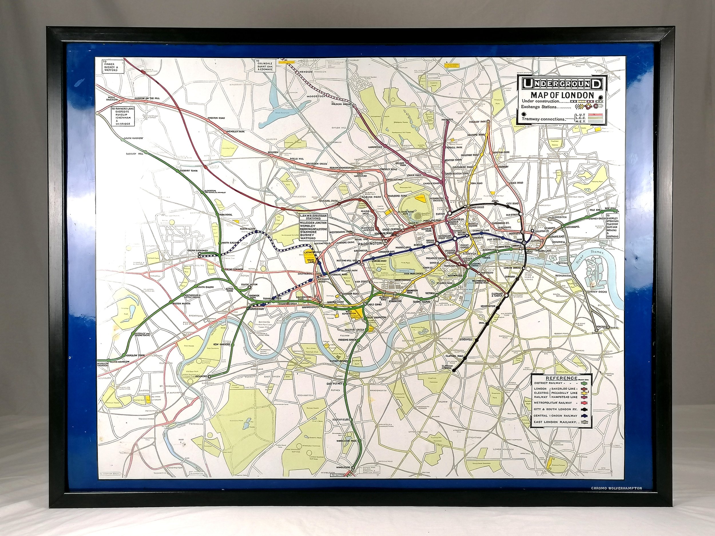
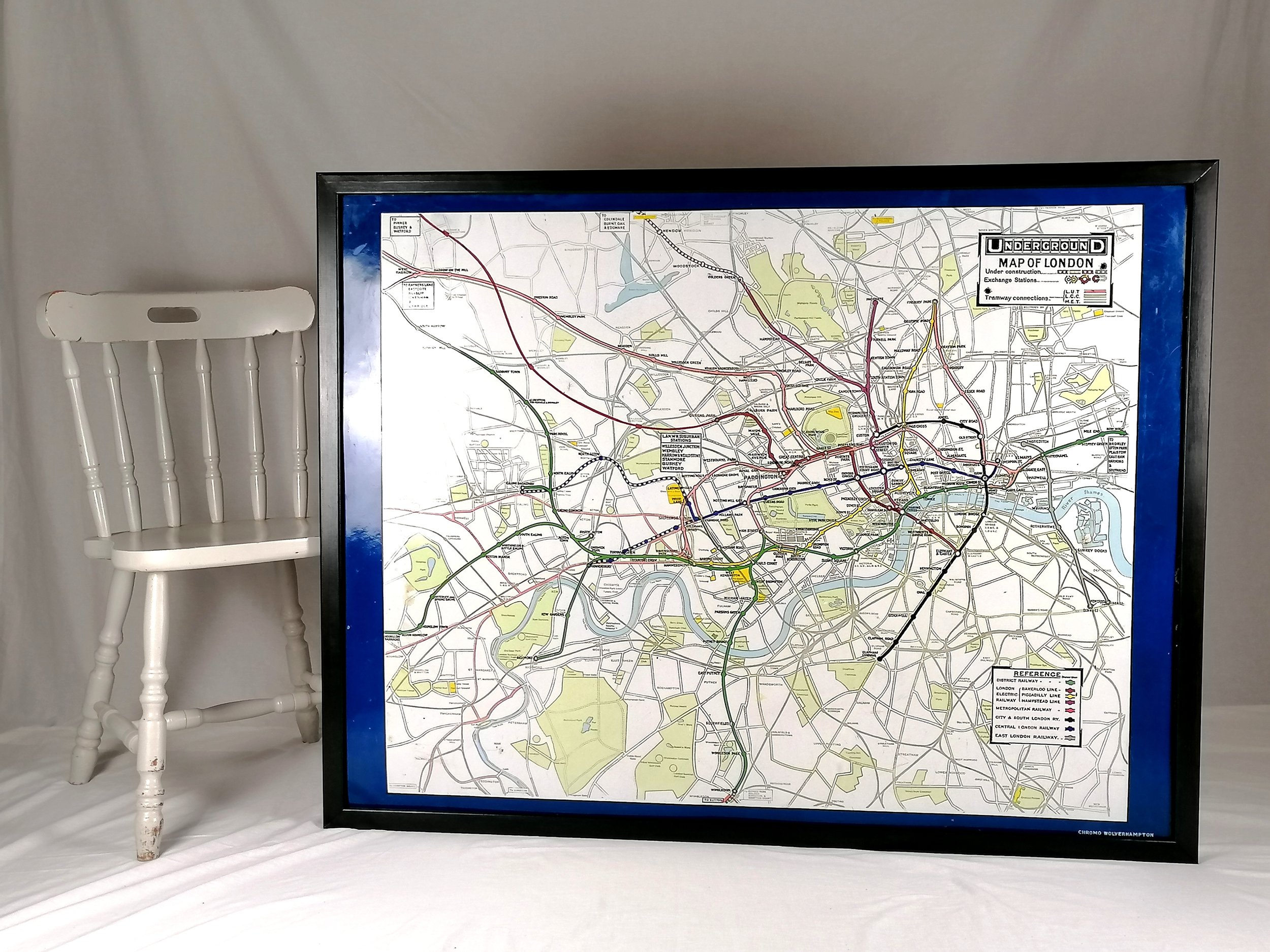
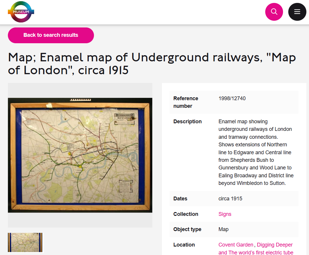

Enamel London Underground Map (1915) - Framed
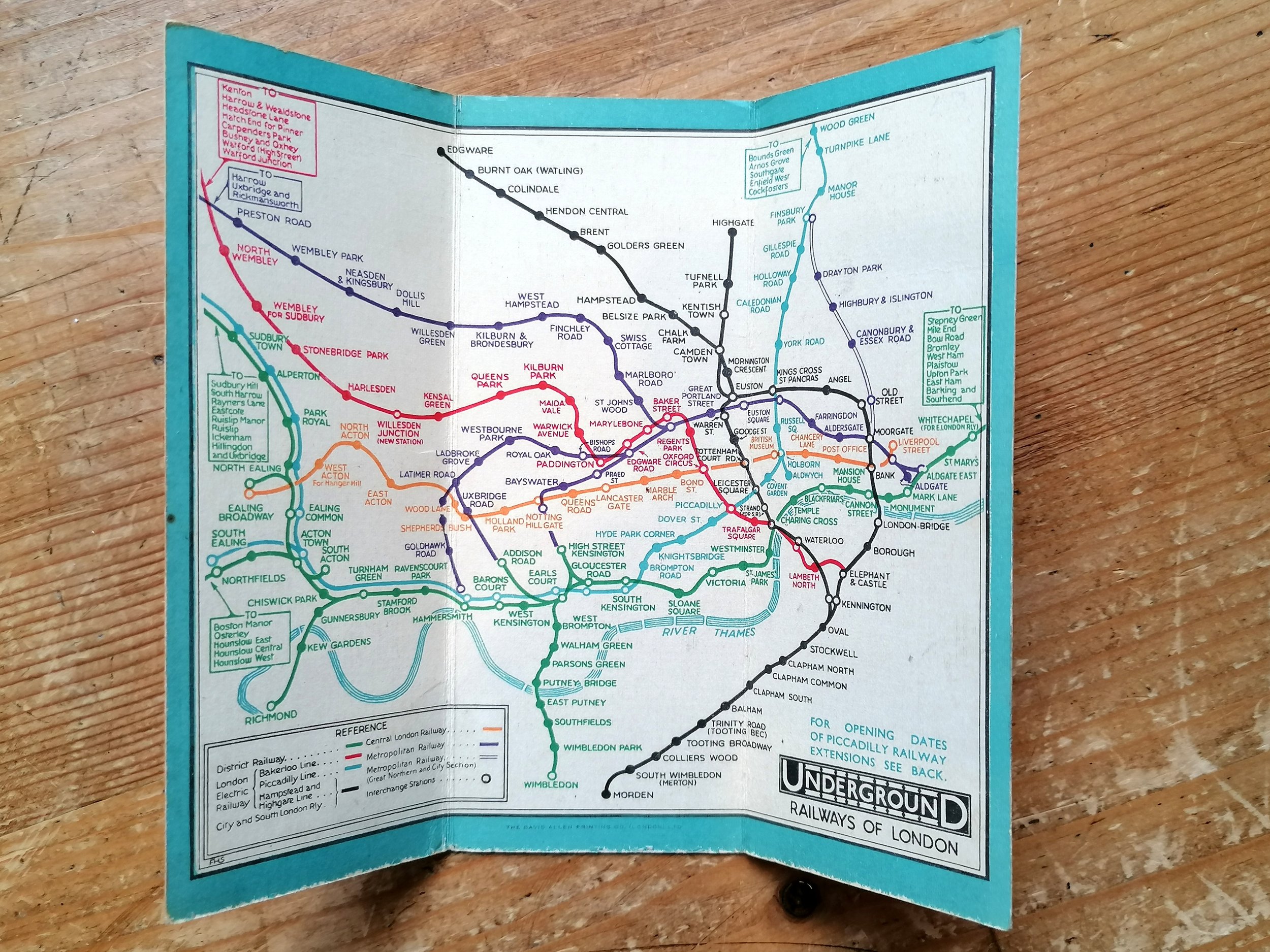
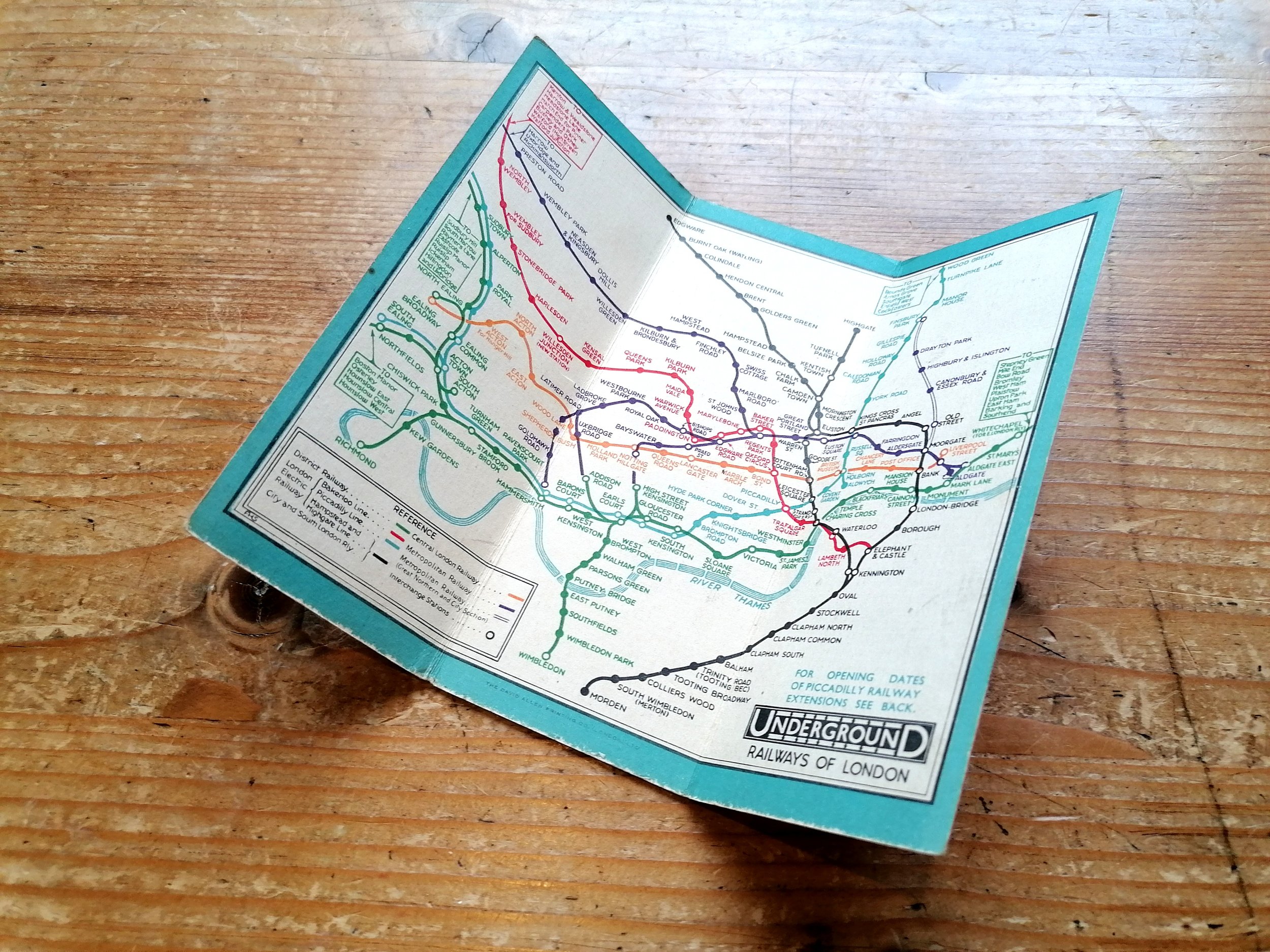
Underground Map of London
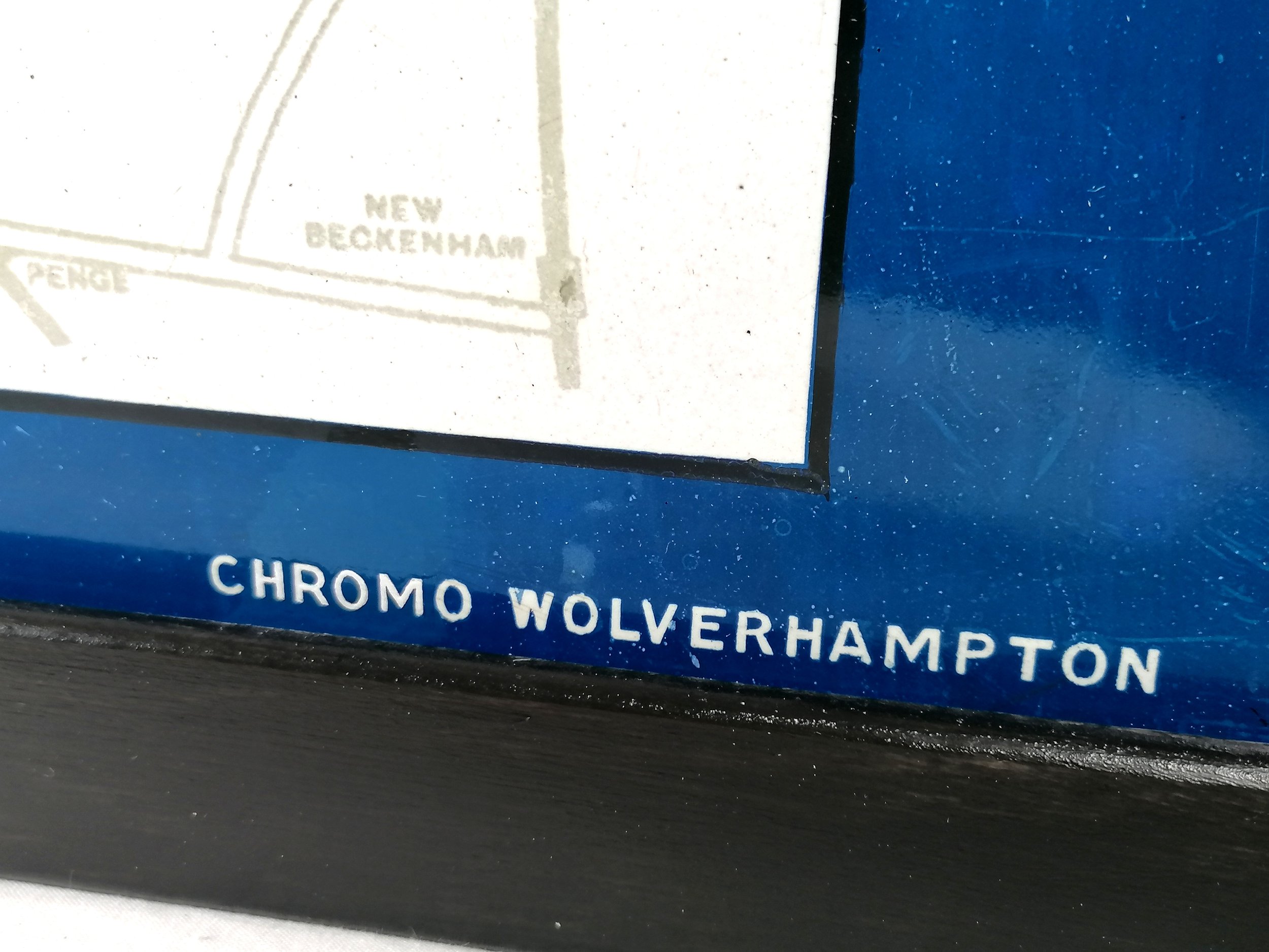
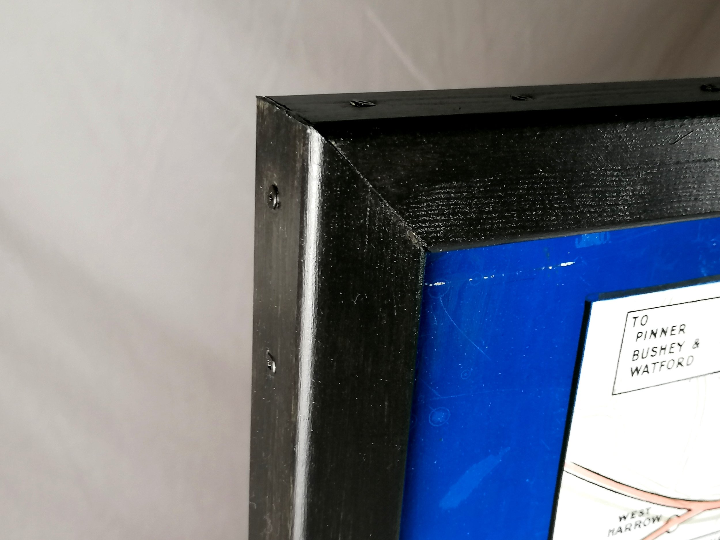
Vitreous enamel and rolled iron. Manufactured by Chromo Wolverhampton for the Underground Electric Railways of London. Circa 1915. Size: Map 127 × 96cm / Framed 133cm x 101cm x 4cm. Condition: Outstanding example. Some loss at the edges as to be expected (or even desired) with a sign of this age. Minor marks. Two drilled holes in the legend box - it is clear that these holes were created during the production process though for what purpose it is unclear. The example held by LT Museum has exactly the same holes.
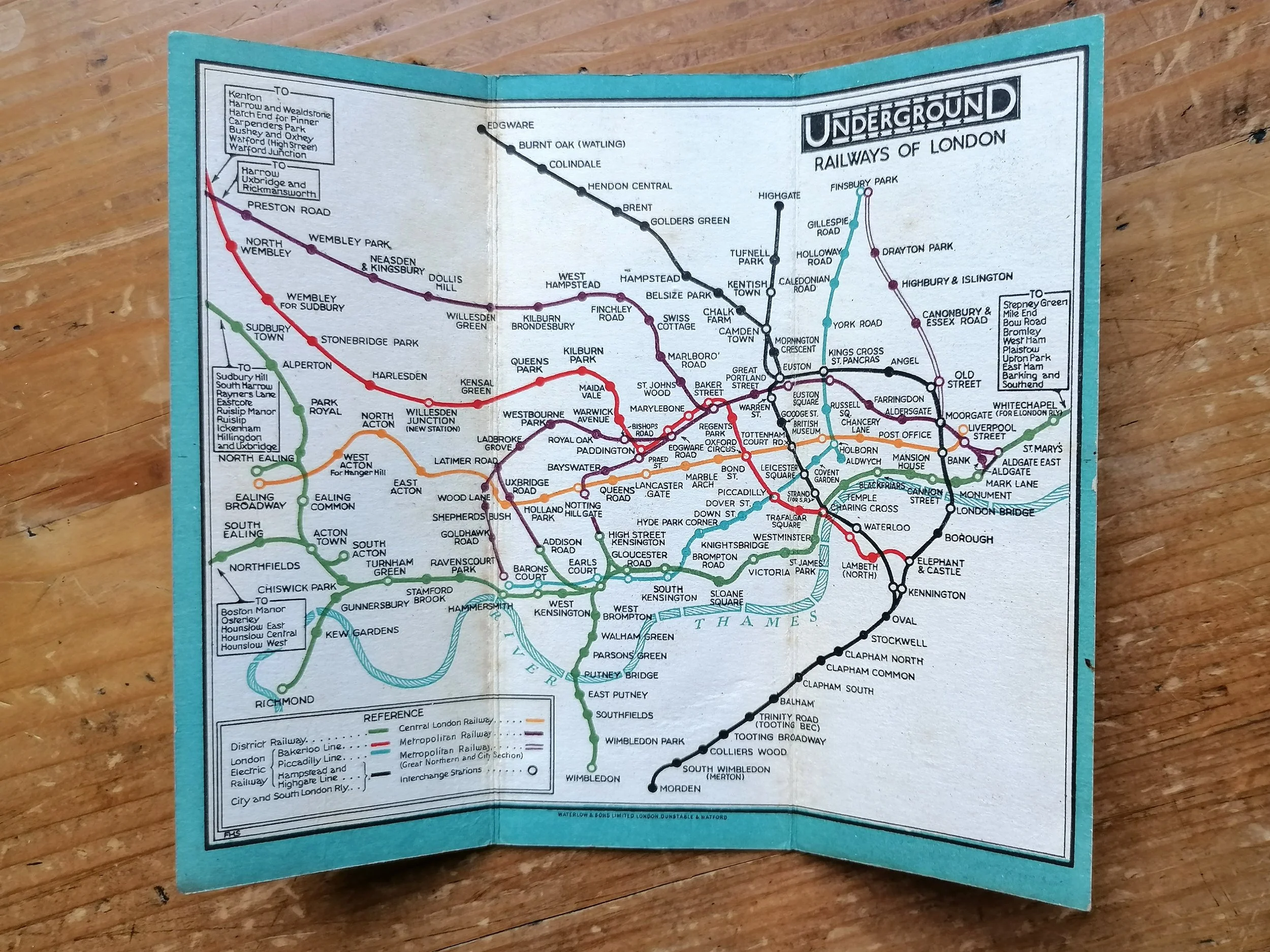
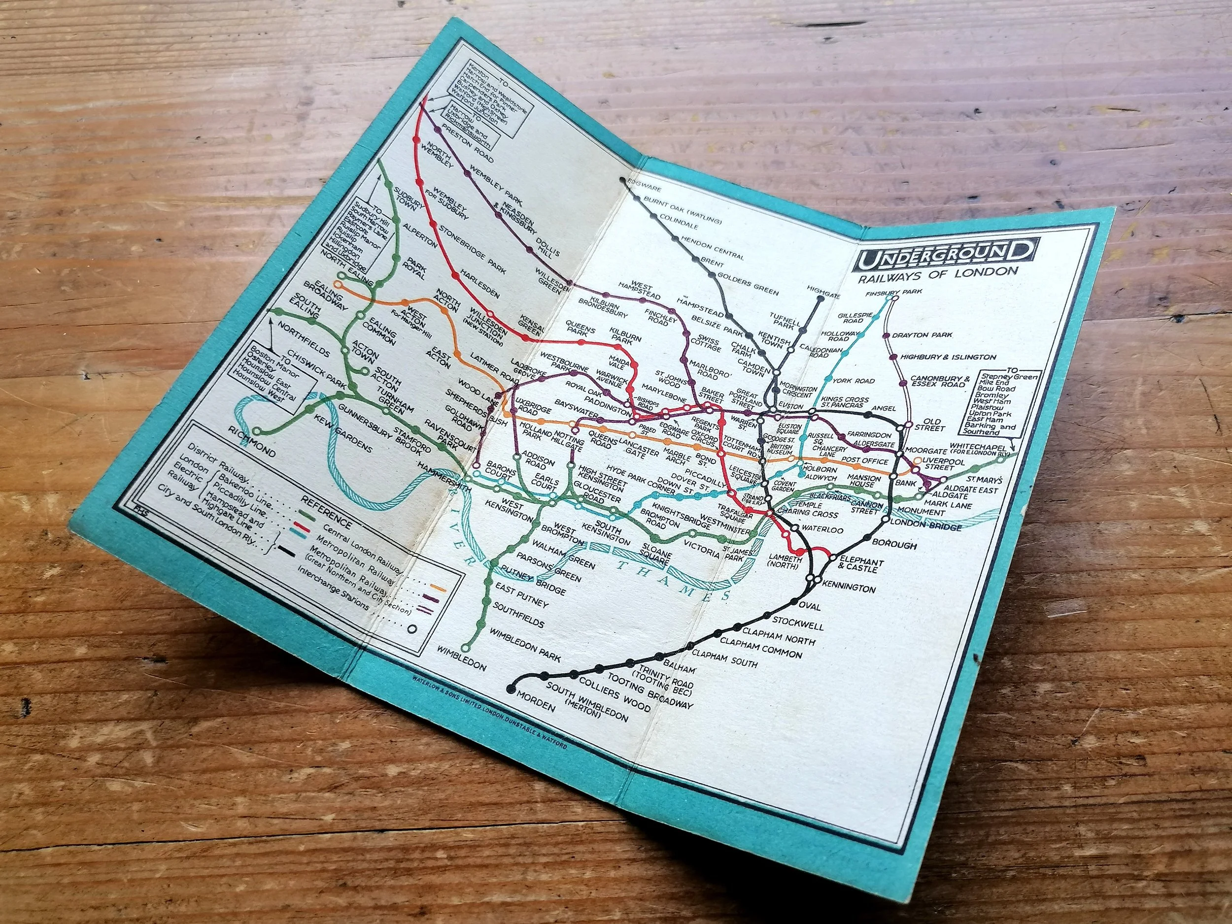
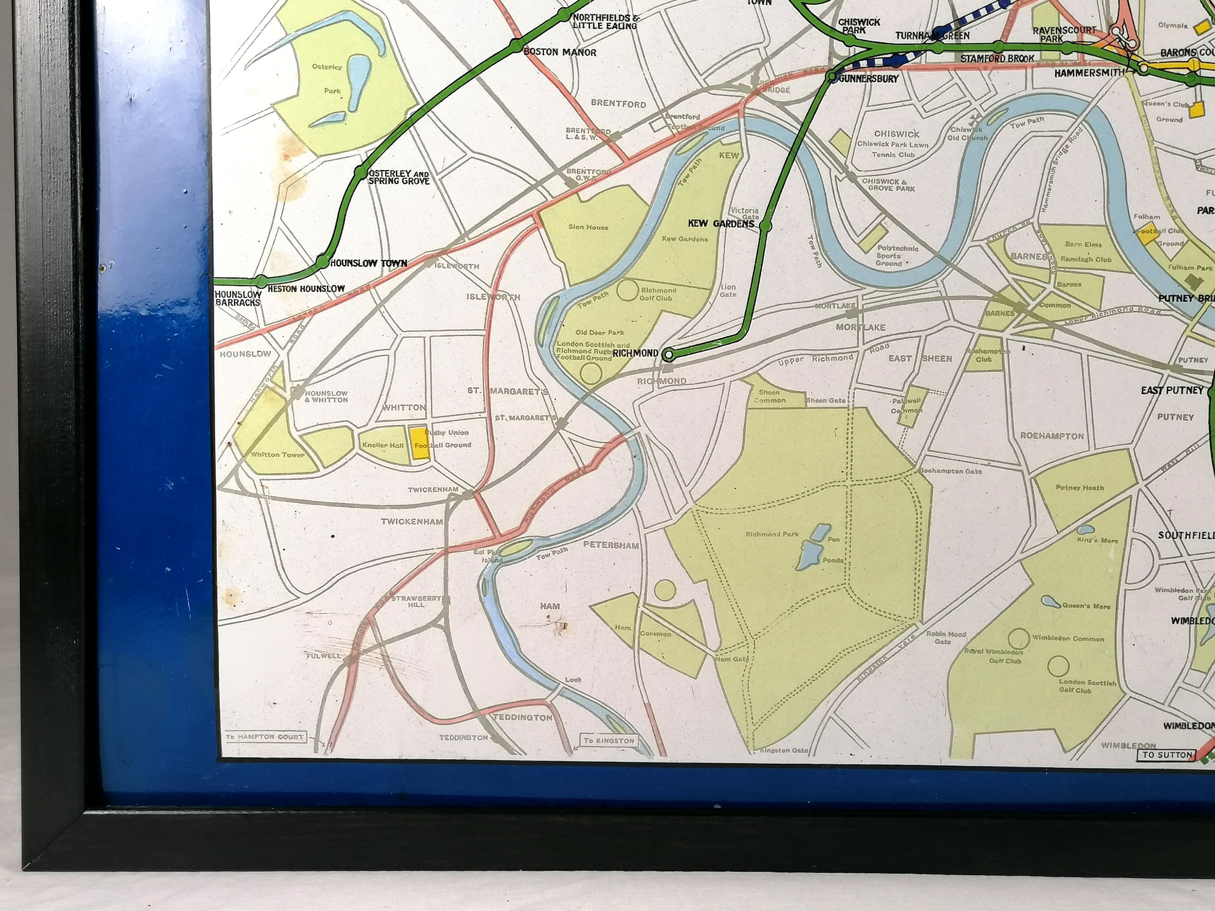
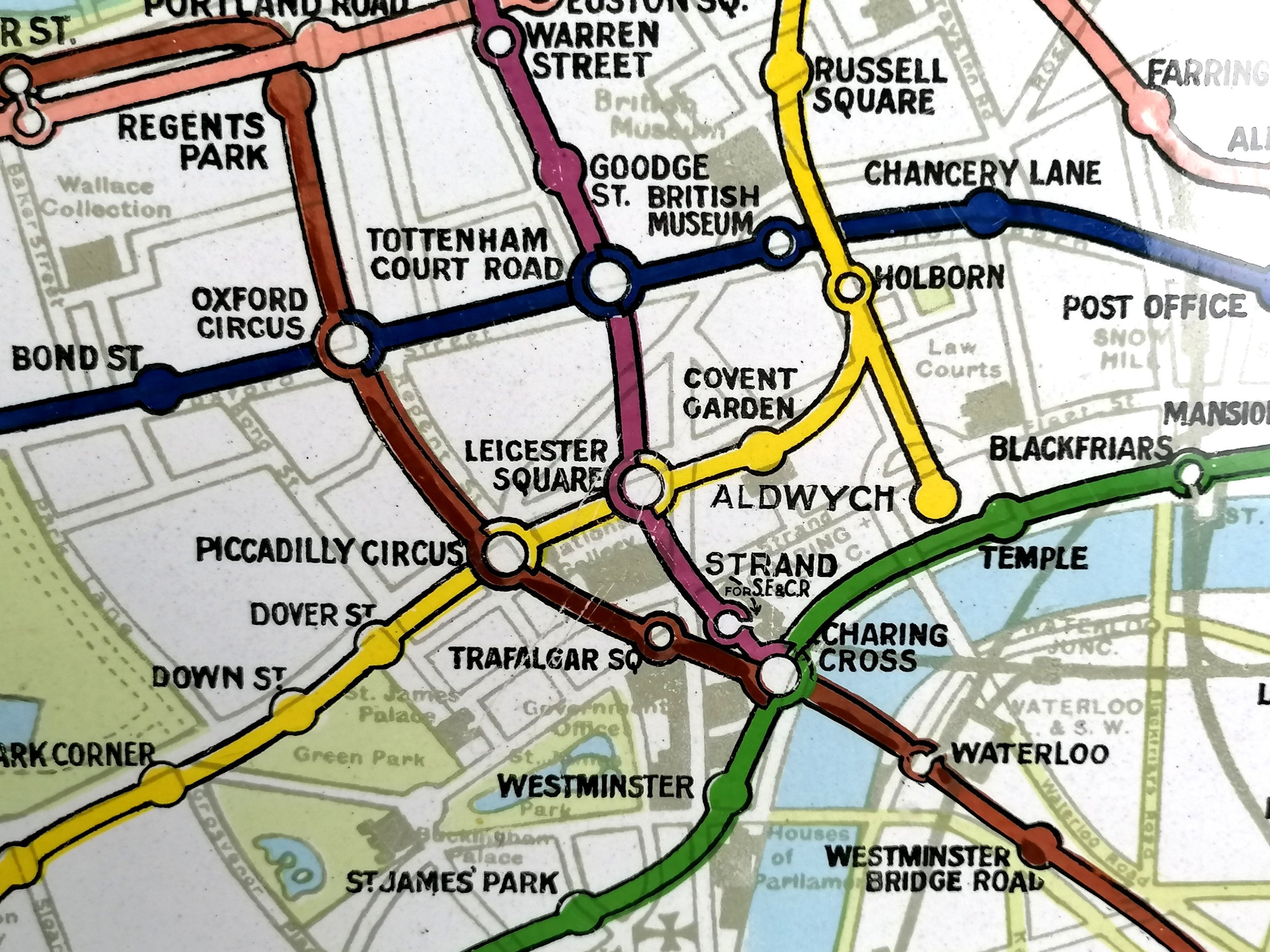
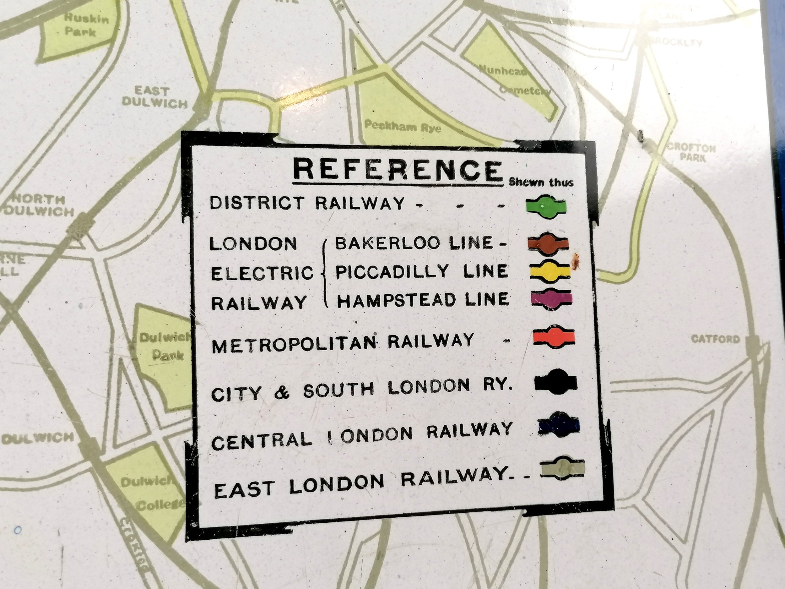
This amazing WWI-era London relic can be dated to 1915 and would have been displayed at the entrance to a London Underground station. The map features all the London Underground lines of the day who, despite operating as separate companies, had agreed to coordinate under a single ‘UndergrounD’ brand (and map) from 1908.
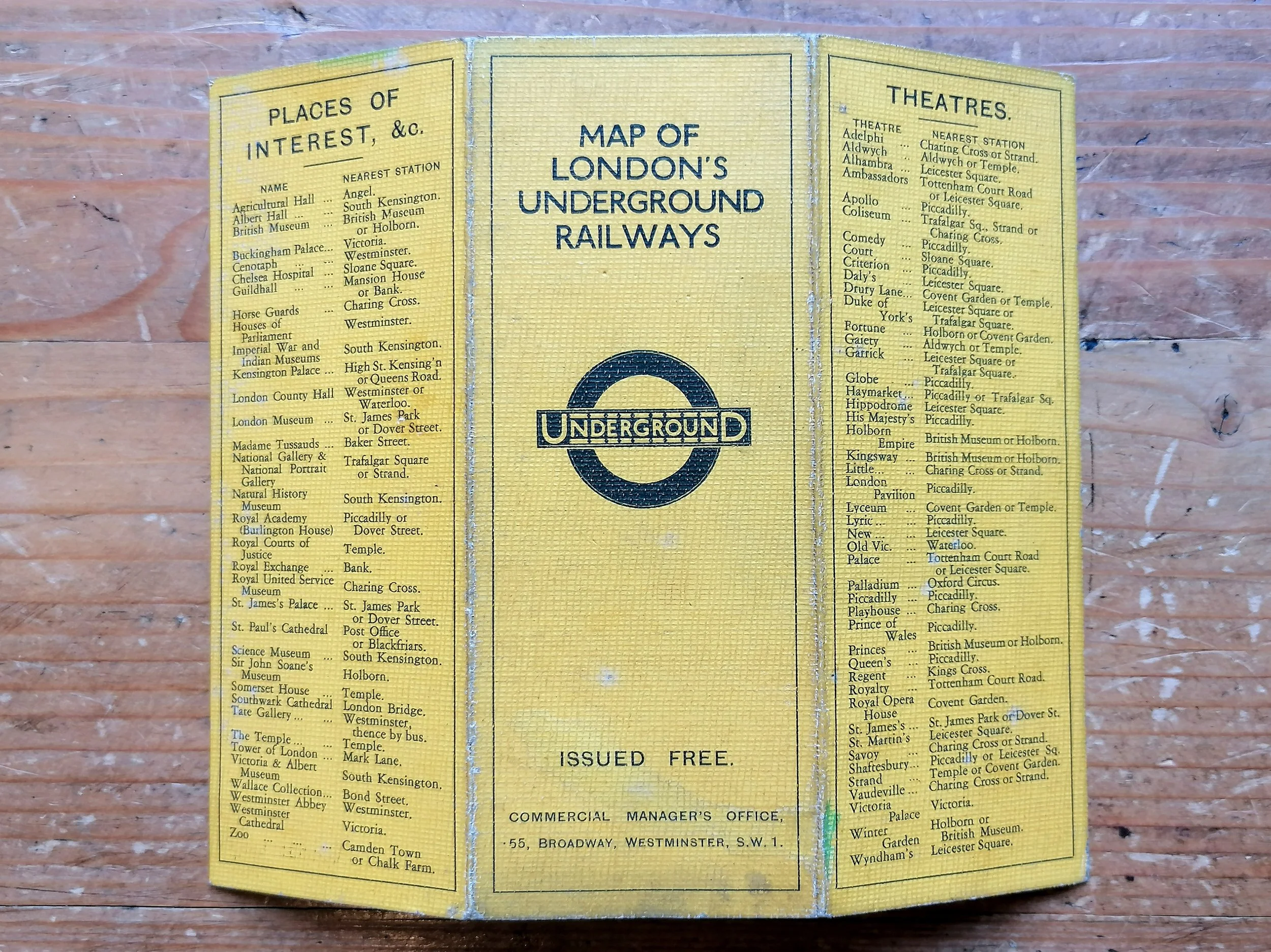
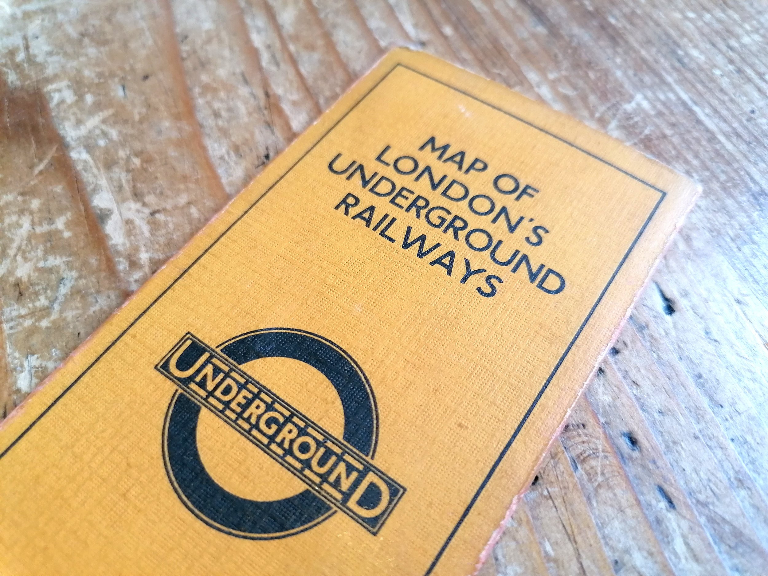
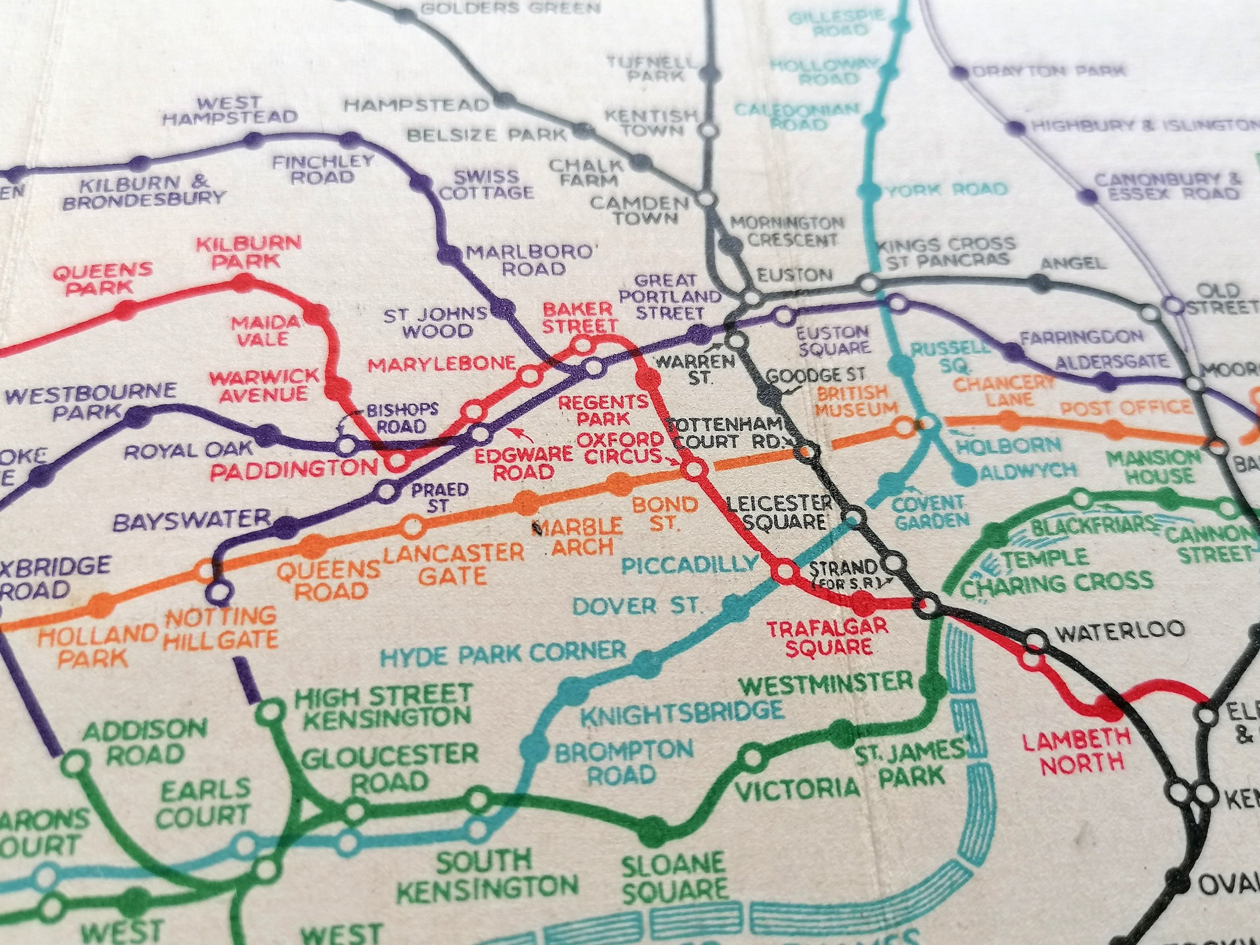
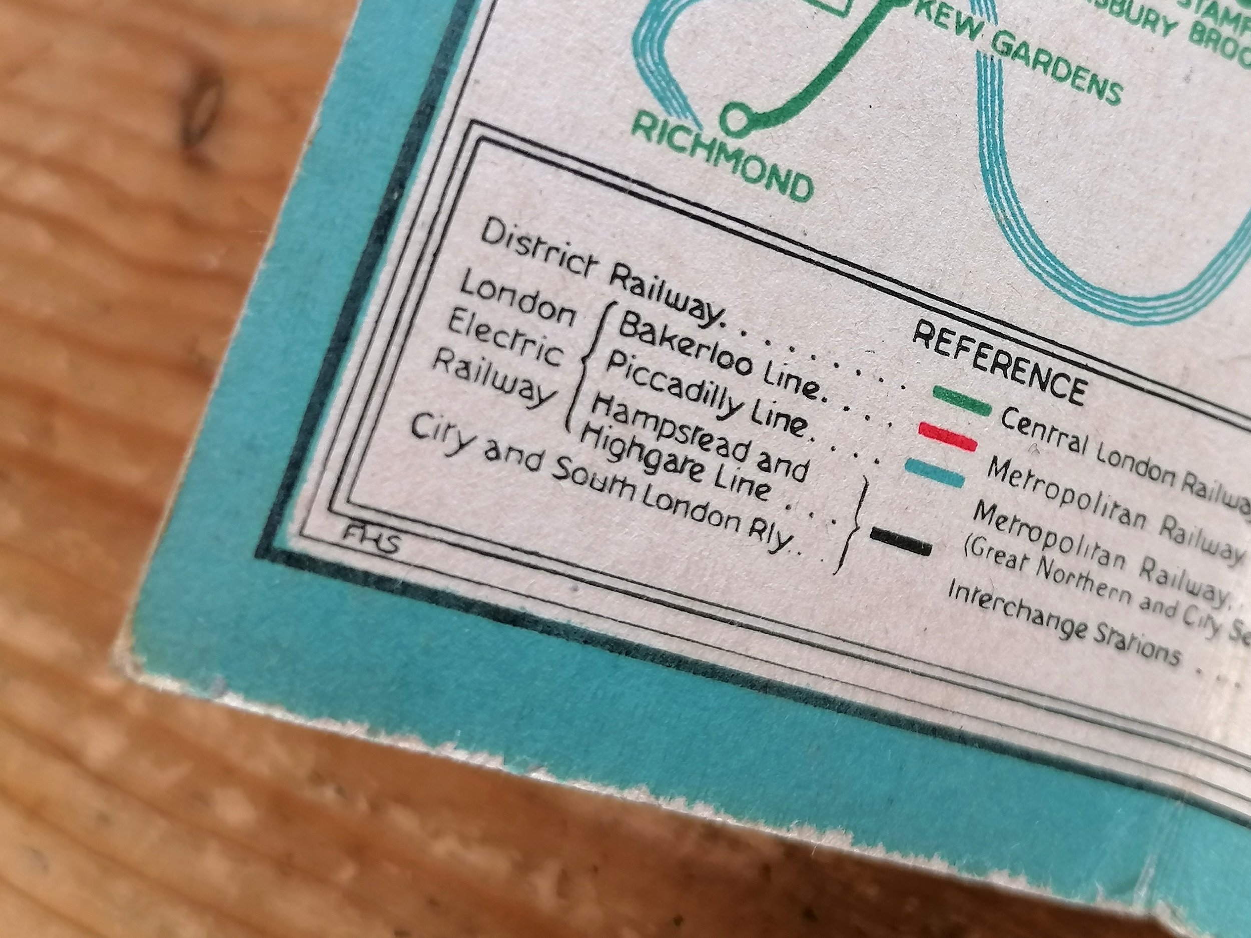
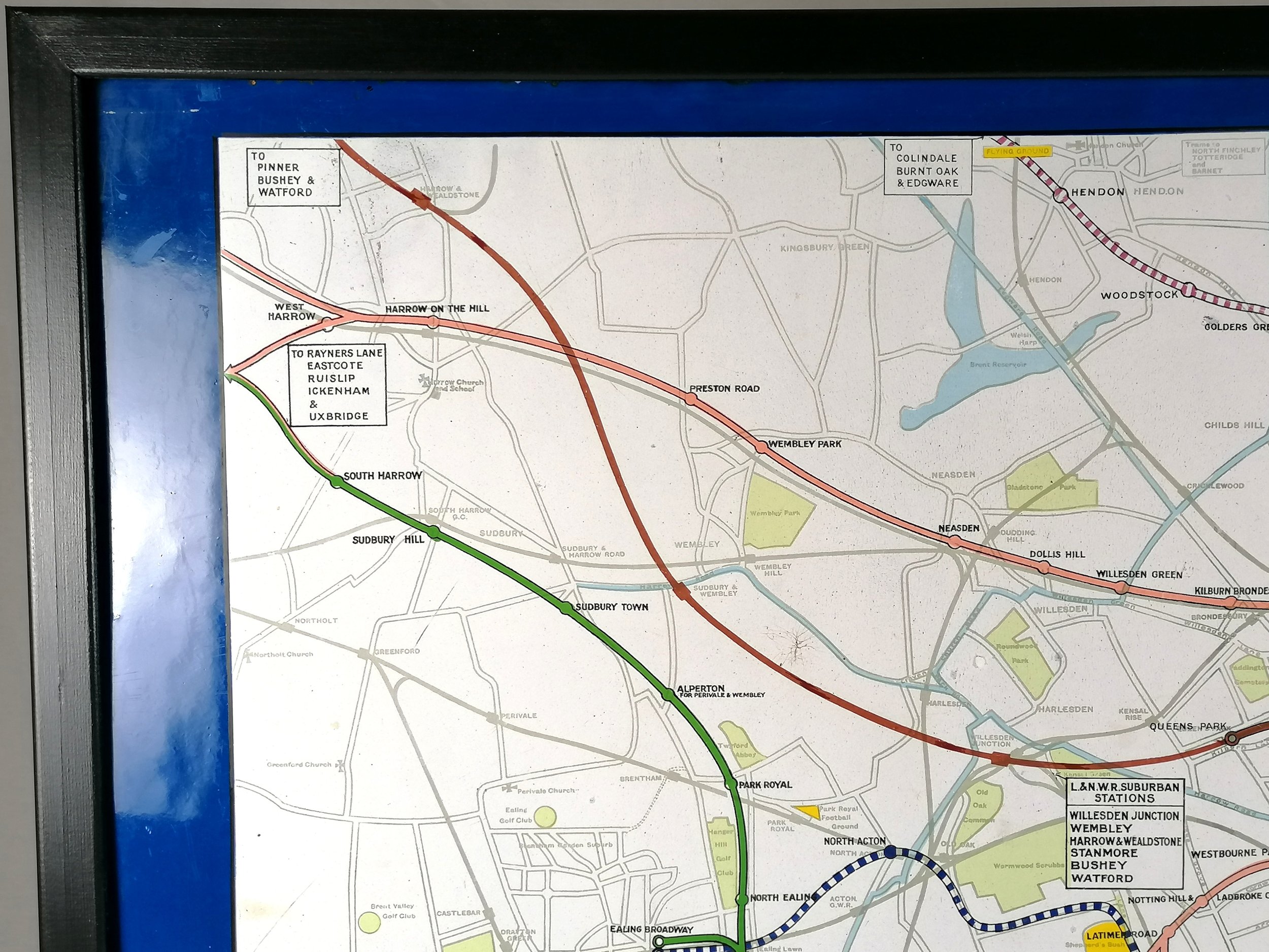
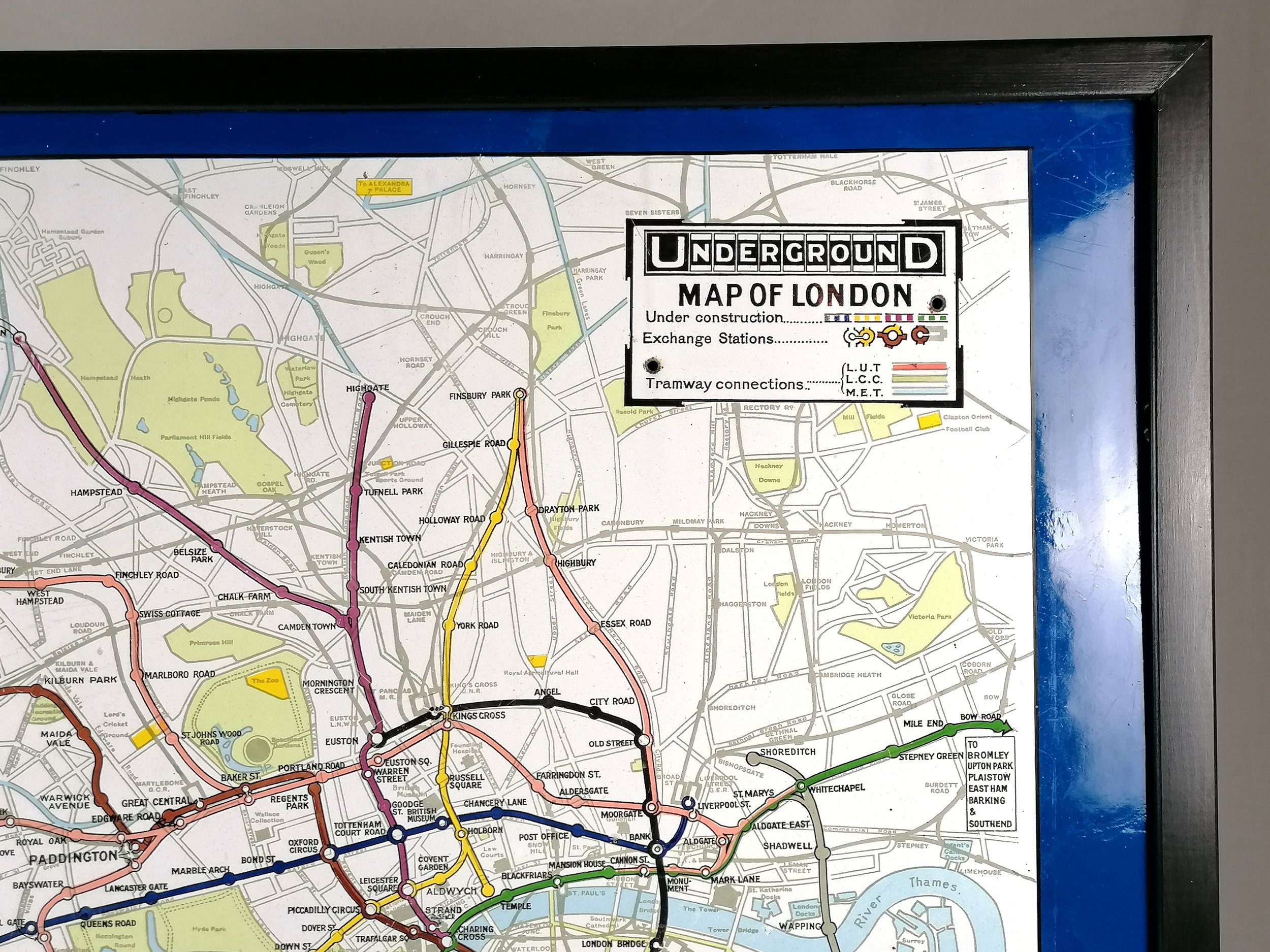
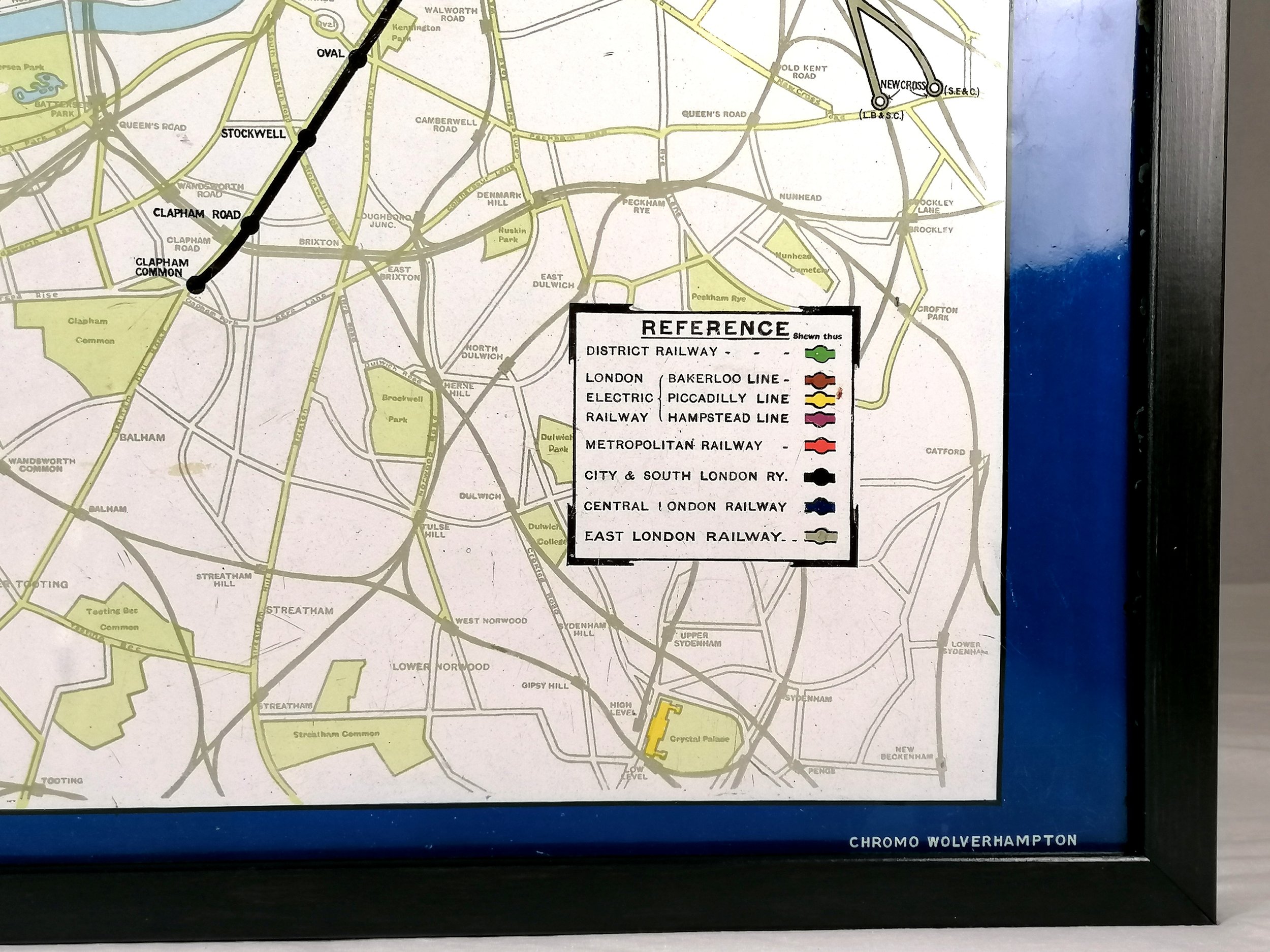
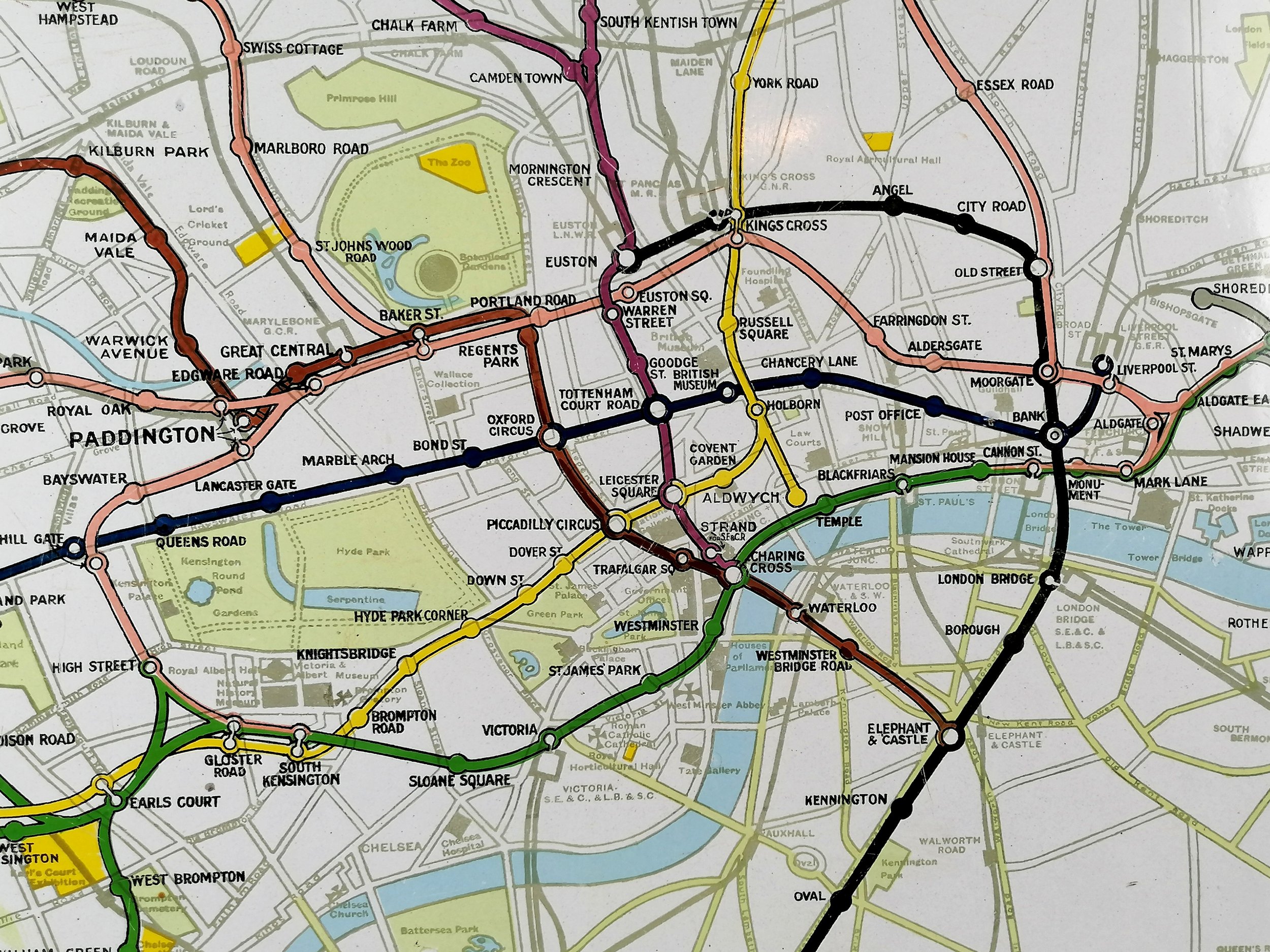
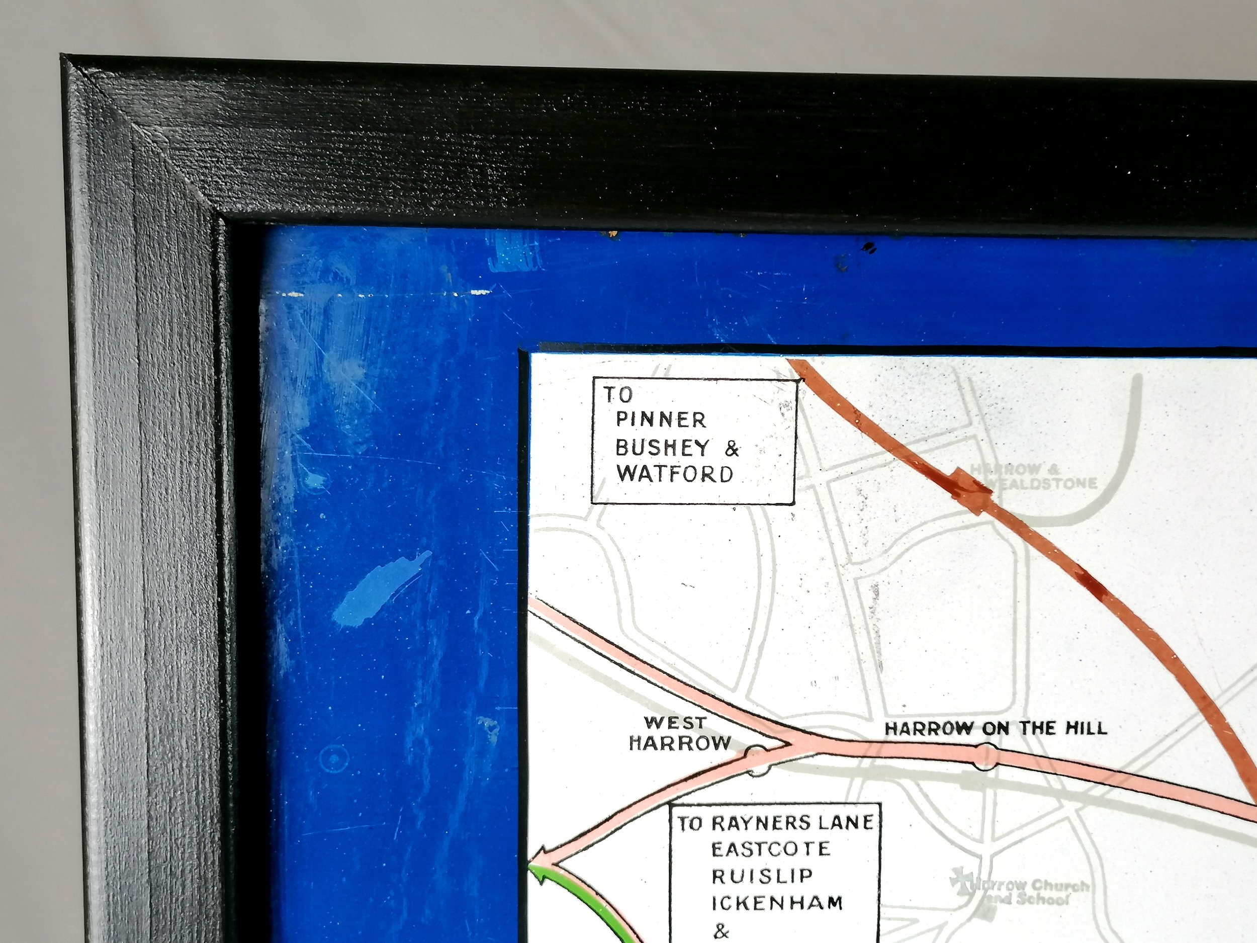
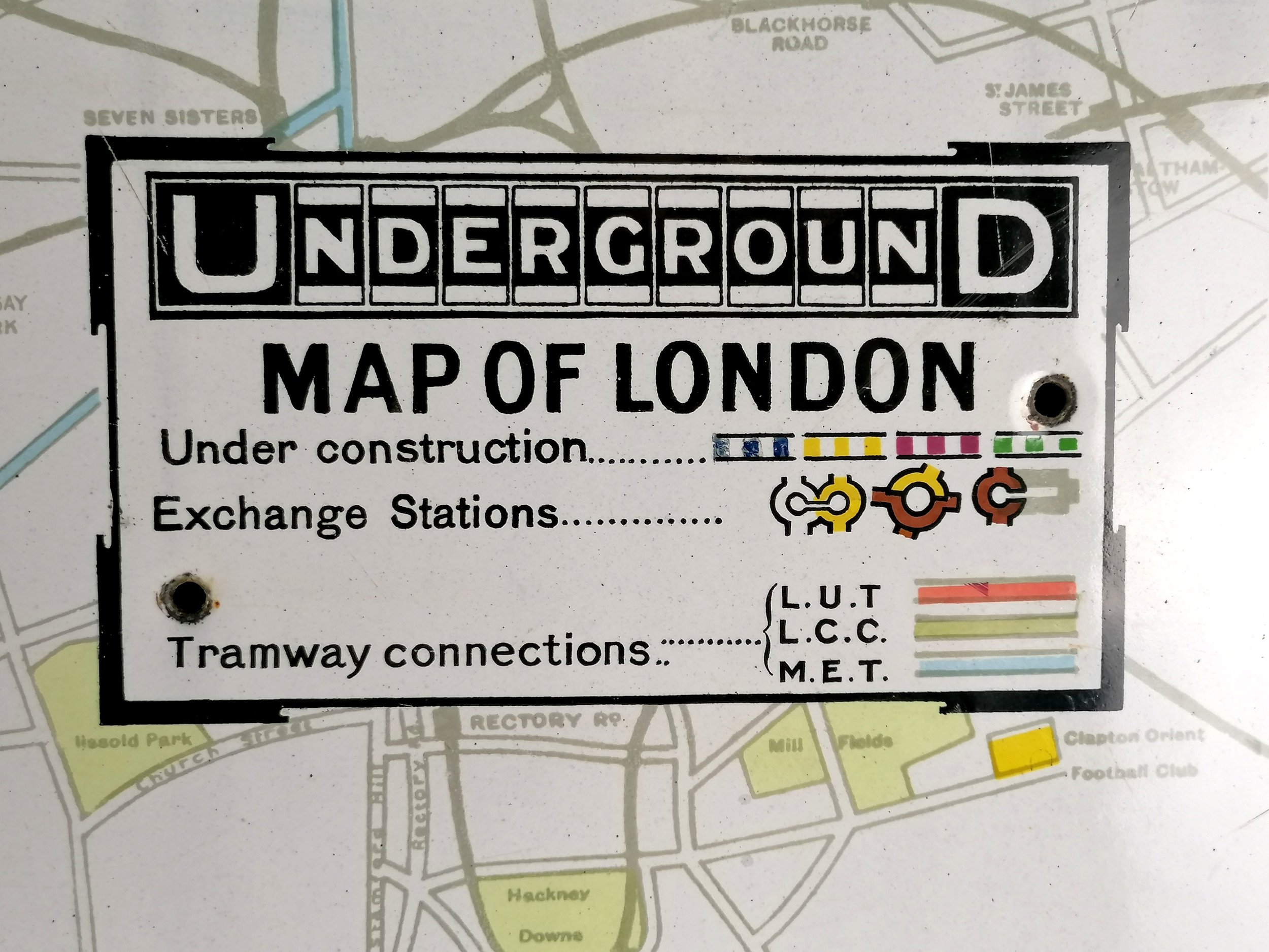
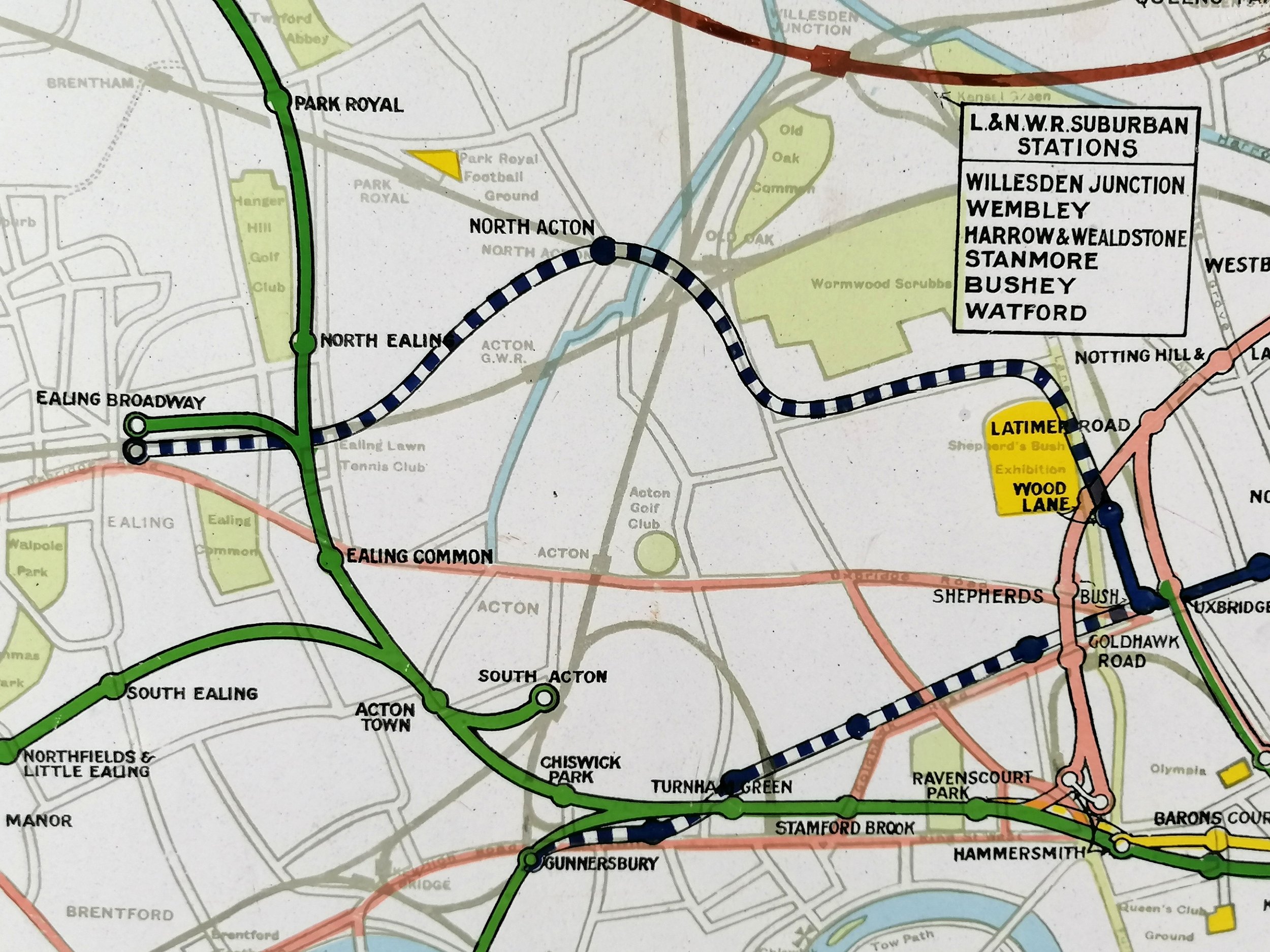
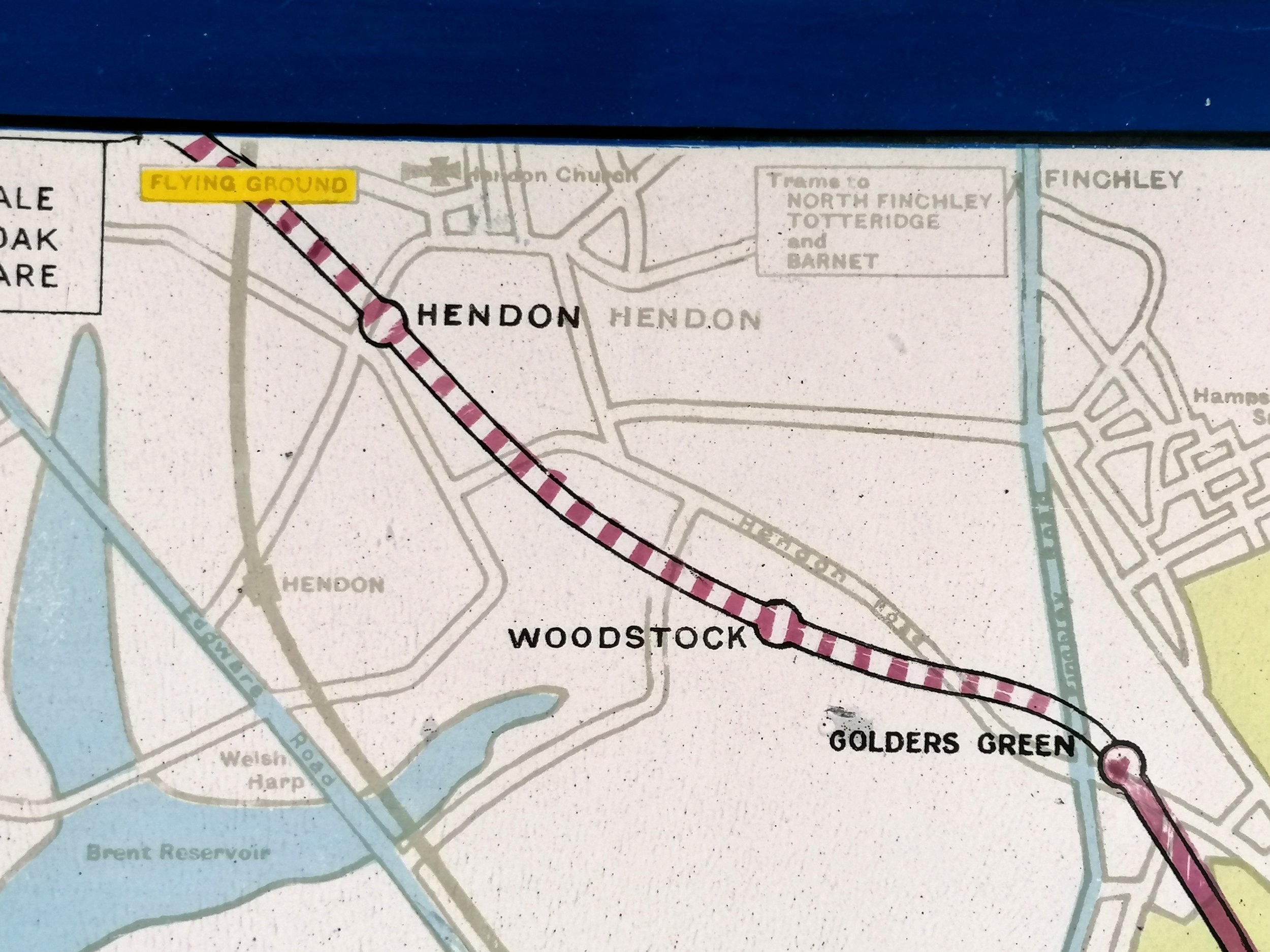
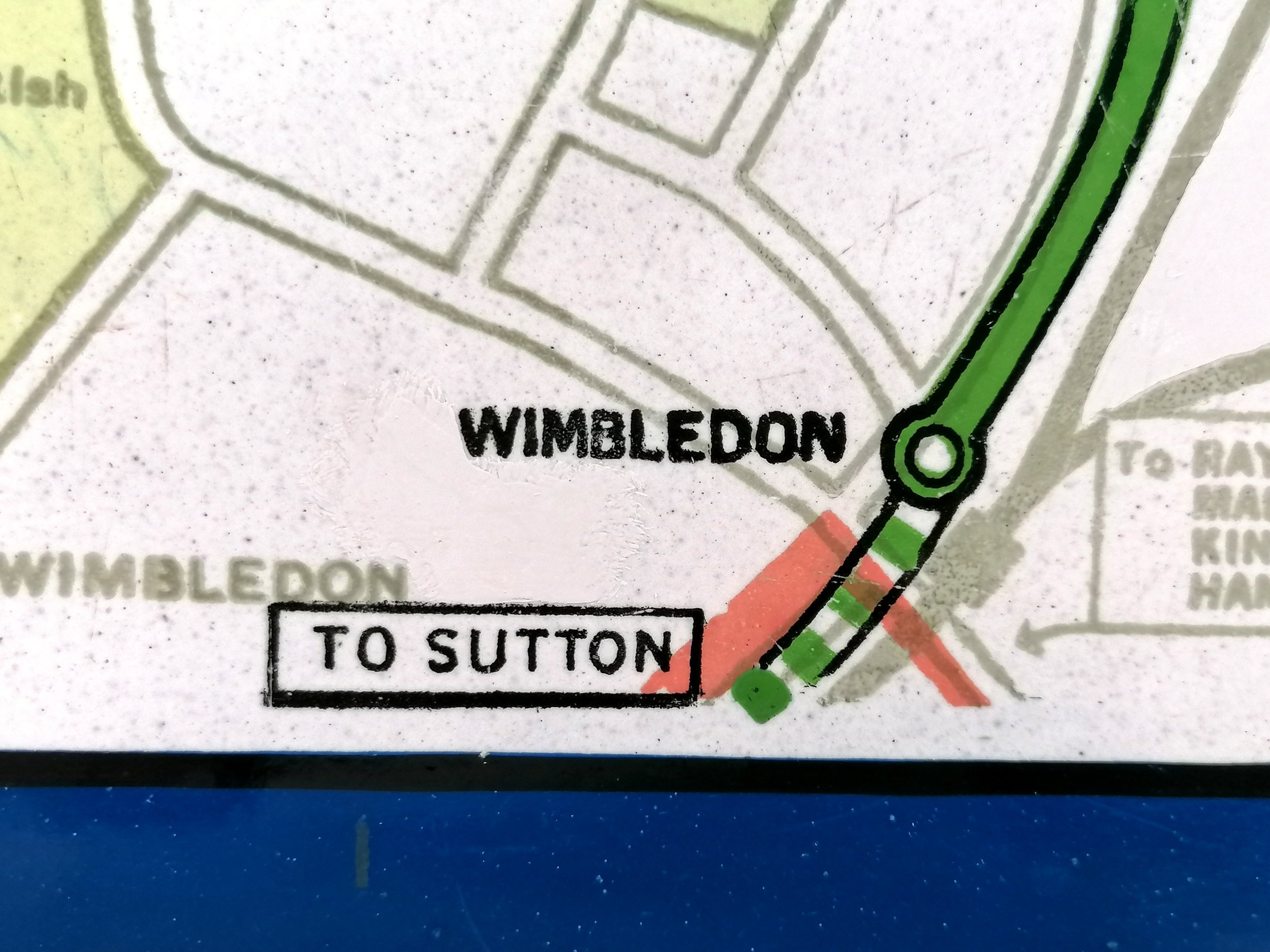
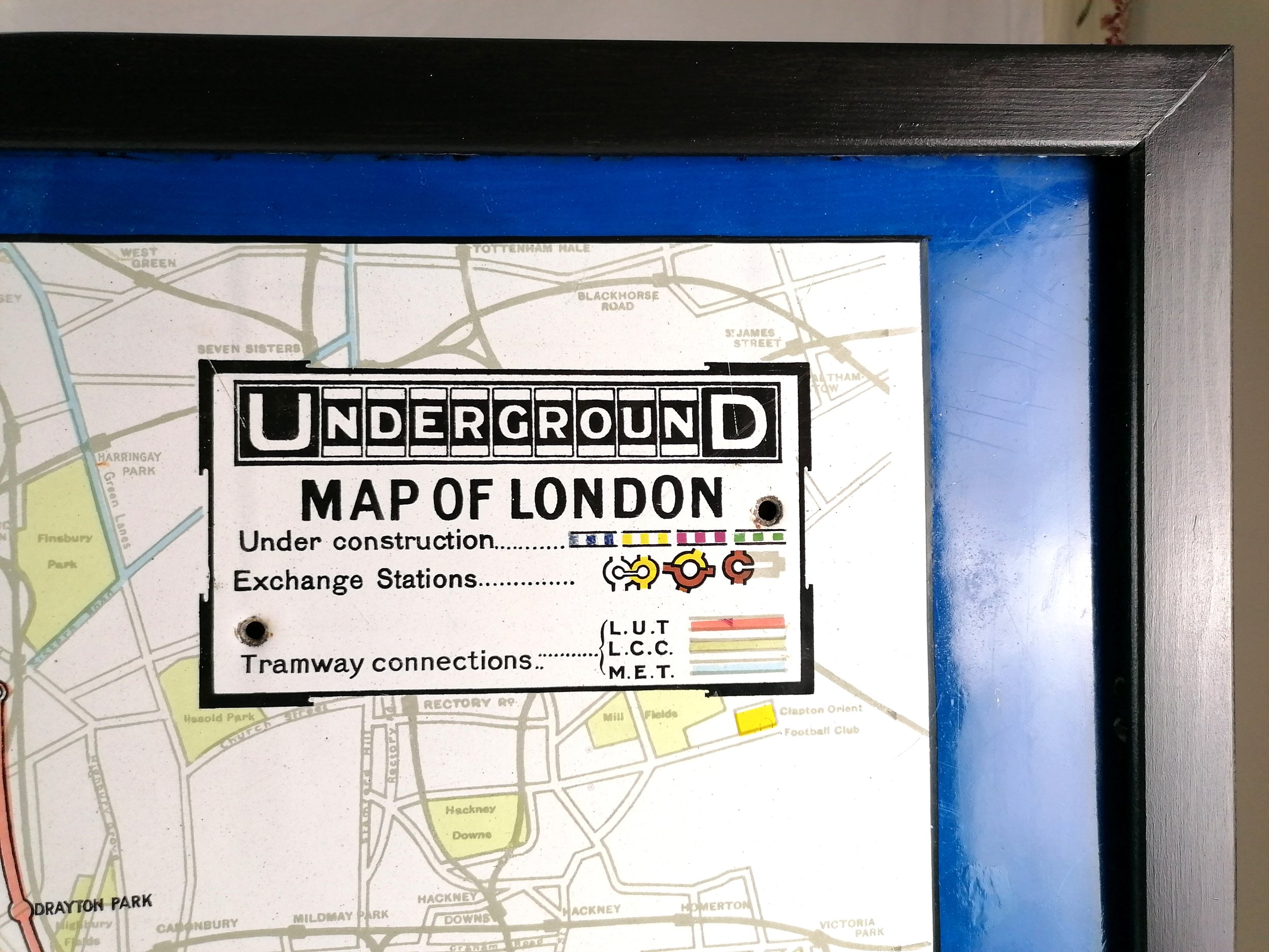
In the top right corner we see one of the last appearances of the 1908 ‘UndergrounD’ wordmark which was updated in 1916 when the Johnston typeface was introduced across the network. This map dates to early 1915, during this time the Bakerloo began extending services along the existing L&NWR - this map shows the Bakerloo as far as Queens Park station (opened Feb 1915) but has yet to reach Willesden Junction (which it did in May 1915). Reflecting the pre-war optimism of 1914, it features four planned extensions (shown as dashed lines) but the redirection of finances towards the War effort lead to two extensions being cancelled with the other two pushed into the 1920s.
London Transport Museum hold an example of this enamel map at their depot in Acton, (item reference 1998/12740).
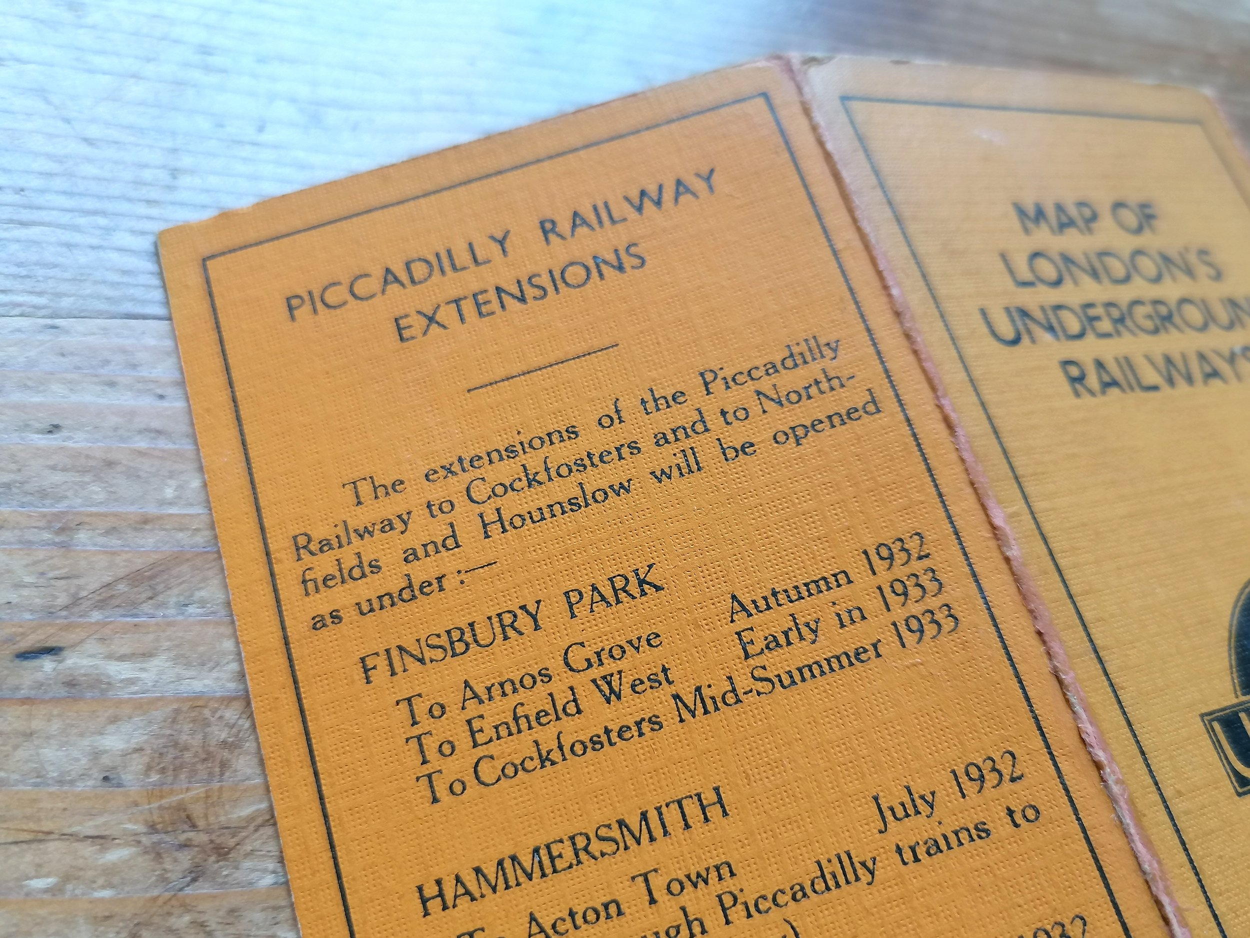
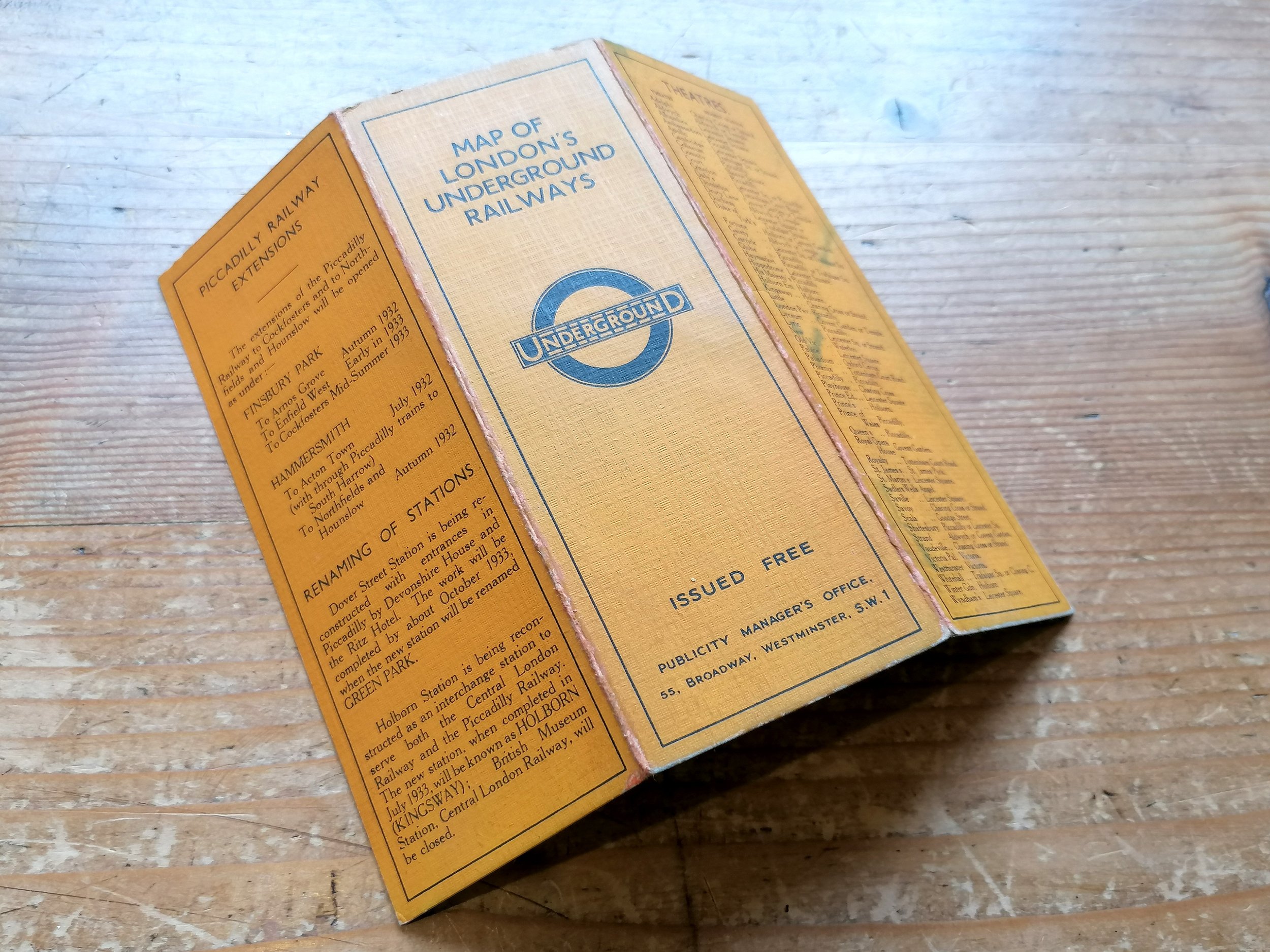
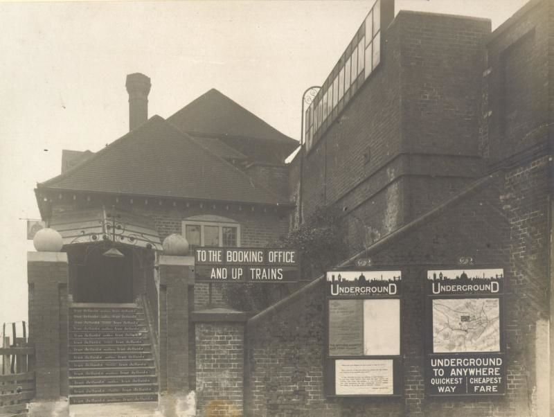
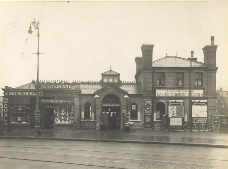
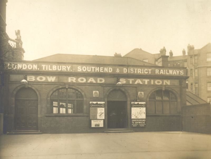
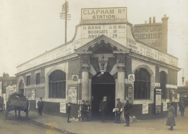
Whilst most station maps were printed on paper (with print runs usually in the low thousands), these enamel maps were produced for stations with outdoor display frames - usually at entrances. Therefore they were produced in low numbers. The bronze display frames were installed from around 1909 to carry the first unified maps of the Underground. Enamel maps continued to be issued up the mid-1930s.
Chromo Wolverhampton (short for the Chromographic Enamel Company (Wolverhampton) Limited) were founded in 1886 and among the first manufacturers of vitreous enamel signs. They were used extensively by the London Underground railway companies from as early as the 1890s.
Free UK Delivery. For non-UK delivery please request quotation. This is a large and heavy item (20kg+).
Underground Map of London
Vitreous enamel and rolled iron. Manufactured by Chromo Wolverhampton for the Underground Electric Railways of London. Circa 1915. Size: Map 127 × 96cm / Framed 133cm x 101cm x 4cm. Condition: Outstanding example. Some loss at the edges as to be expected (or even desired) with a sign of this age. Minor marks. Two drilled holes in the legend box - it is clear that these holes were created during the production process though for what purpose it is unclear. The example held by LT Museum has exactly the same holes.
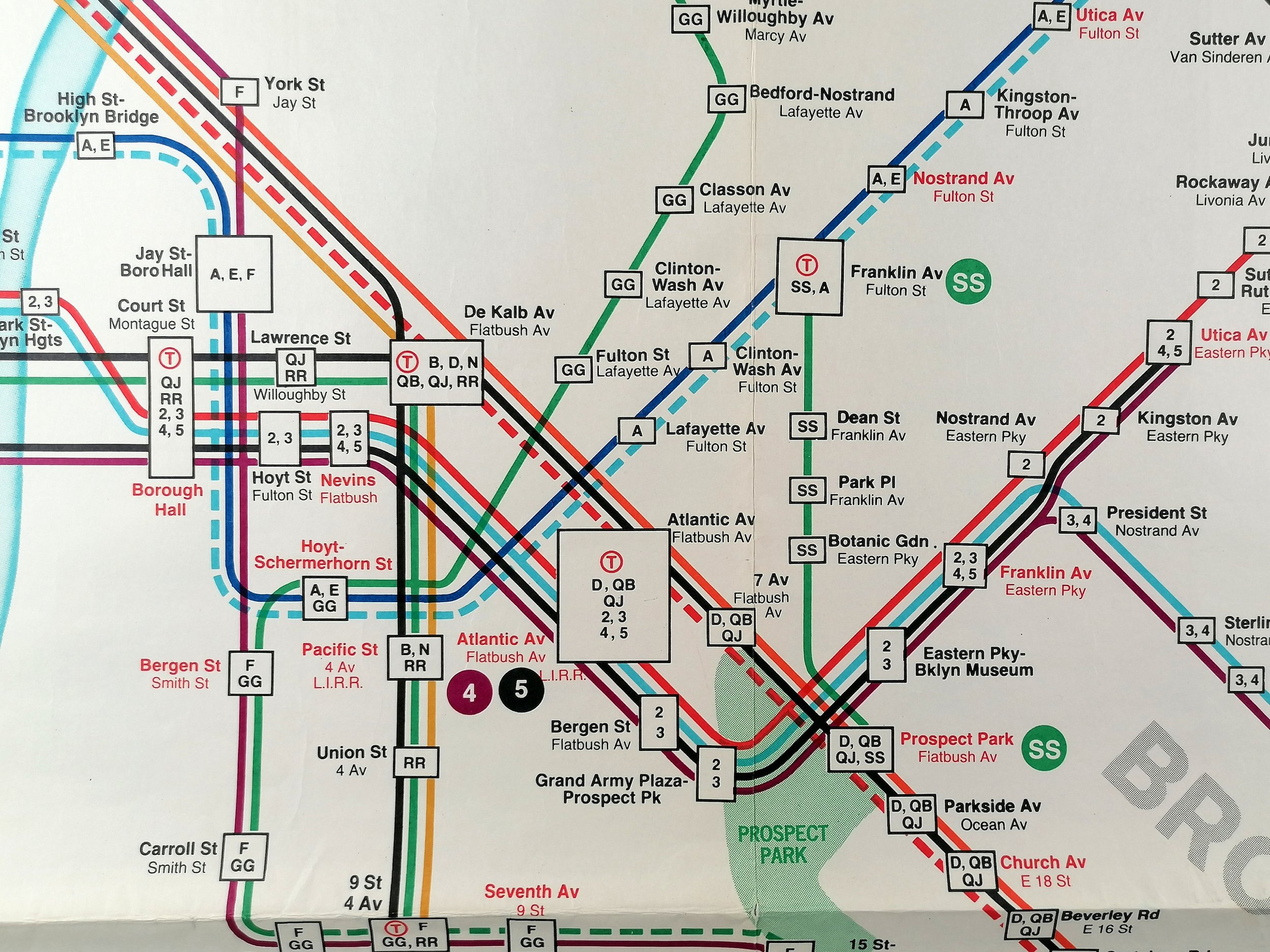
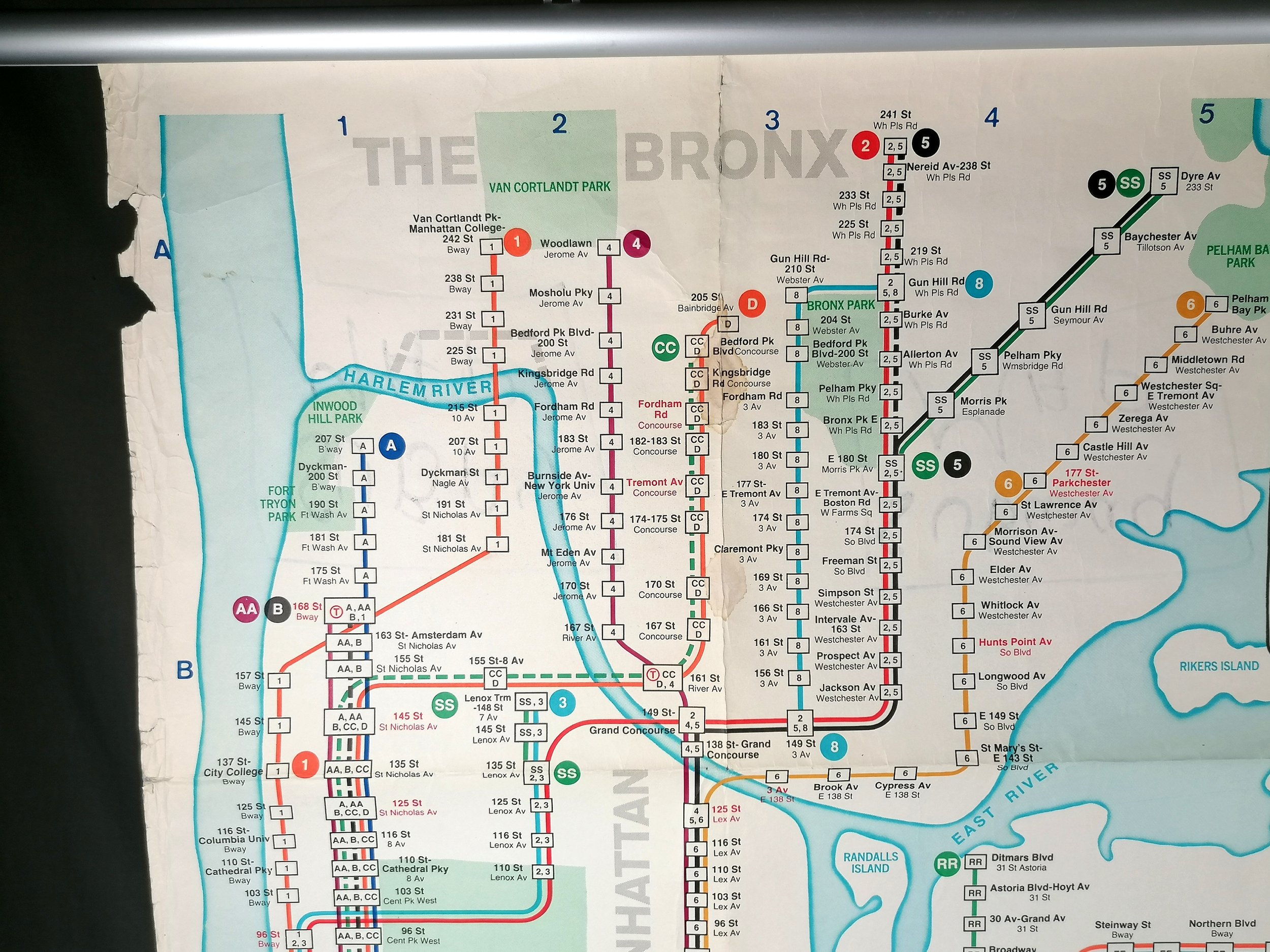
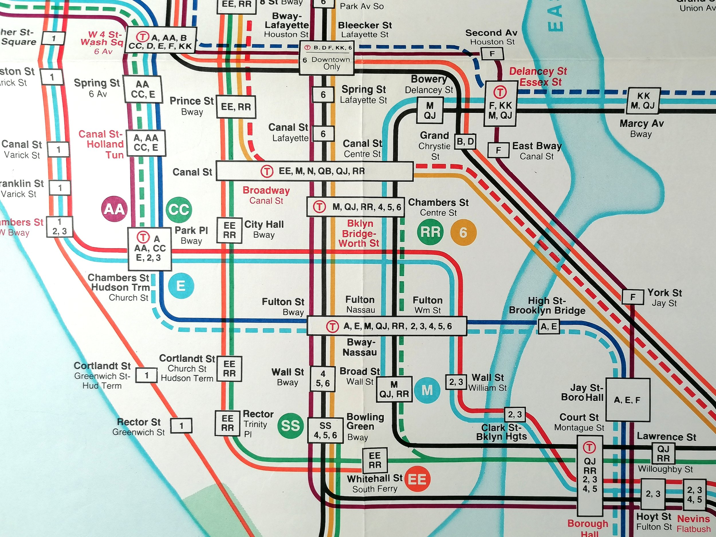
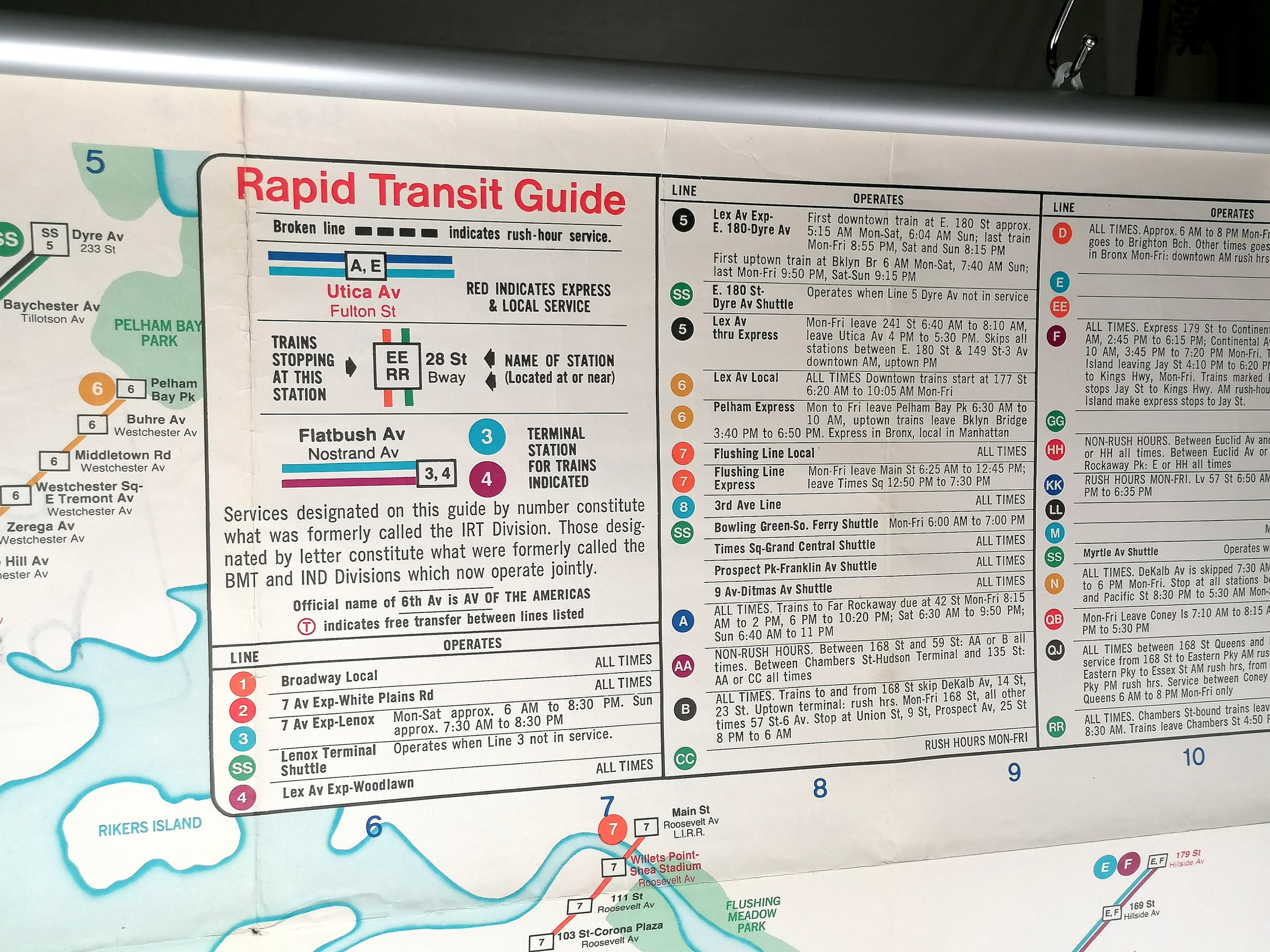
This amazing WWI-era London relic can be dated to 1915 and would have been displayed at the entrance to a London Underground station. The map features all the London Underground lines of the day who, despite operating as separate companies, had agreed to coordinate under a single ‘UndergrounD’ brand (and map) from 1908.
In the top right corner we see one of the last appearances of the 1908 ‘UndergrounD’ wordmark which was updated in 1916 when the Johnston typeface was introduced across the network. This map dates to early 1915, during this time the Bakerloo began extending services along the existing L&NWR - this map shows the Bakerloo as far as Queens Park station (opened Feb 1915) but has yet to reach Willesden Junction (which it did in May 1915). Reflecting the pre-war optimism of 1914, it features four planned extensions (shown as dashed lines) but the redirection of finances towards the War effort lead to two extensions being cancelled with the other two pushed into the 1920s.
London Transport Museum hold an example of this enamel map at their depot in Acton, (item reference 1998/12740).
Whilst most station maps were printed on paper (with print runs usually in the low thousands), these enamel maps were produced for stations with outdoor display frames - usually at entrances. Therefore they were produced in low numbers. The bronze display frames were installed from around 1909 to carry the first unified maps of the Underground. Enamel maps continued to be issued up the mid-1930s.
Chromo Wolverhampton (short for the Chromographic Enamel Company (Wolverhampton) Limited) were founded in 1886 and among the first manufacturers of vitreous enamel signs. They were used extensively by the London Underground railway companies from as early as the 1890s.
Free UK Delivery. For non-UK delivery please request quotation. This is a large and heavy item (20kg+).
Underground Map of London
Vitreous enamel and rolled iron. Manufactured by Chromo Wolverhampton for the Underground Electric Railways of London. Circa 1915. Size: Map 127 × 96cm / Framed 133cm x 101cm x 4cm. Condition: Outstanding example. Some loss at the edges as to be expected (or even desired) with a sign of this age. Minor marks. Two drilled holes in the legend box - it is clear that these holes were created during the production process though for what purpose it is unclear. The example held by LT Museum has exactly the same holes.
This amazing WWI-era London relic can be dated to 1915 and would have been displayed at the entrance to a London Underground station. The map features all the London Underground lines of the day who, despite operating as separate companies, had agreed to coordinate under a single ‘UndergrounD’ brand (and map) from 1908.
In the top right corner we see one of the last appearances of the 1908 ‘UndergrounD’ wordmark which was updated in 1916 when the Johnston typeface was introduced across the network. This map dates to early 1915, during this time the Bakerloo began extending services along the existing L&NWR - this map shows the Bakerloo as far as Queens Park station (opened Feb 1915) but has yet to reach Willesden Junction (which it did in May 1915). Reflecting the pre-war optimism of 1914, it features four planned extensions (shown as dashed lines) but the redirection of finances towards the War effort lead to two extensions being cancelled with the other two pushed into the 1920s.
London Transport Museum hold an example of this enamel map at their depot in Acton, (item reference 1998/12740).
Whilst most station maps were printed on paper (with print runs usually in the low thousands), these enamel maps were produced for stations with outdoor display frames - usually at entrances. Therefore they were produced in low numbers. The bronze display frames were installed from around 1909 to carry the first unified maps of the Underground. Enamel maps continued to be issued up the mid-1930s.
Chromo Wolverhampton (short for the Chromographic Enamel Company (Wolverhampton) Limited) were founded in 1886 and among the first manufacturers of vitreous enamel signs. They were used extensively by the London Underground railway companies from as early as the 1890s.
Free UK Delivery. For non-UK delivery please request quotation. This is a large and heavy item (20kg+).