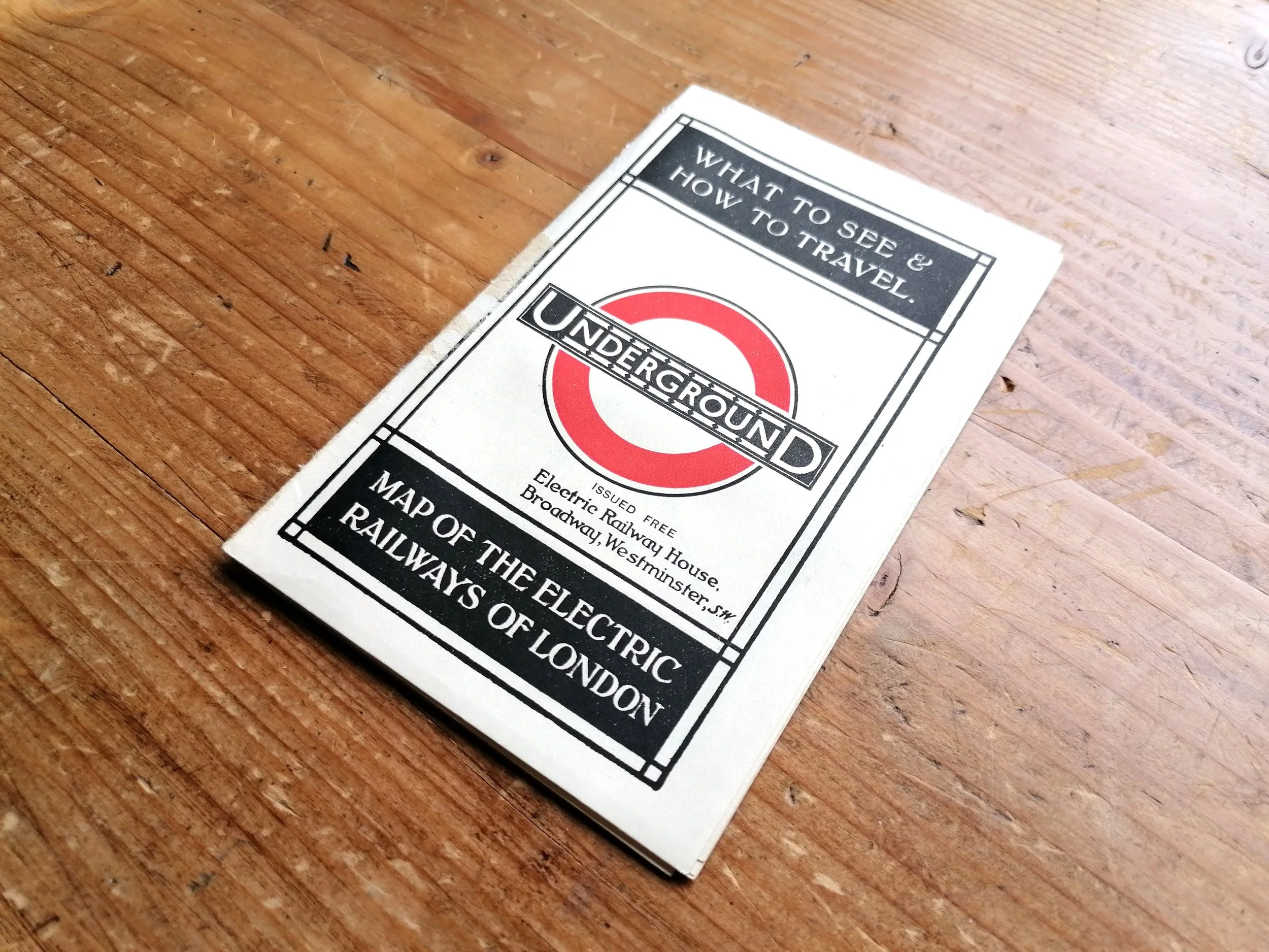
1923 London Underground Map - By Macdonald Gill (January Issue)
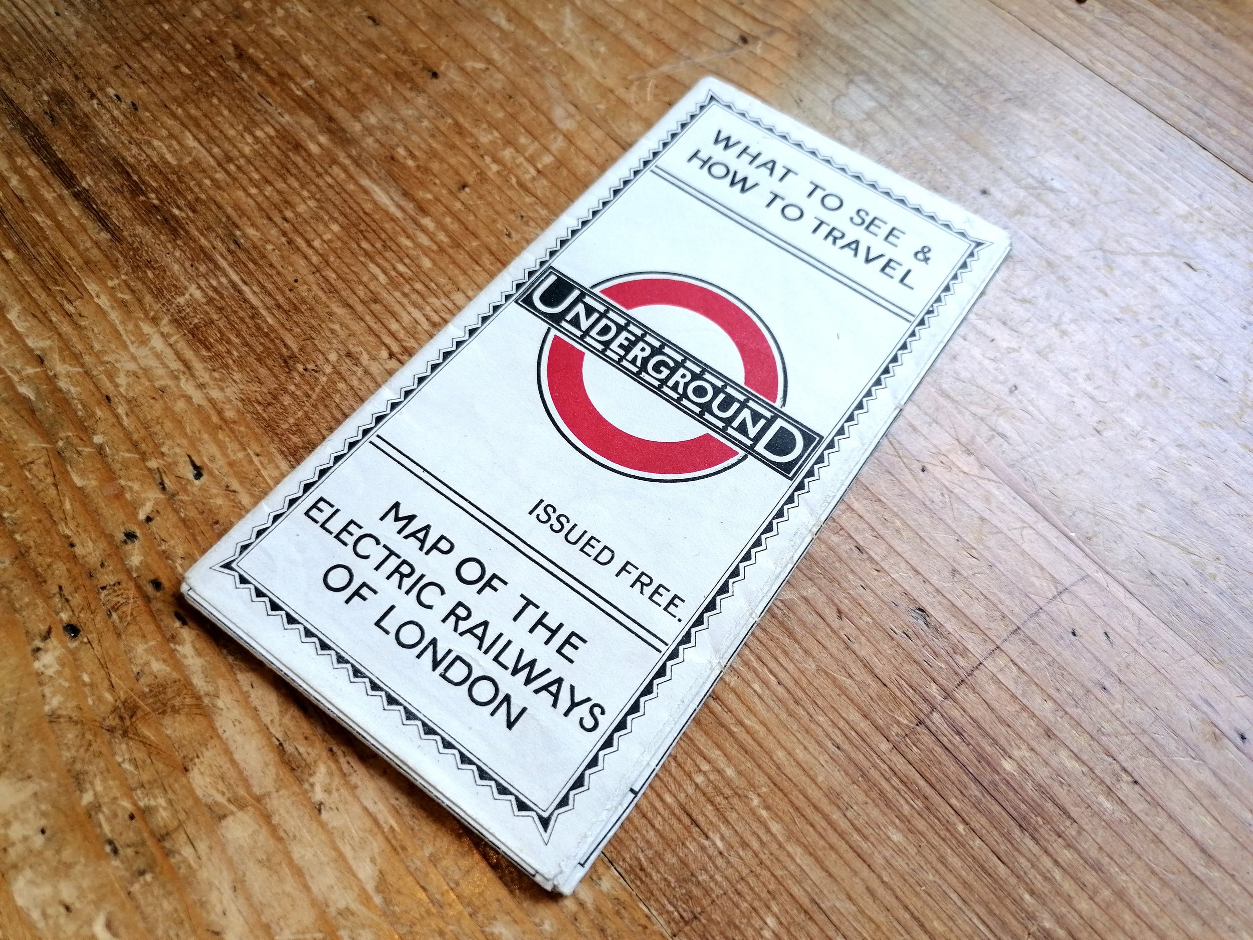
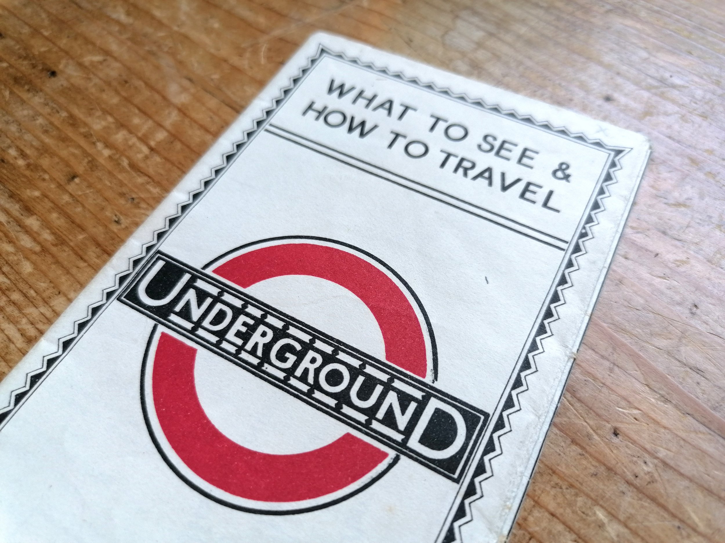
Underground - What to See & How to Travel - Map of the Electric Railways of London. 1923
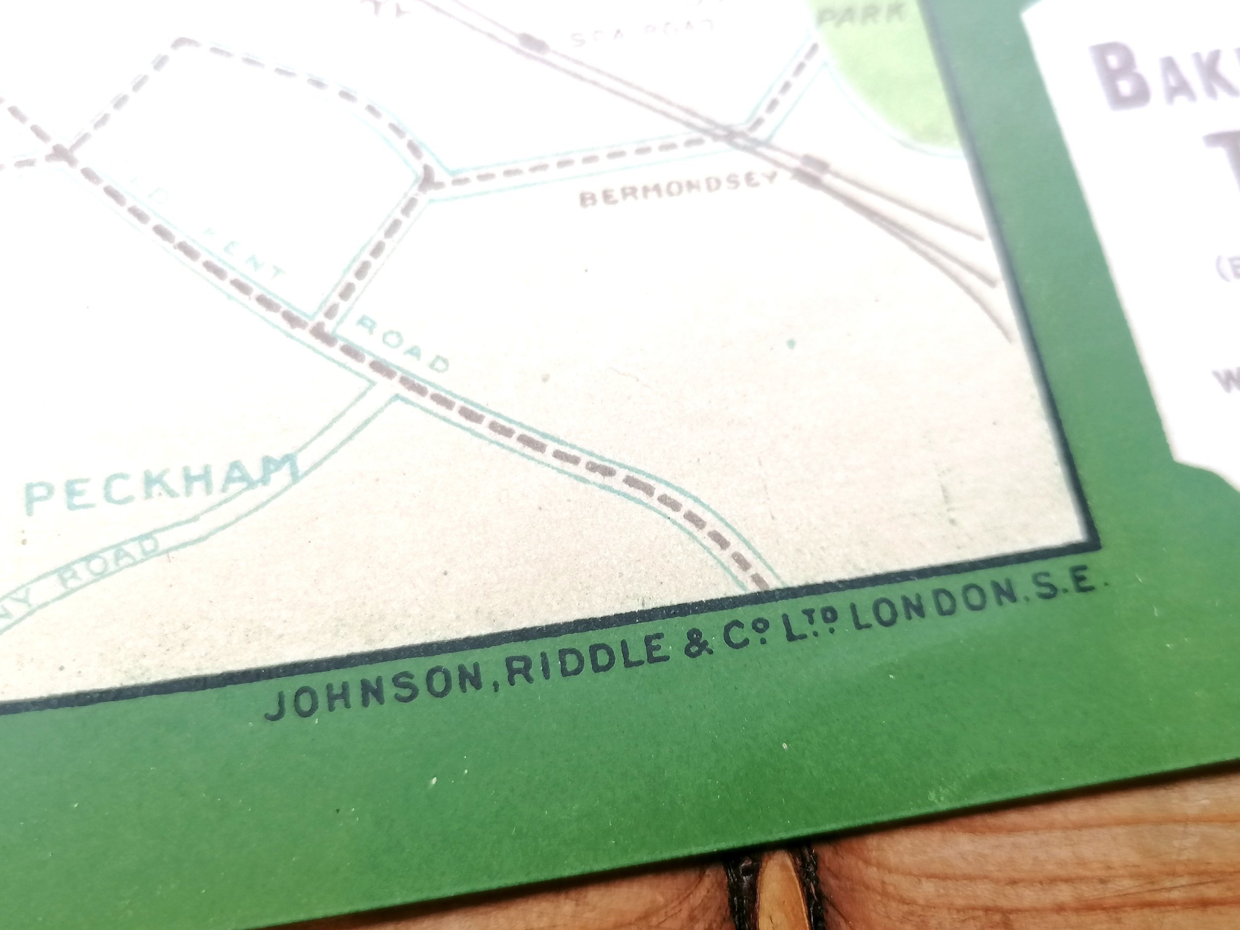
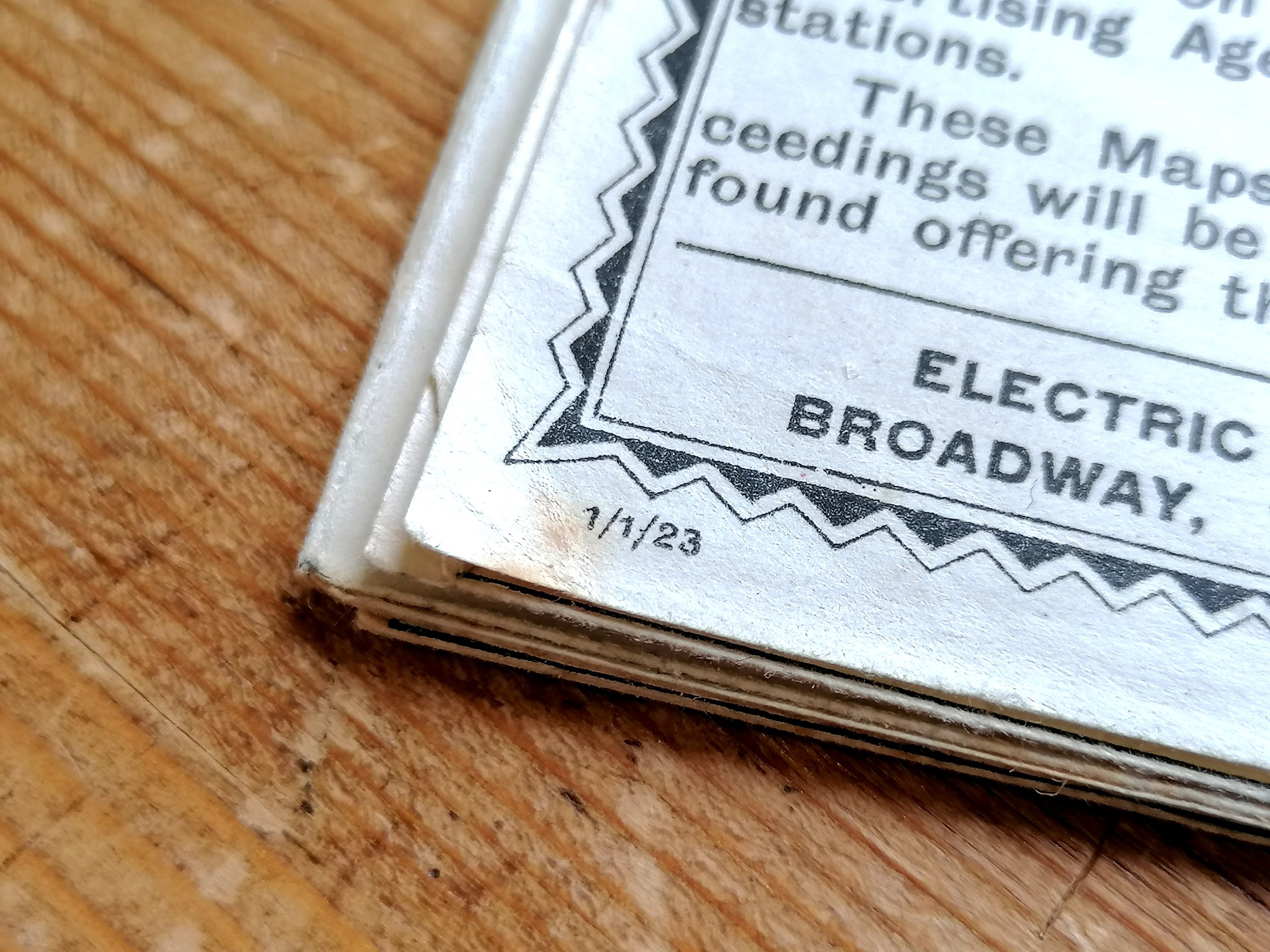
Designed by Macdonald Gill. Printed by Waterlow & Sons for London Underground Electric Railways. Folded paper pocket map. Print Code 1/1/23. Measures 45cm x 37cm. Condition: Very good lightly used example.
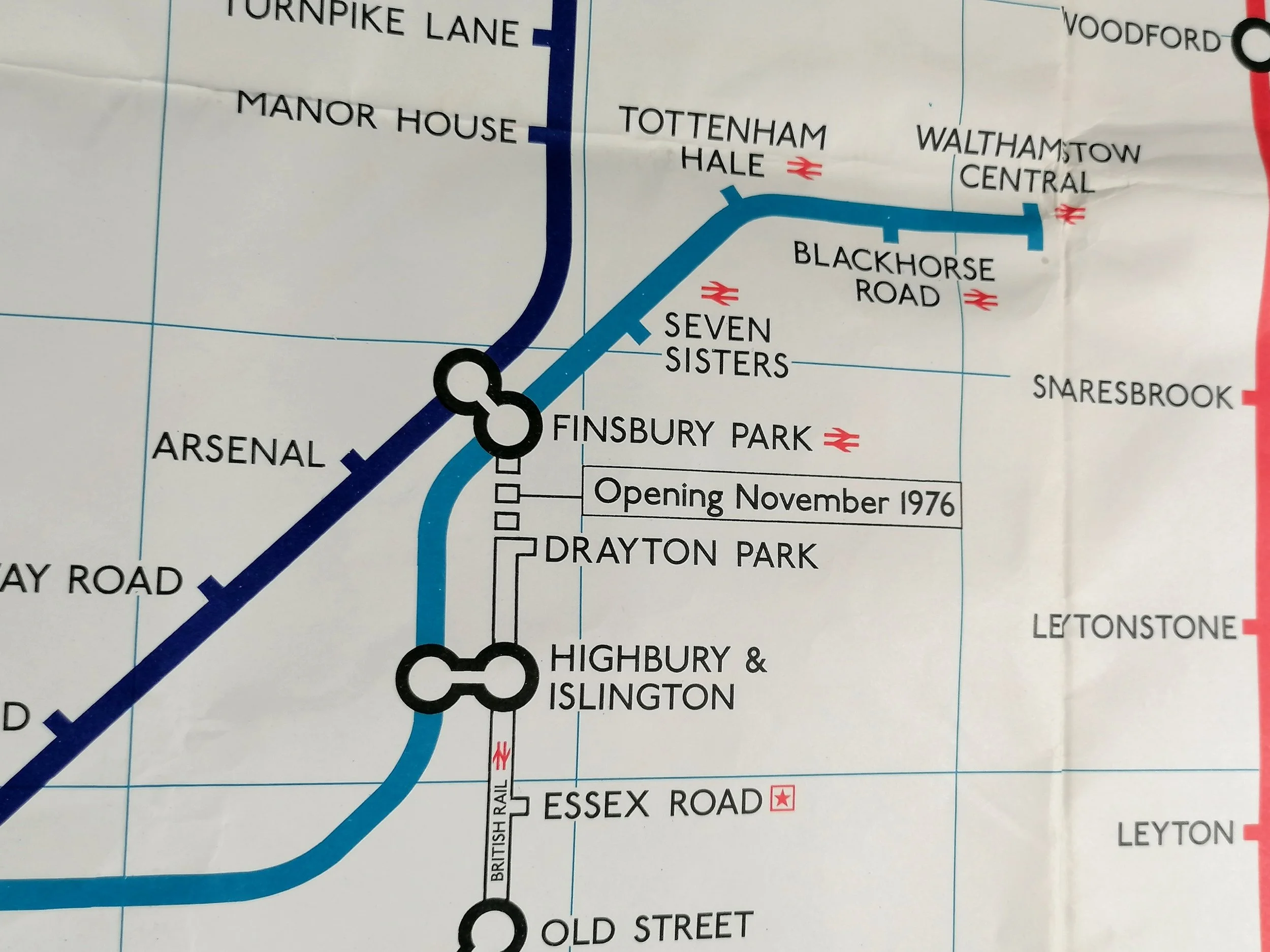
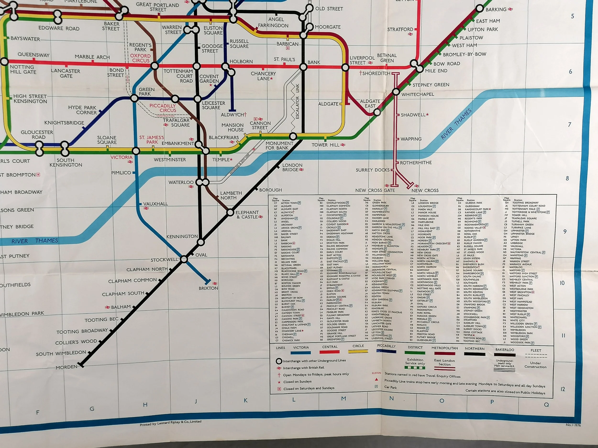
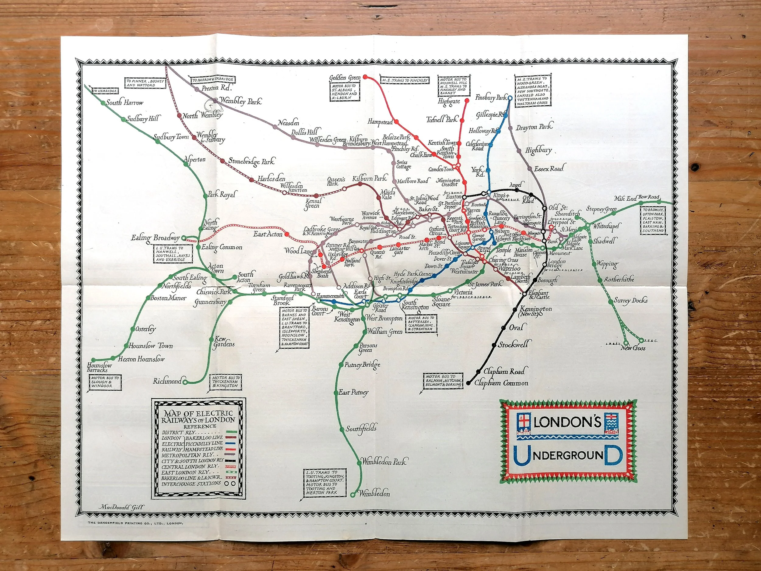
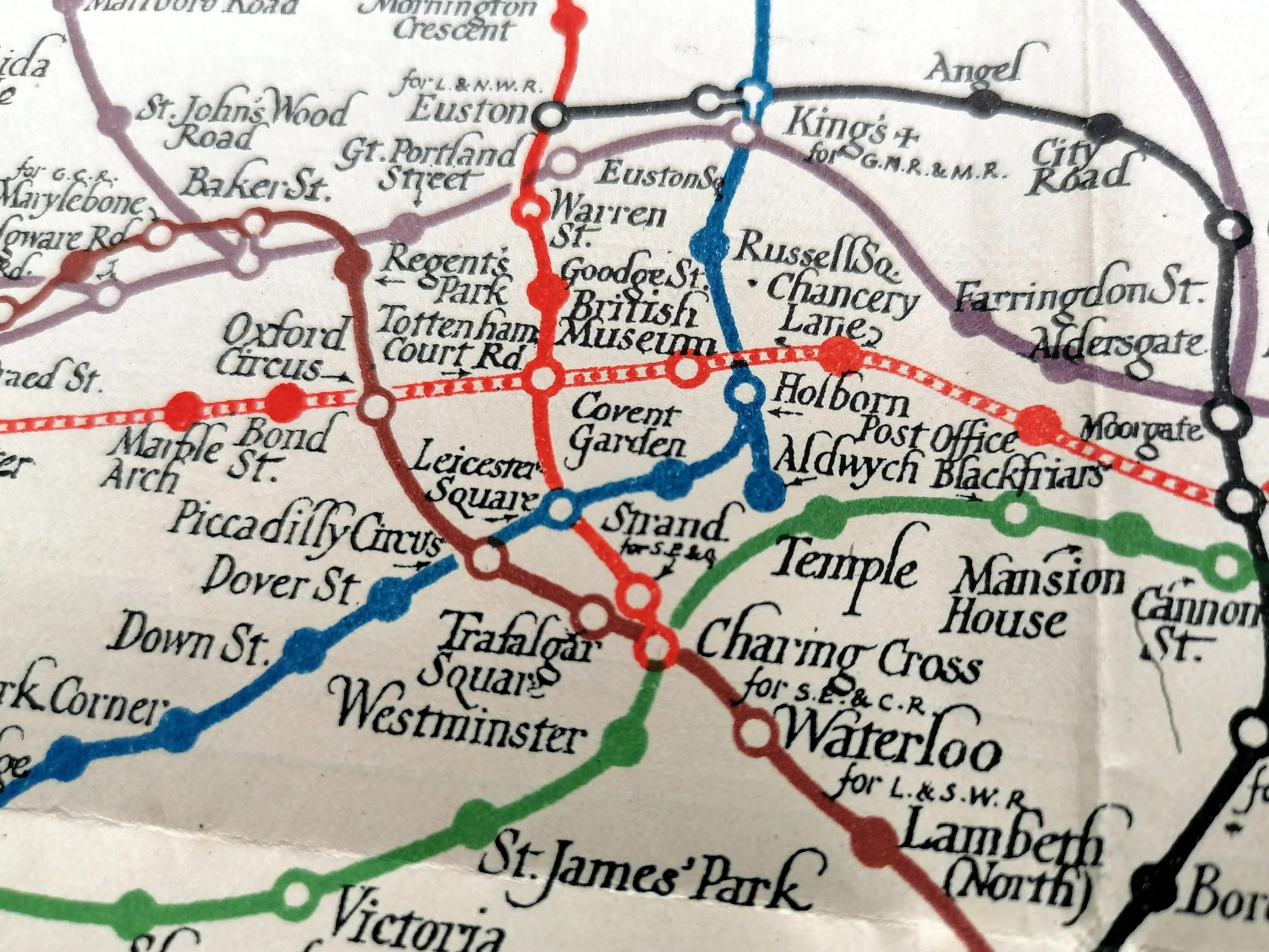
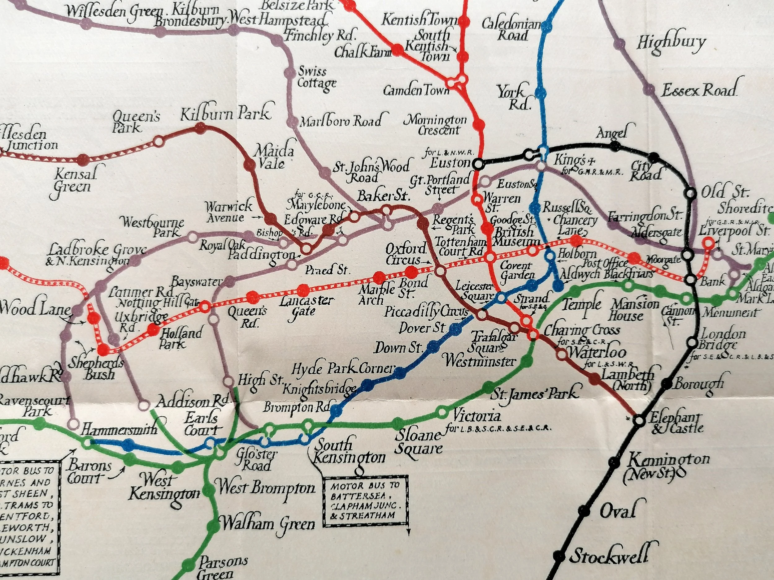
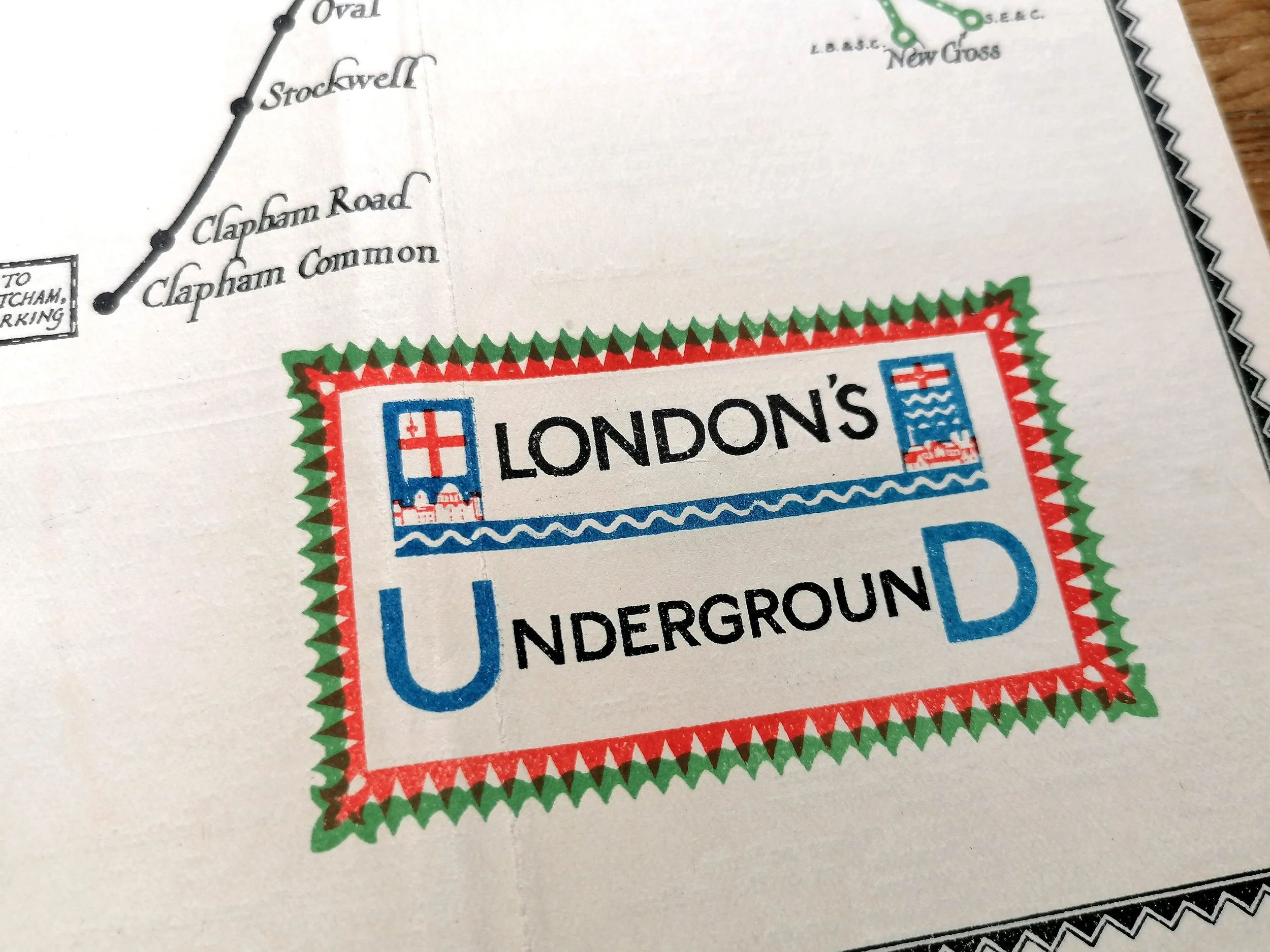
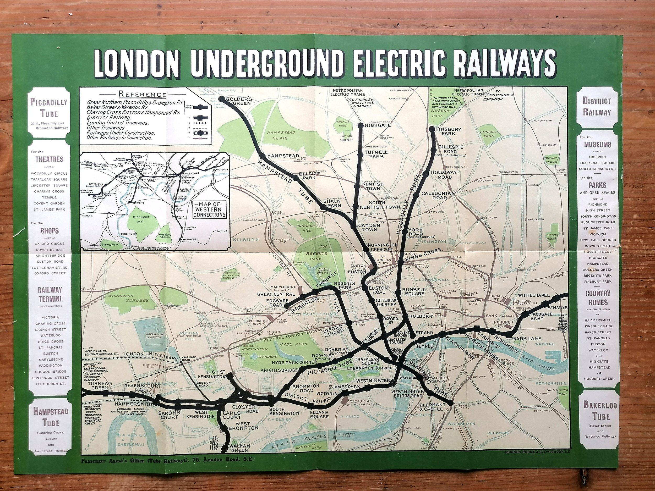
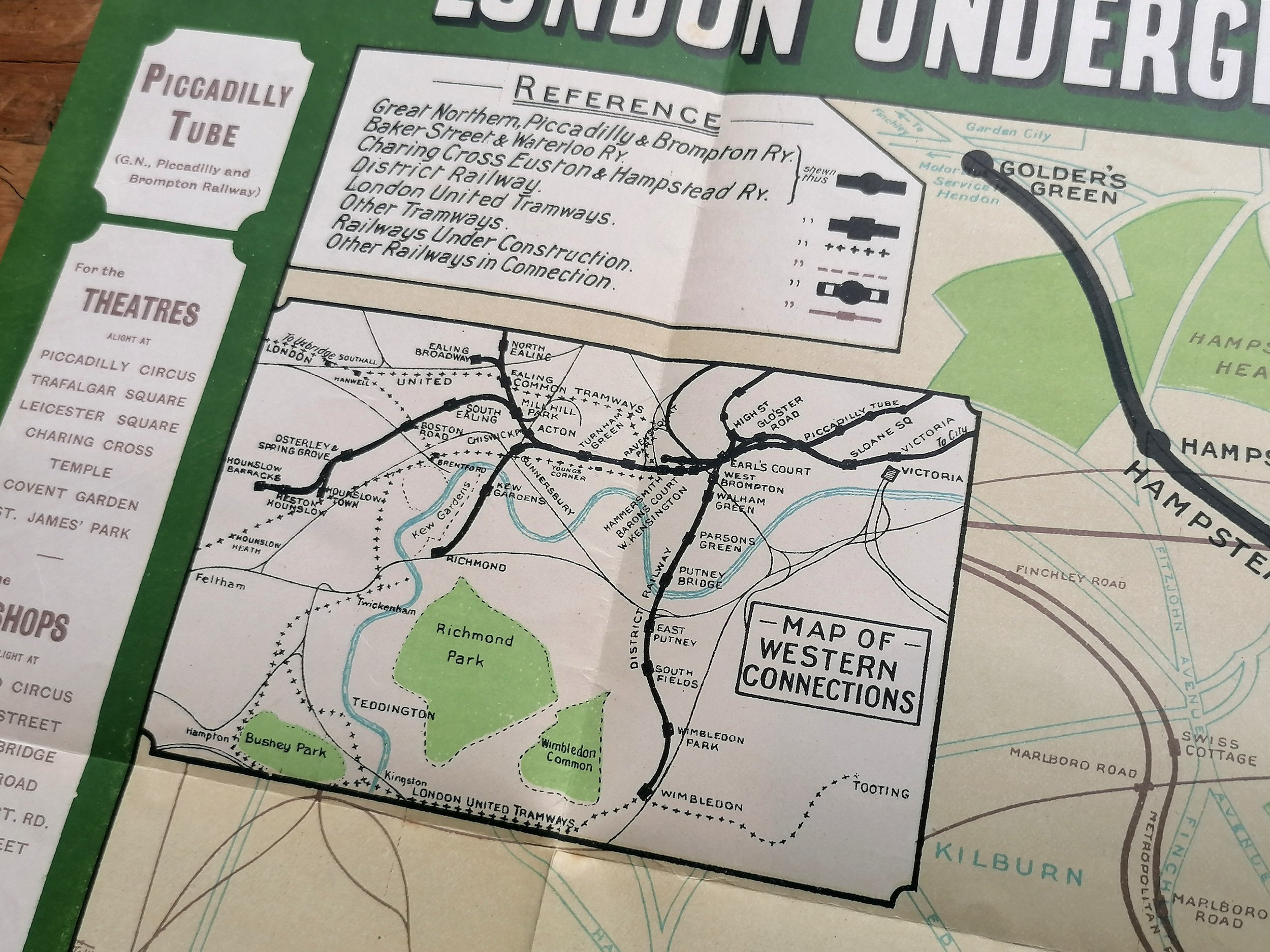
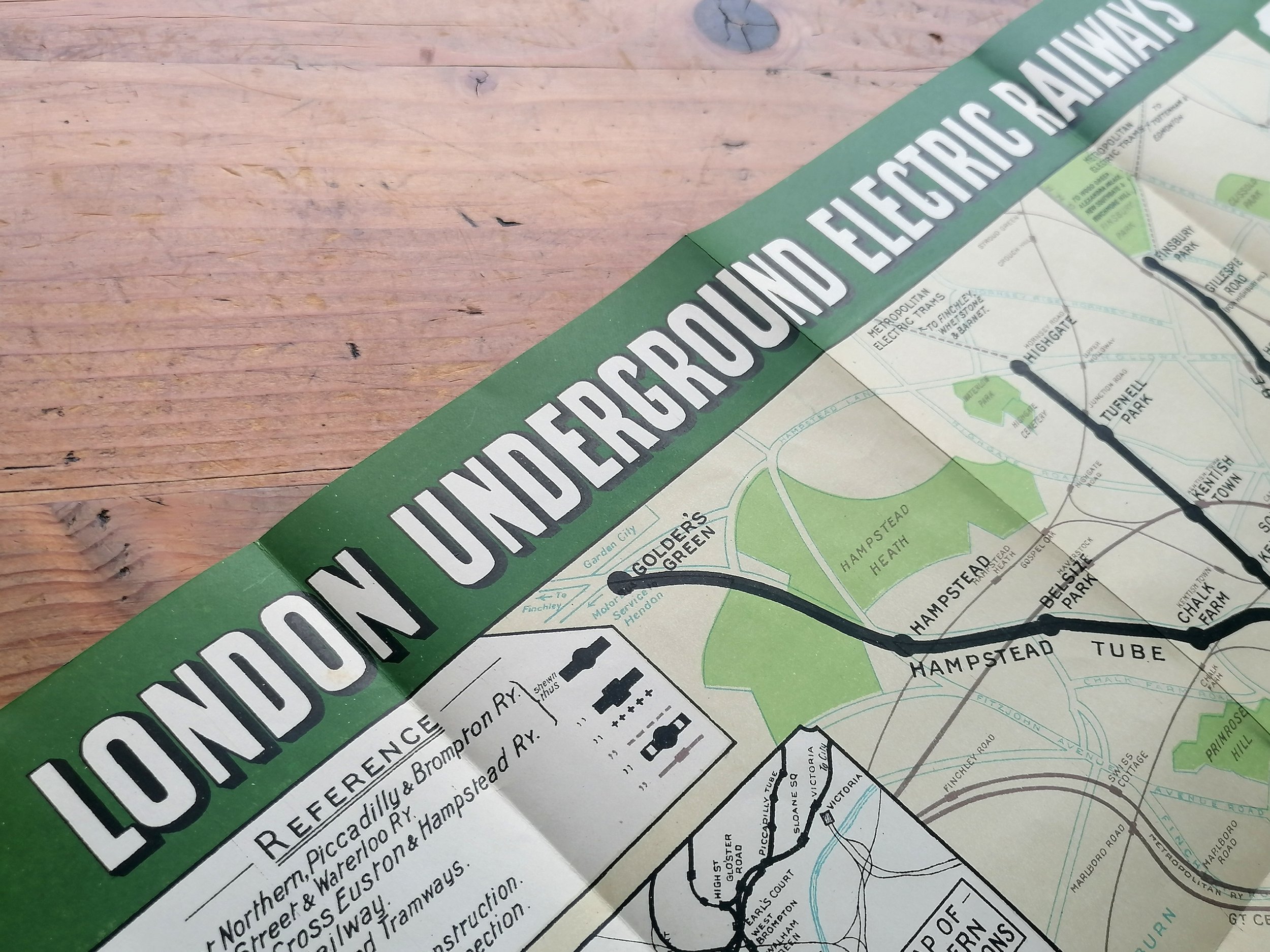
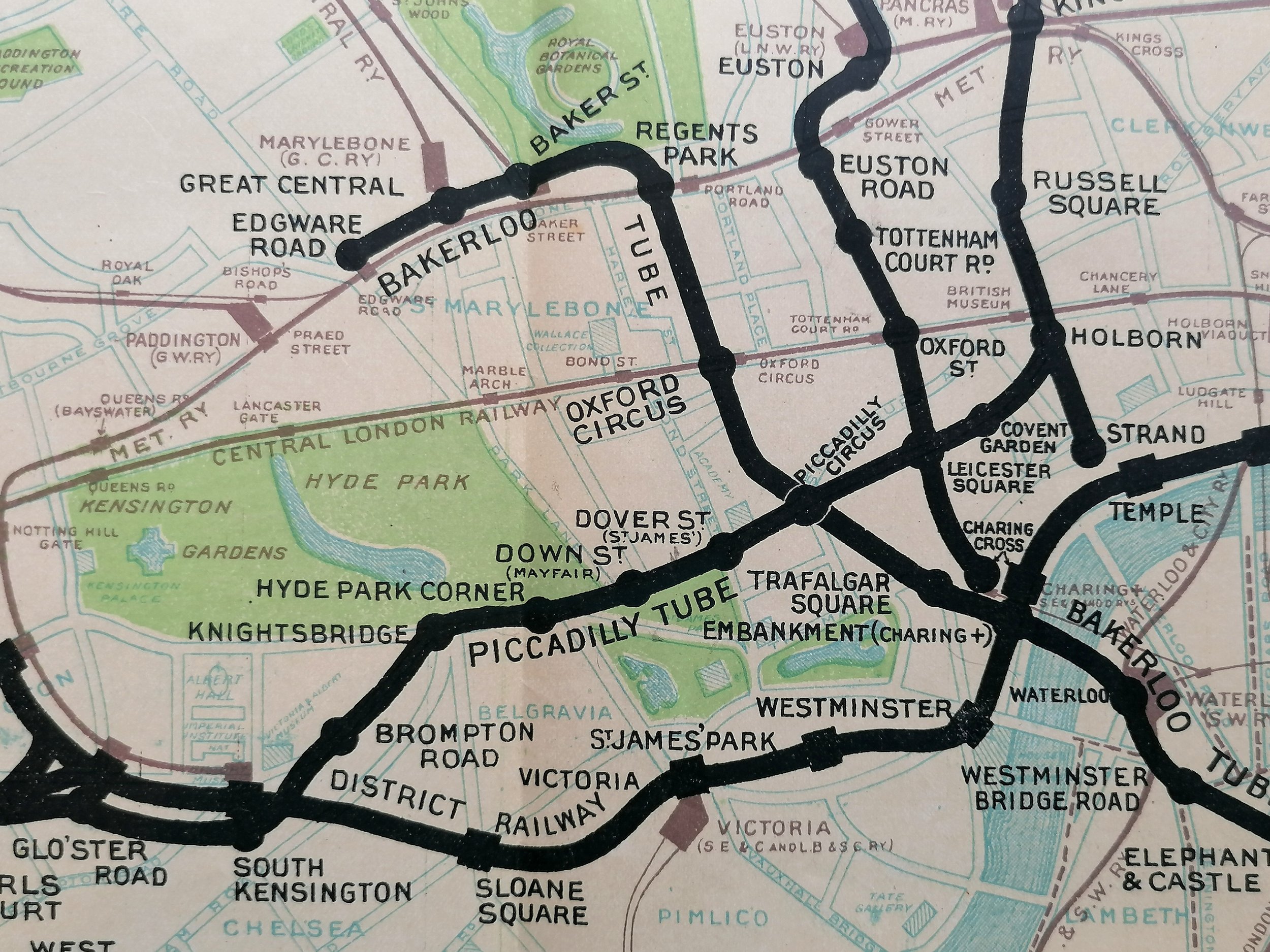
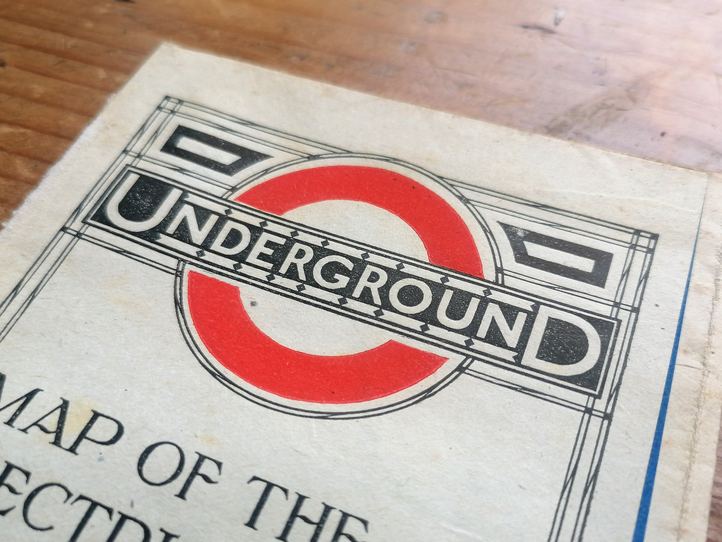
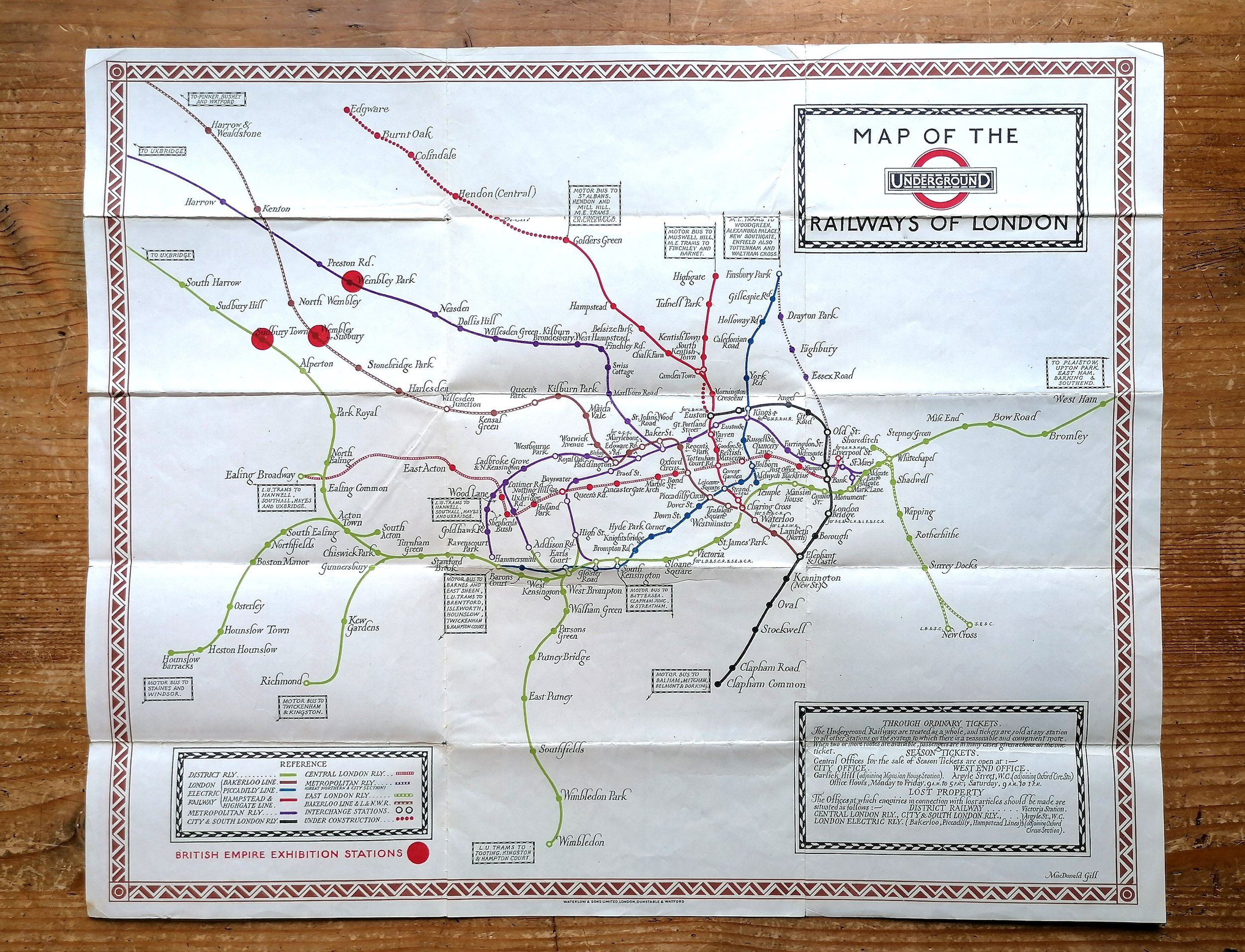
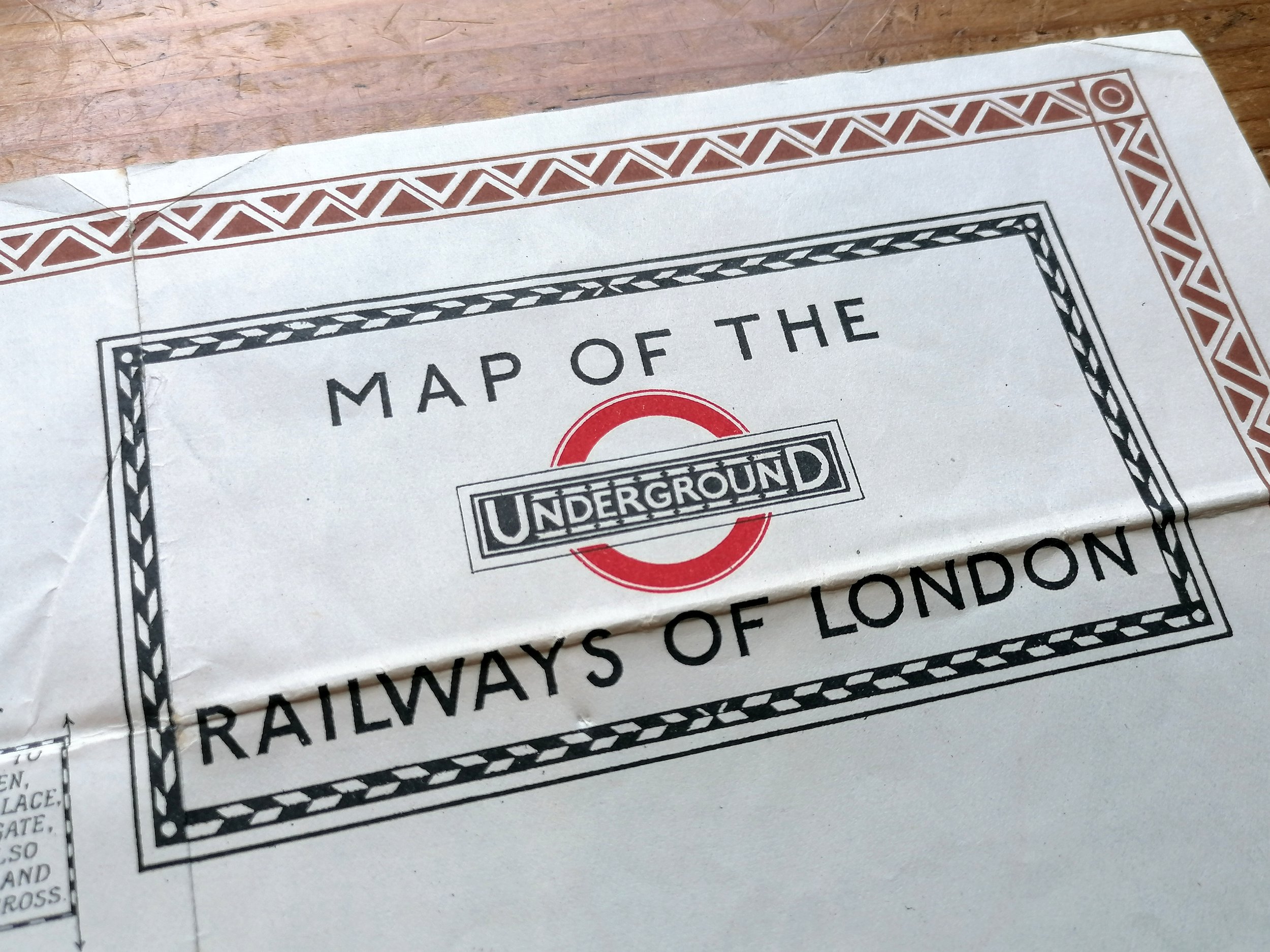
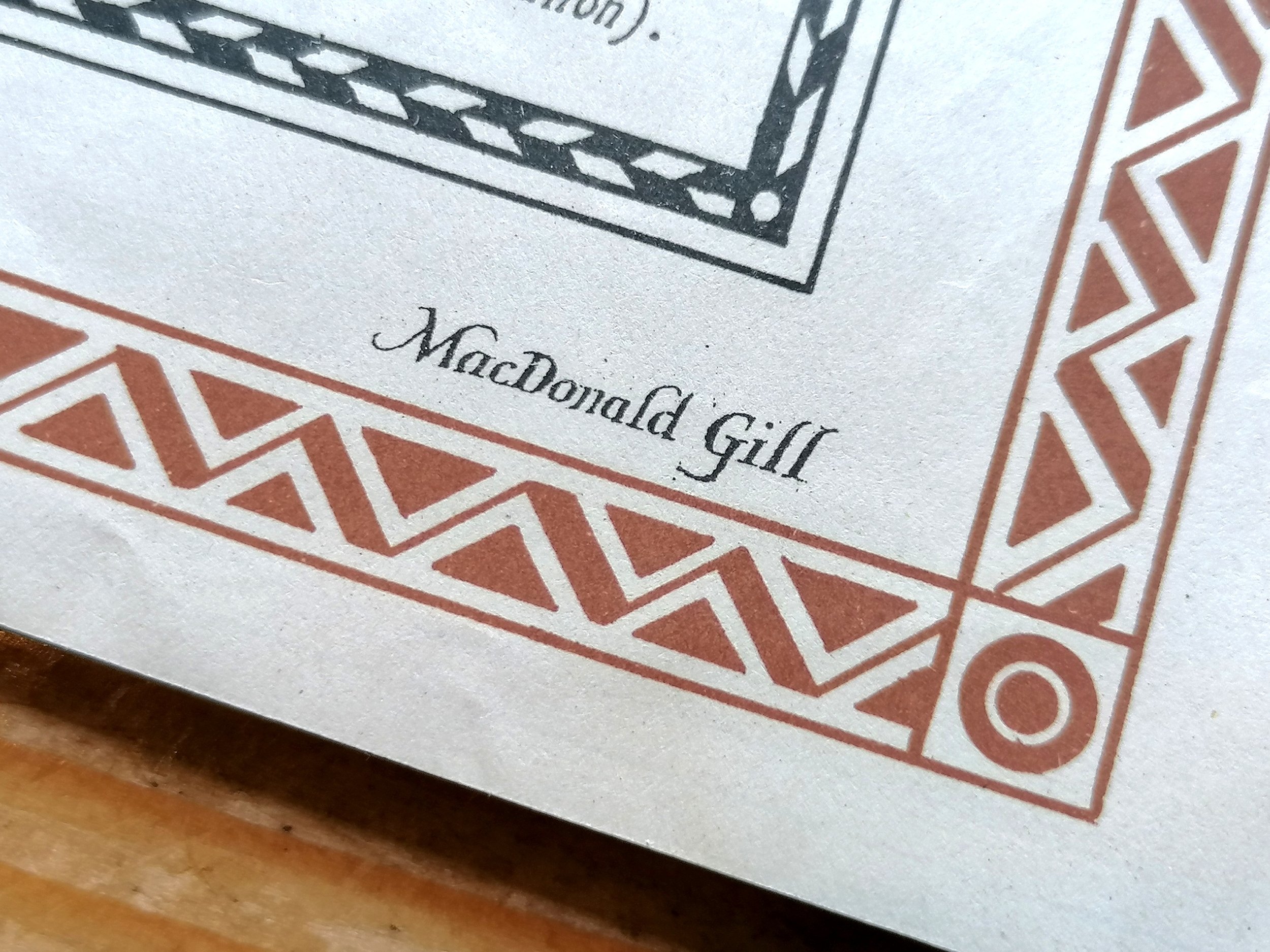
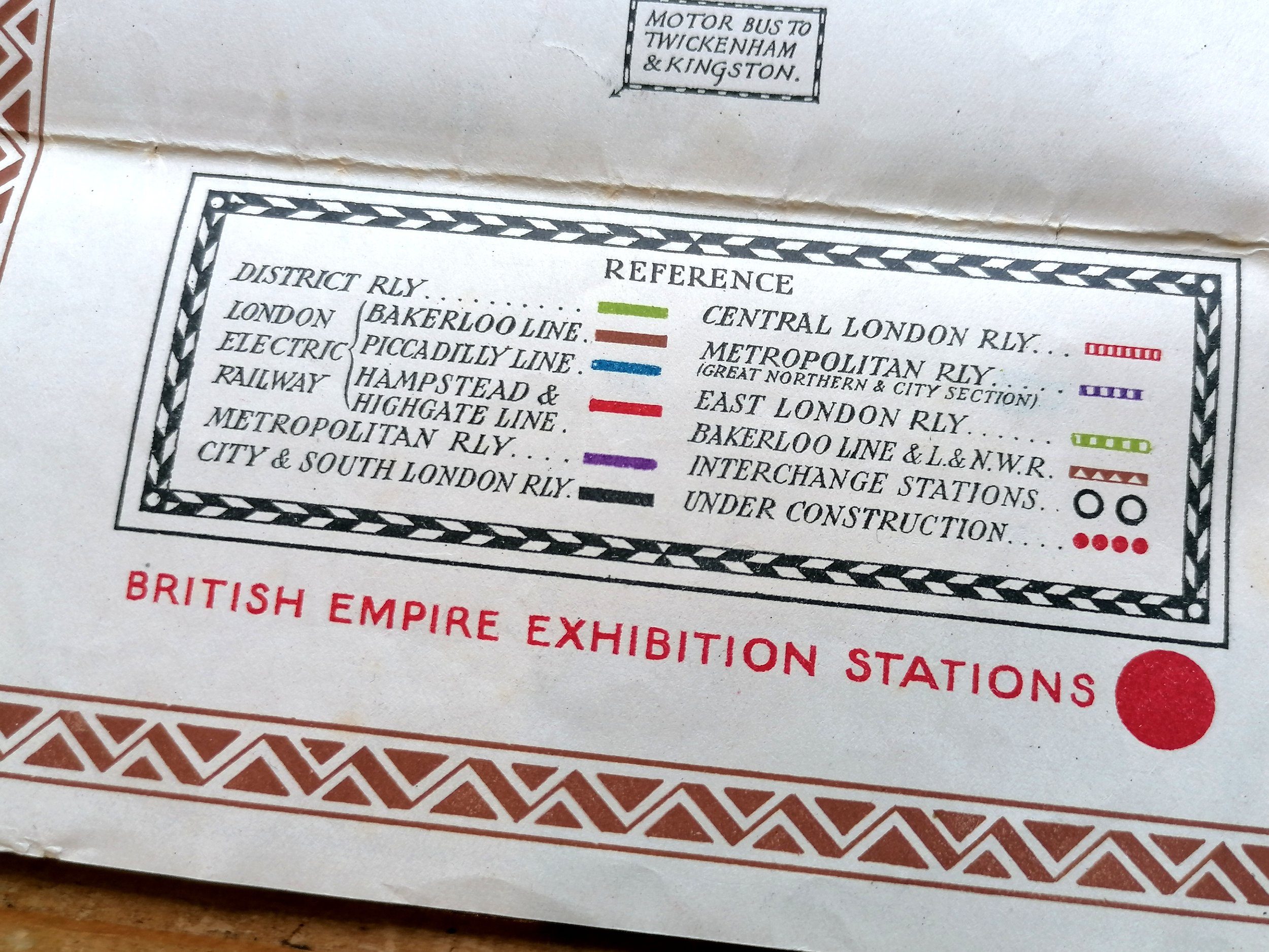
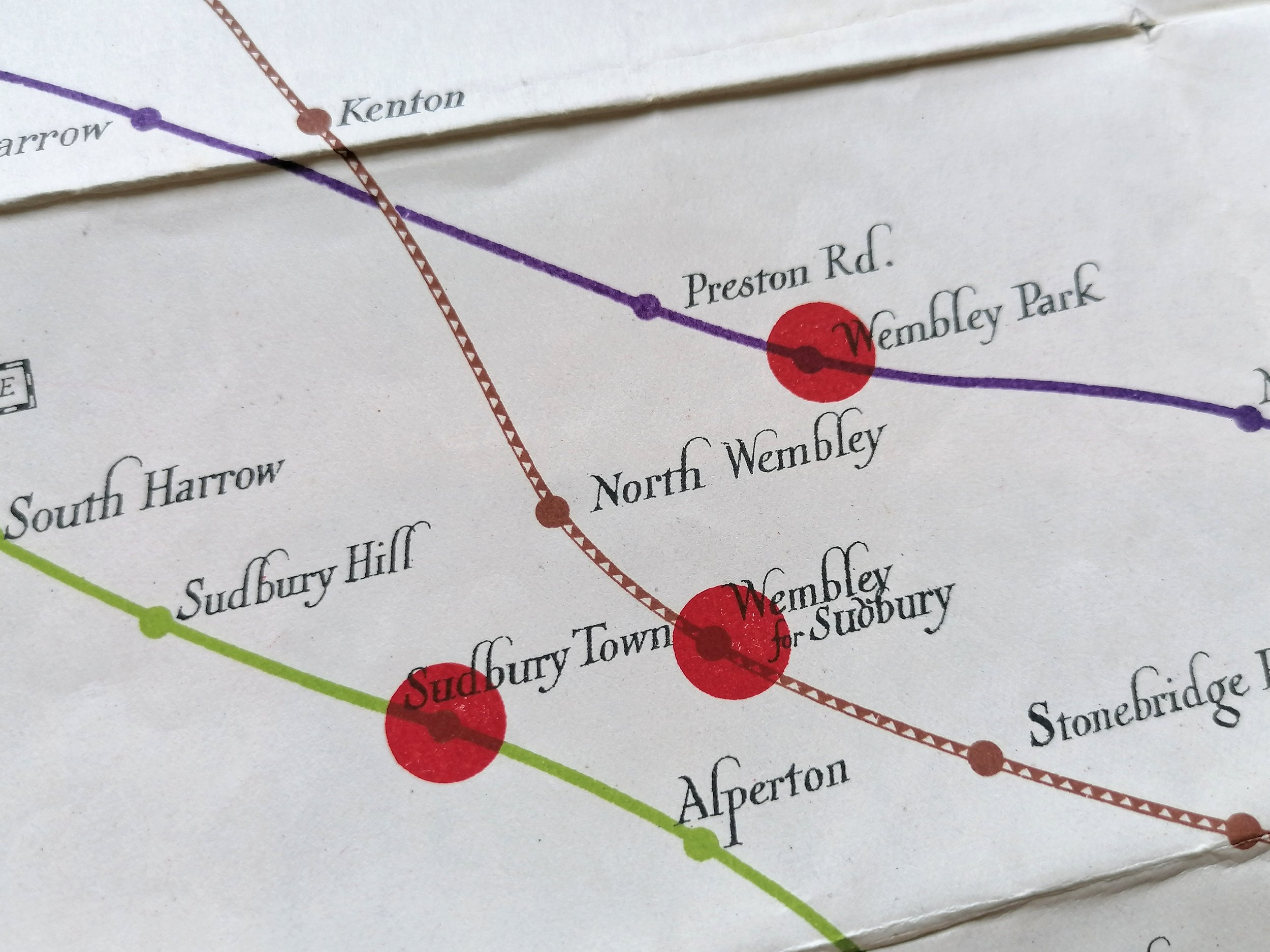
This wonderful fold-out pocket map of the London Underground was designed by Macdonald Gill who also designed maps of the Underground between 1920-1924. This was the largest of the series and the only one to bear the UndergrounD roundel on the map itself. The stations serving the British Empire Exhibition (1924) are shown as an bold red overprint. This is the 1st iteration of the 1923 Gill design that saw 4 dated issues (Jan '23, June' 23, Nov '23 and April' 24).
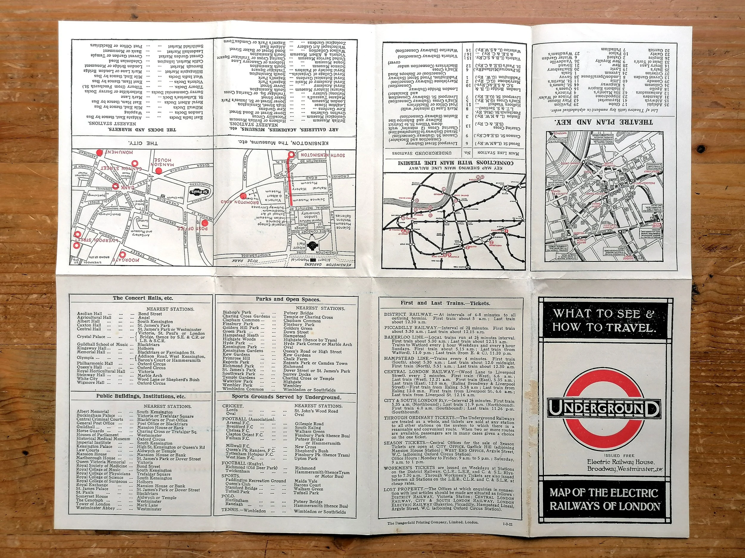
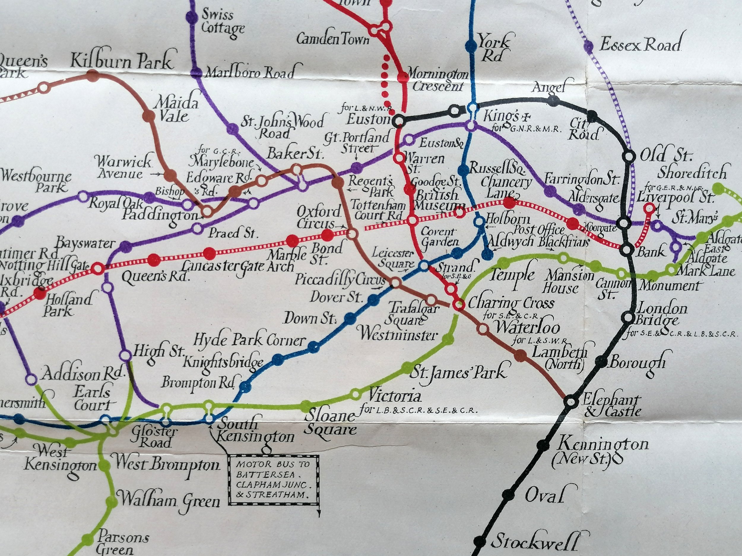
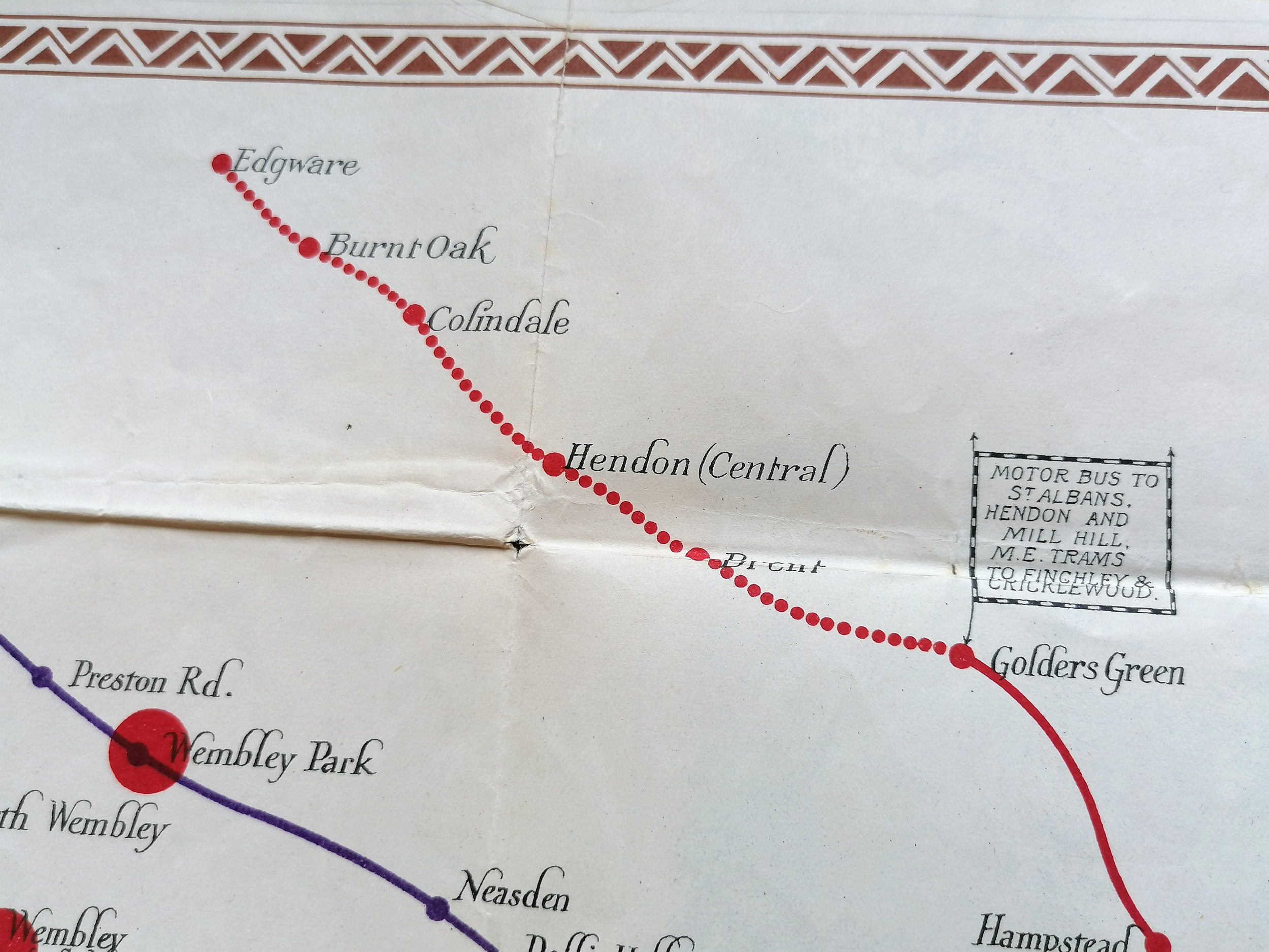
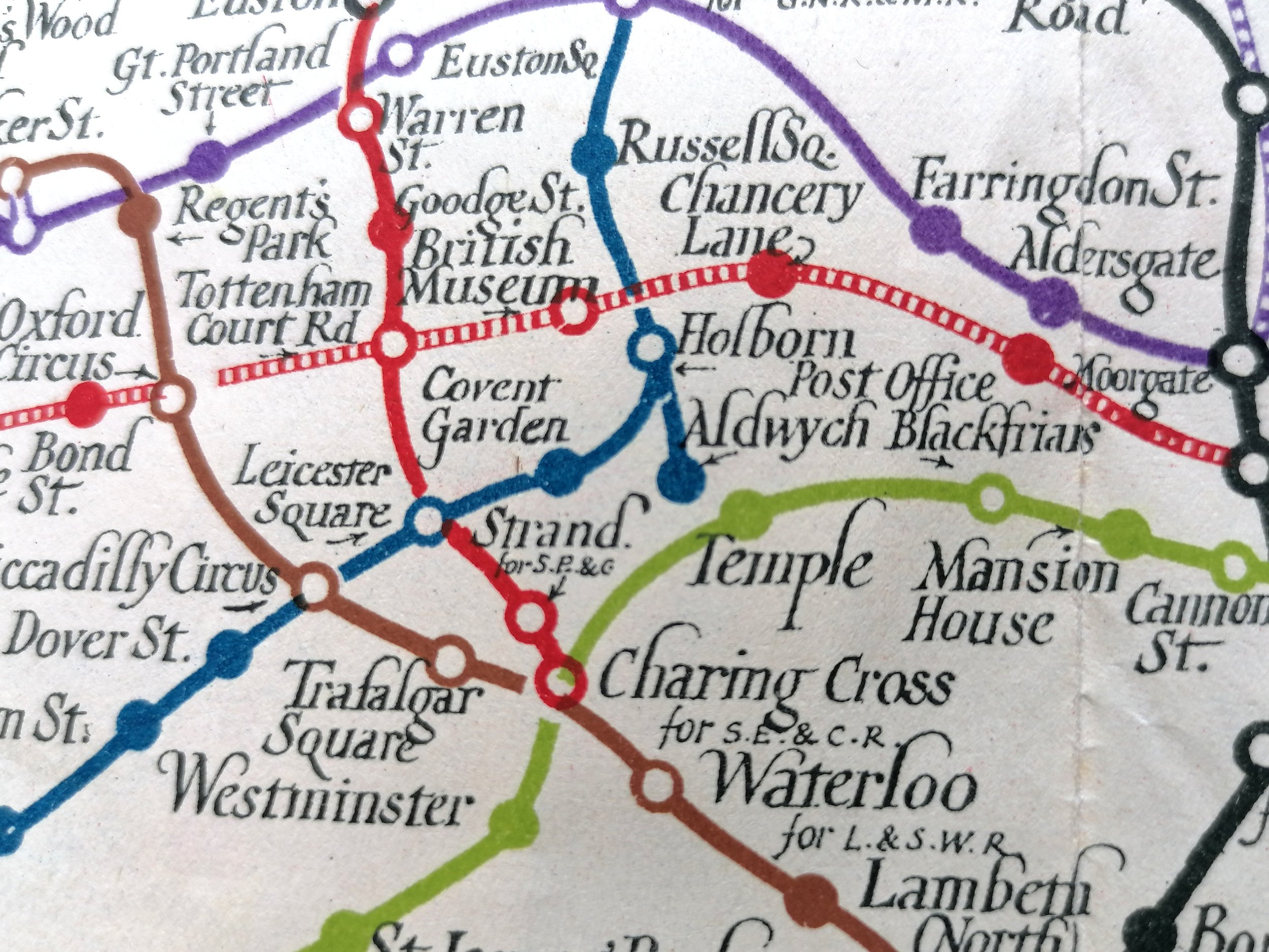
Gill applied an elegant and decorative quality to the Underground map with ornate borders and the use of calligraphy for station names whilst removing all topographical detail including the River Thames.In this edition, three red dots indicate the stations serving the British Empire Exhibition (later issues also show North Wembley to make 4 dots). The back of this issue has some nice photographic park scenes (Hampstead Heath, Richmond, London Zoo etc). This makes way for text in later issues.
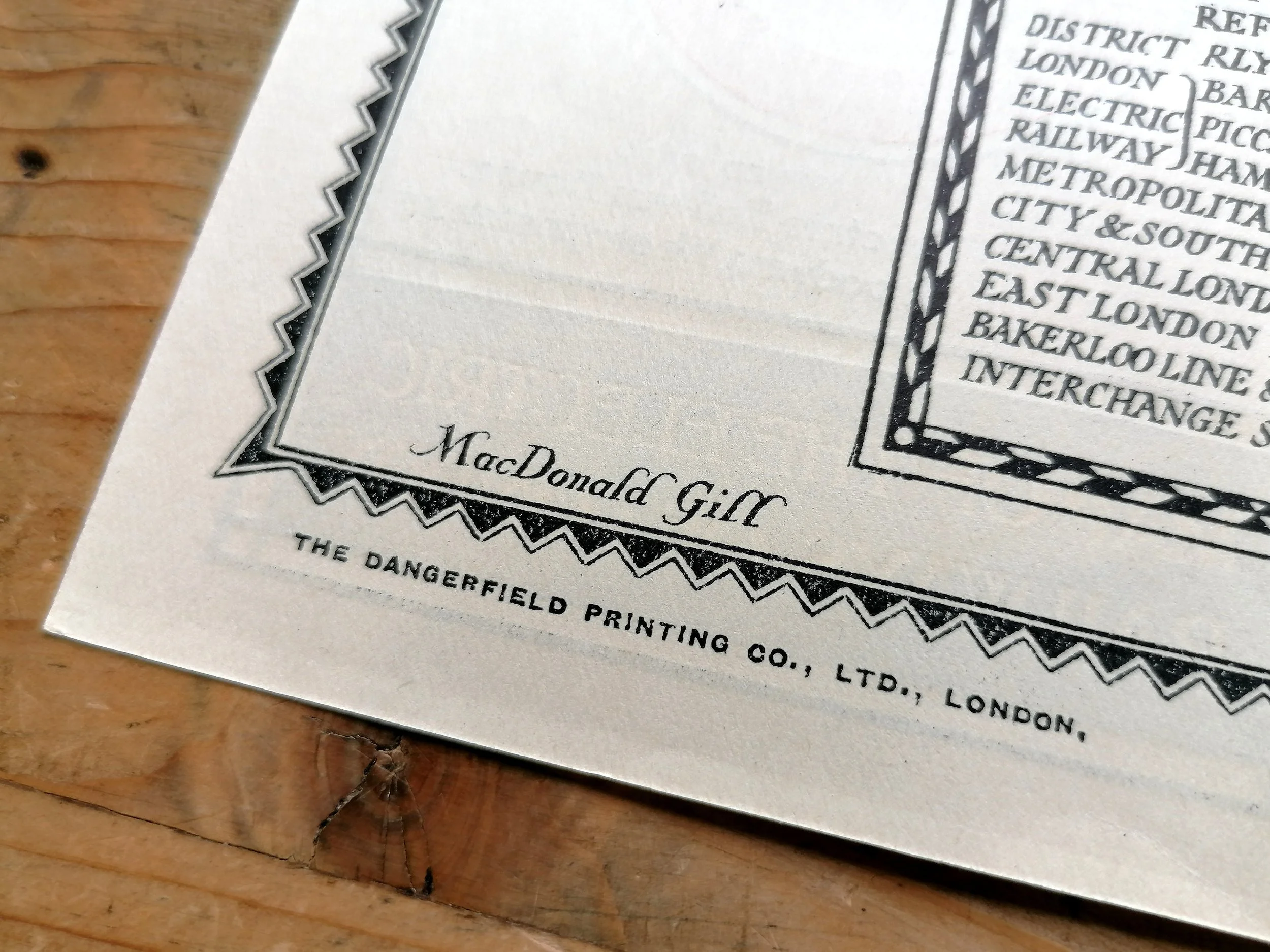
Max (as he was known to his friends) was a versatile and highly sought after artist, cartographer and illustrator that worked regularly with Frank Pick and the Underground Electric Railways Company. His most notable work for the Underground was in 1913 and the remarkable pictorial map of London titled "By Paying Us Your Pennies" (later renamed the Wonderground Map of London). Whilst Gill is best known for defining a new genre in pictorial mapping he boasts an enormous and varied body of work from childrens book illustration to architecture
Underground - What to See & How to Travel - Map of the Electric Railways of London. 1923
Designed by Macdonald Gill. Printed by Waterlow & Sons for London Underground Electric Railways. Folded paper pocket map. Print Code 1/1/23. Measures 45cm x 37cm. Condition: Very good lightly used example.
This wonderful fold-out pocket map of the London Underground was designed by Macdonald Gill who also designed maps of the Underground between 1920-1924. This was the largest of the series and the only one to bear the UndergrounD roundel on the map itself. The stations serving the British Empire Exhibition (1924) are shown as an bold red overprint. This is the 1st iteration of the 1923 Gill design that saw 4 dated issues (Jan '23, June' 23, Nov '23 and April' 24).
Gill applied an elegant and decorative quality to the Underground map with ornate borders and the use of calligraphy for station names whilst removing all topographical detail including the River Thames.In this edition, three red dots indicate the stations serving the British Empire Exhibition (later issues also show North Wembley to make 4 dots). The back of this issue has some nice photographic park scenes (Hampstead Heath, Richmond, London Zoo etc). This makes way for text in later issues.
Max (as he was known to his friends) was a versatile and highly sought after artist, cartographer and illustrator that worked regularly with Frank Pick and the Underground Electric Railways Company. His most notable work for the Underground was in 1913 and the remarkable pictorial map of London titled "By Paying Us Your Pennies" (later renamed the Wonderground Map of London). Whilst Gill is best known for defining a new genre in pictorial mapping he boasts an enormous and varied body of work from childrens book illustration to architecture
- Price does NOT include delivery.
- Delivery/collection must be purchased/organised separate to product purchase.
- Please ensure you have read and agree to the conditions within our Returns Policy (link at bottom of page)
- Please use the Enquiry Form below to request a delivery estimate, if required.
Enquire about this item