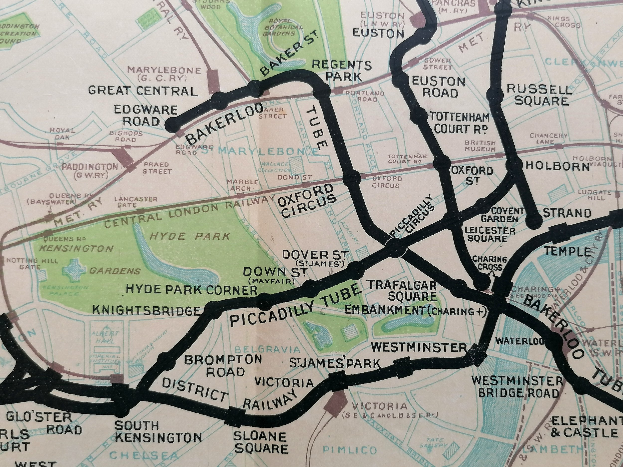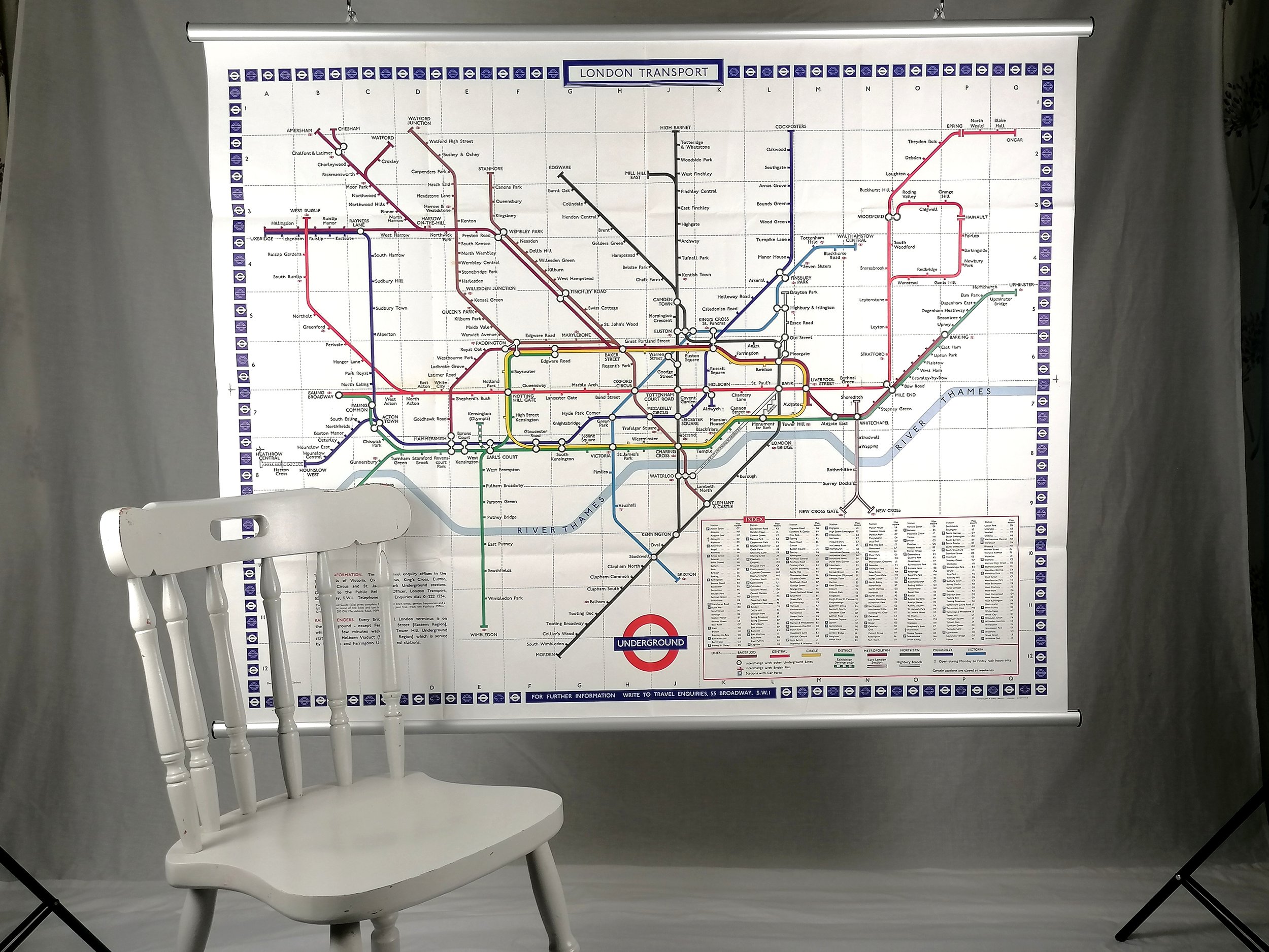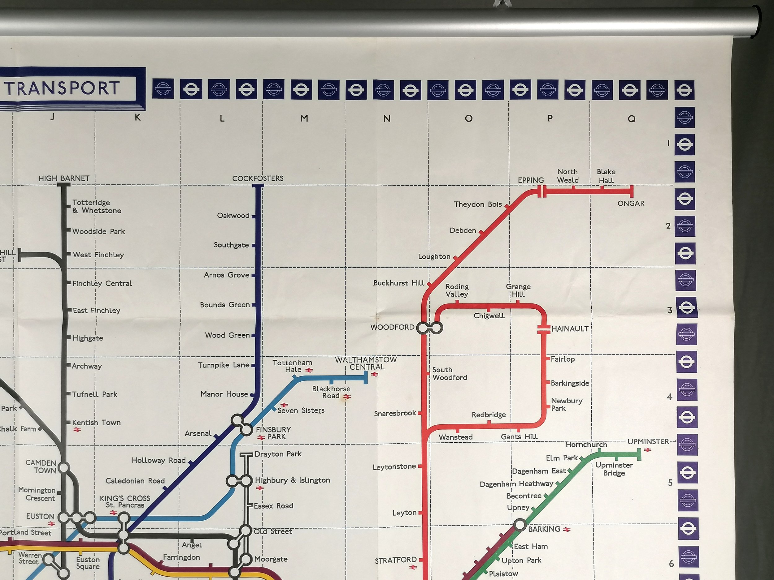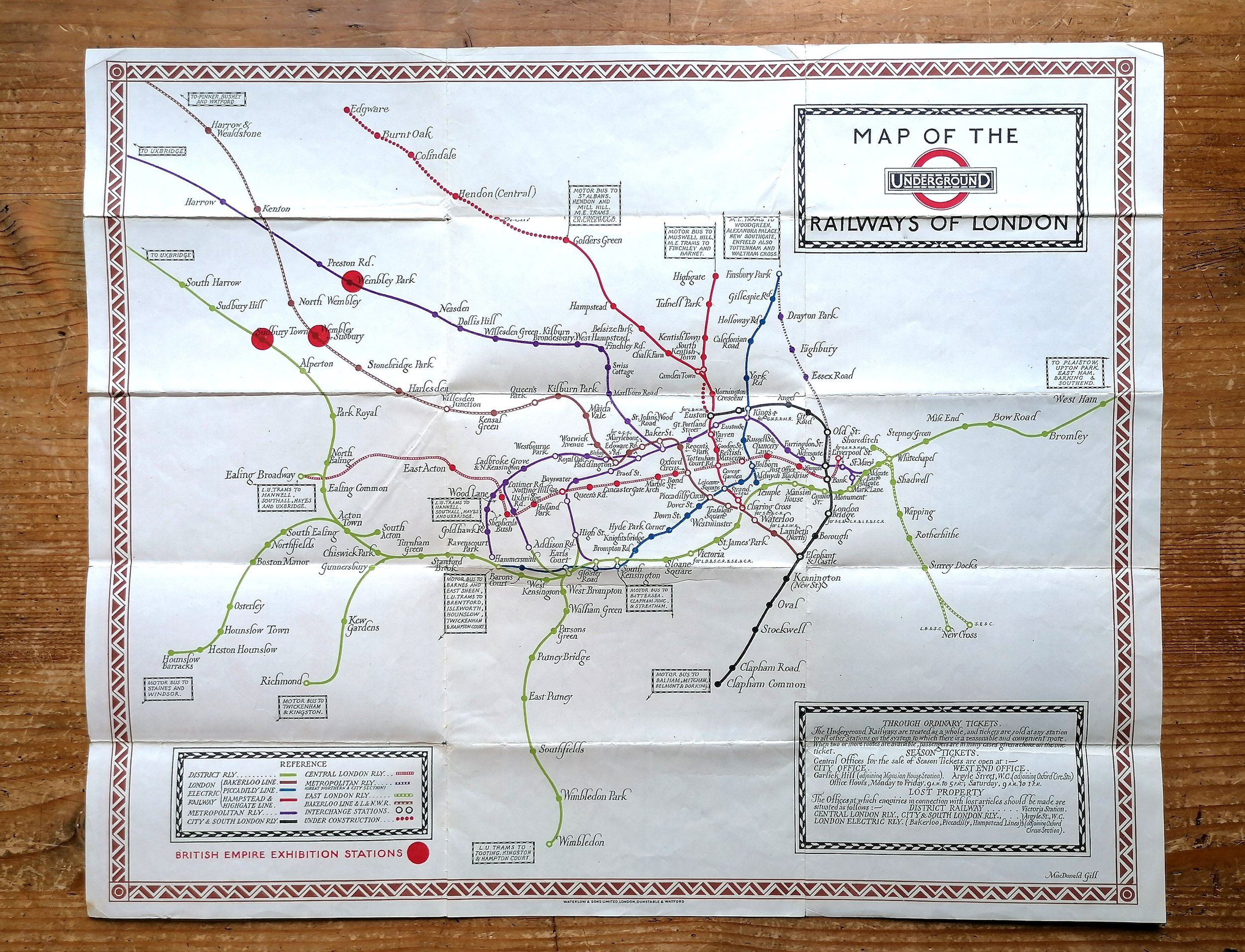
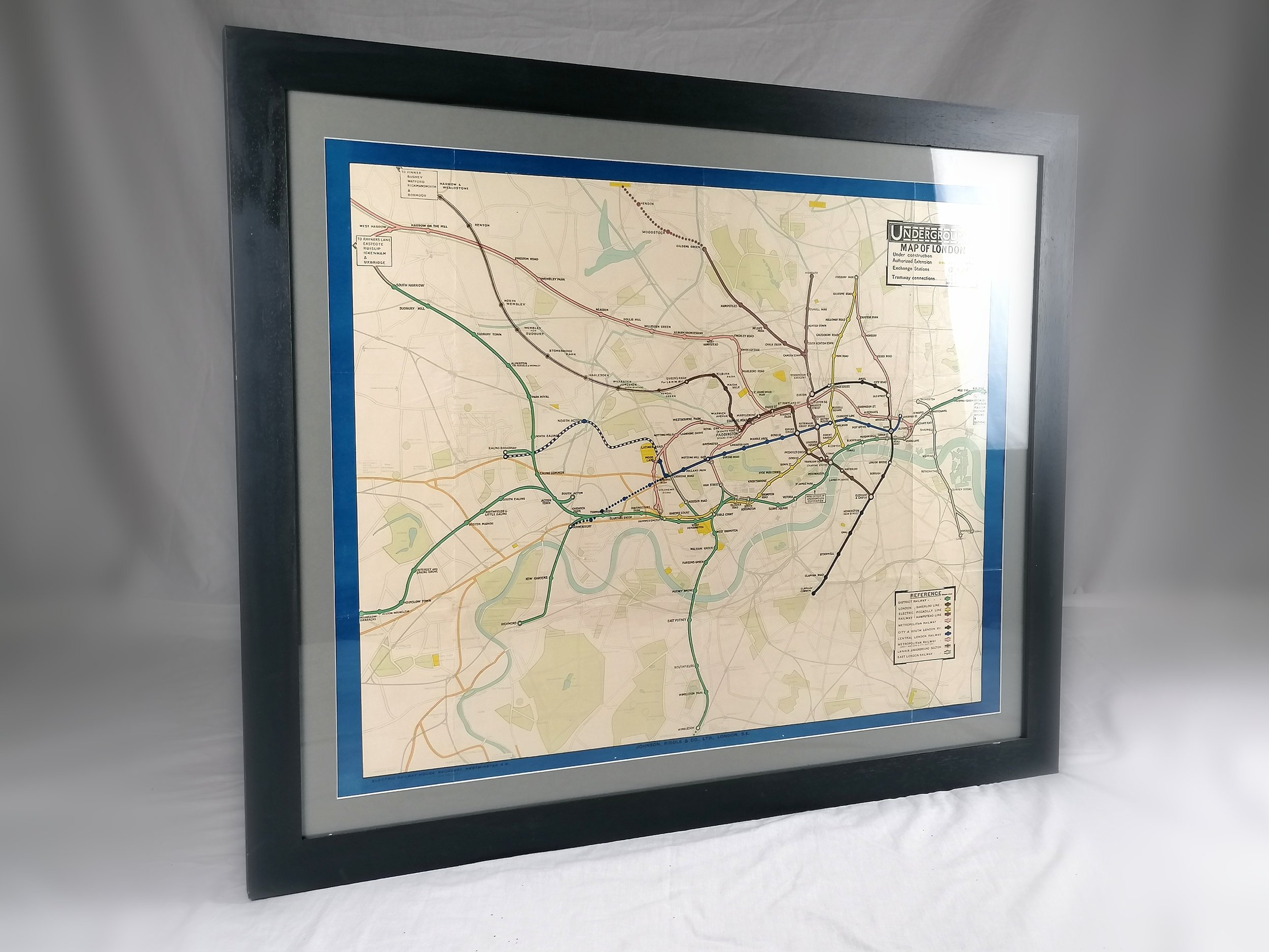

1917 London Underground Station Map (Double Crown)
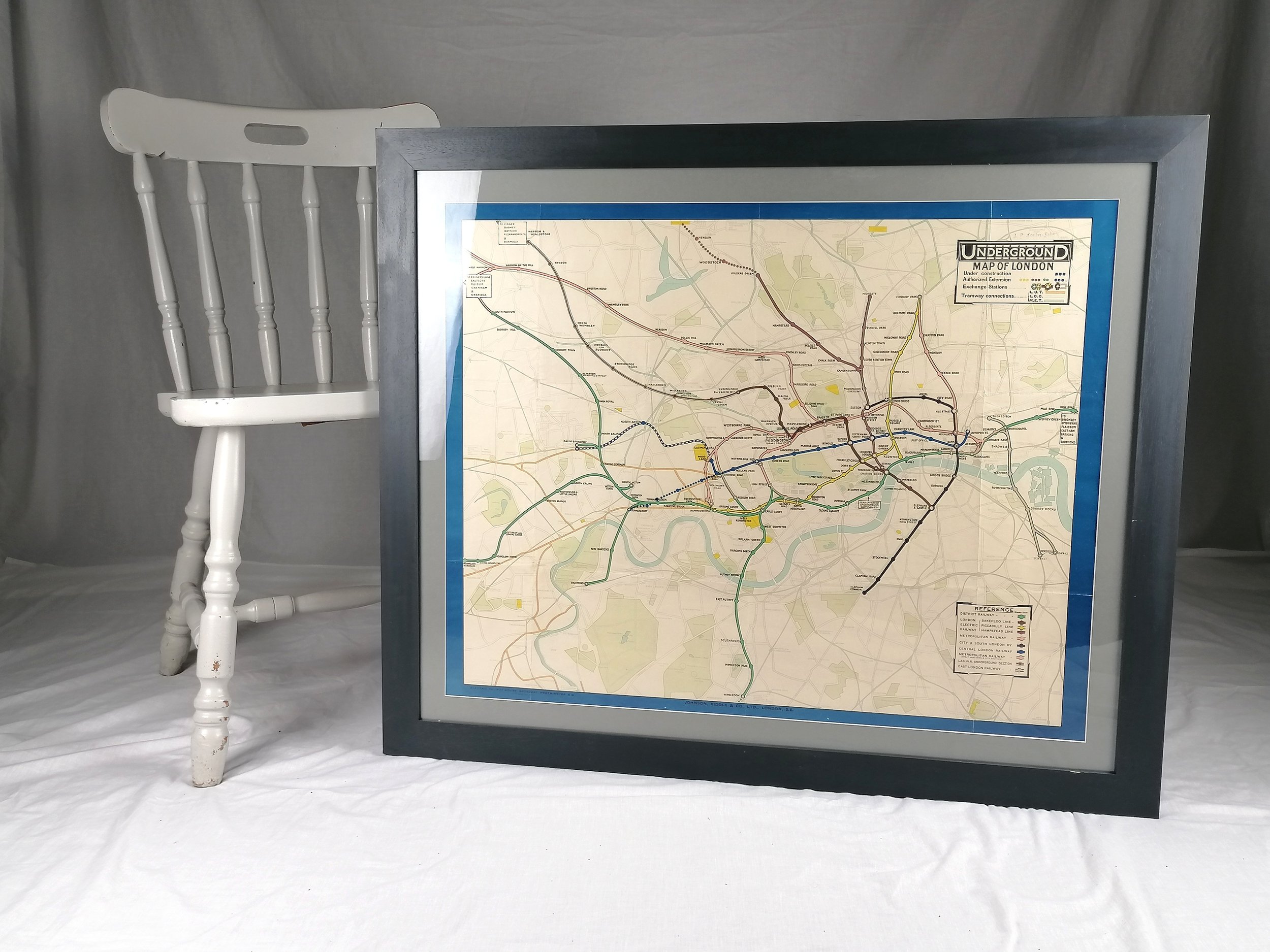
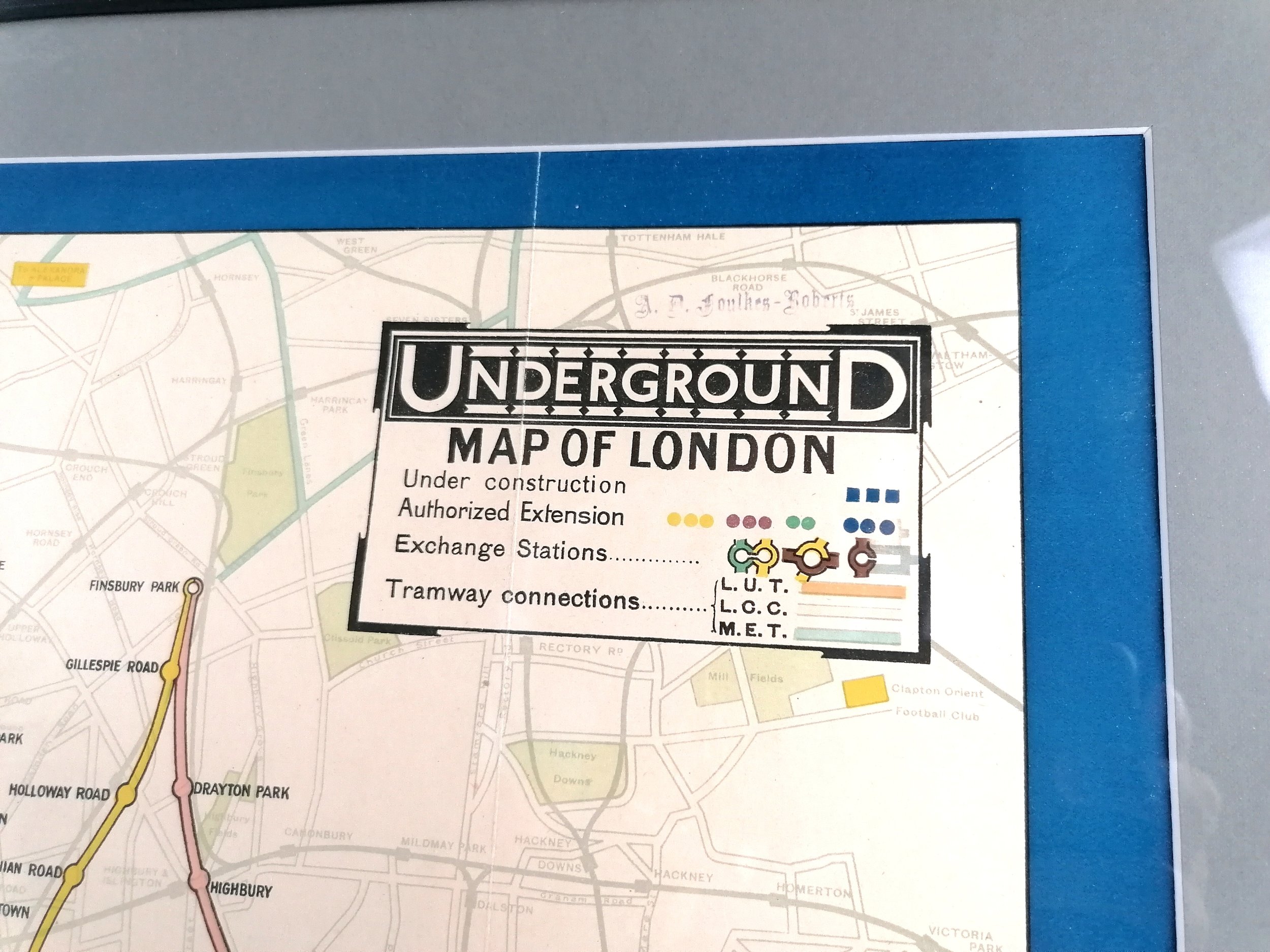
Underground Map of London
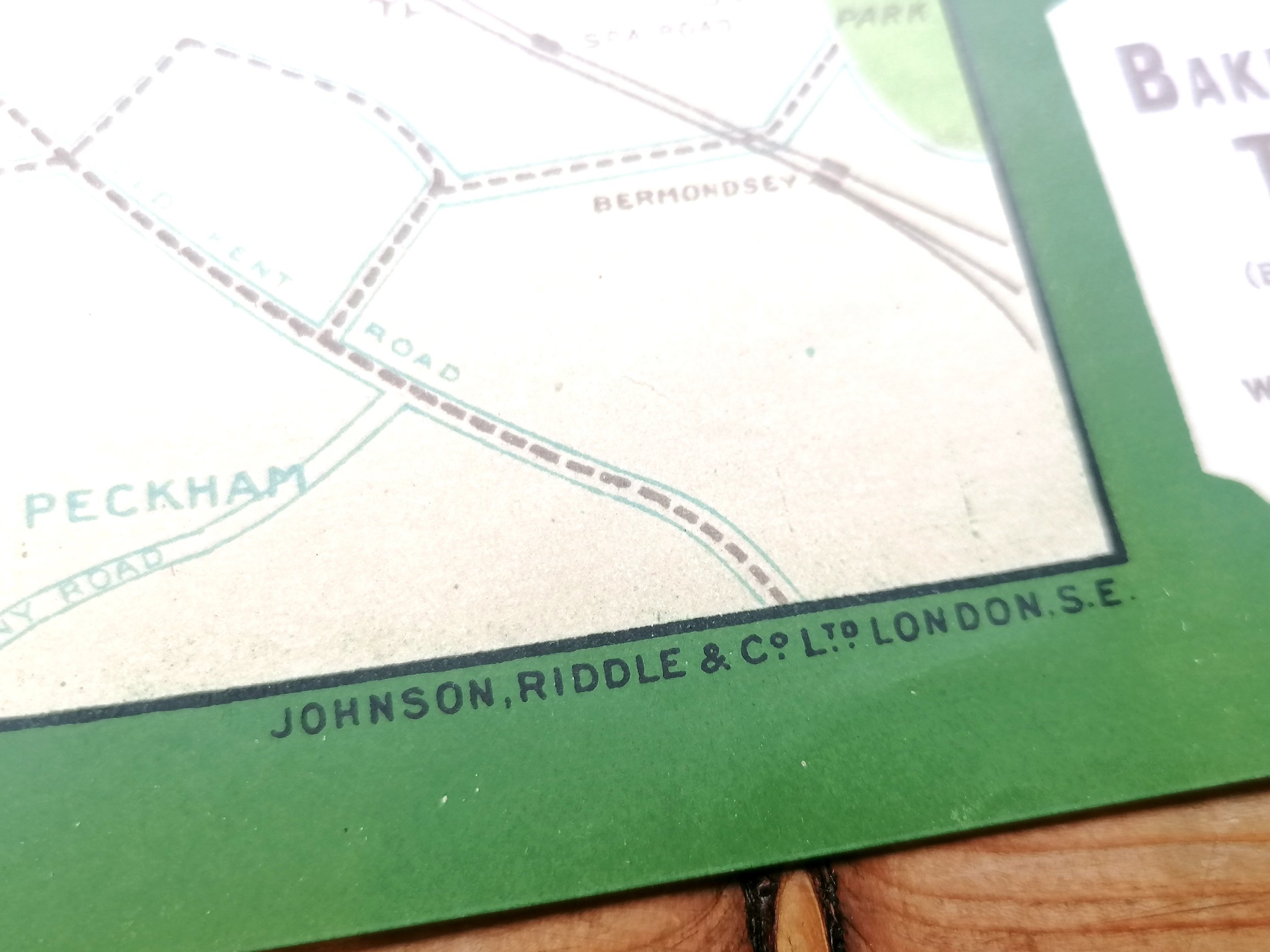
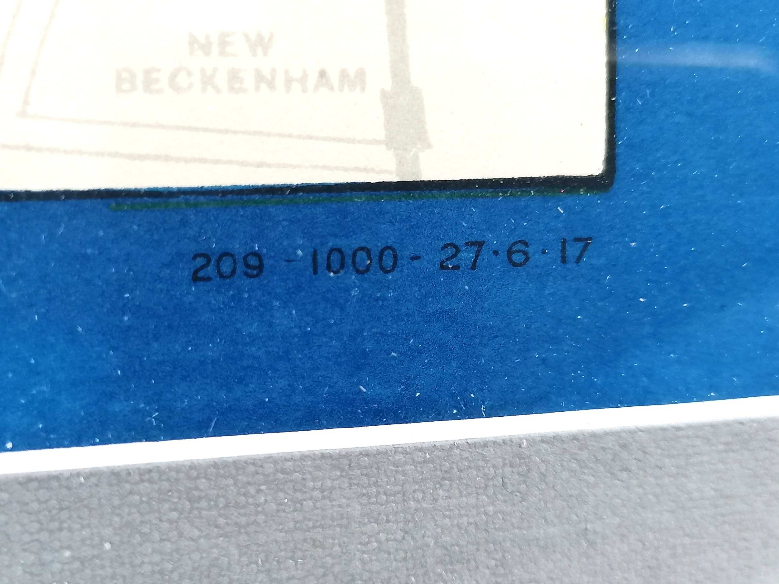
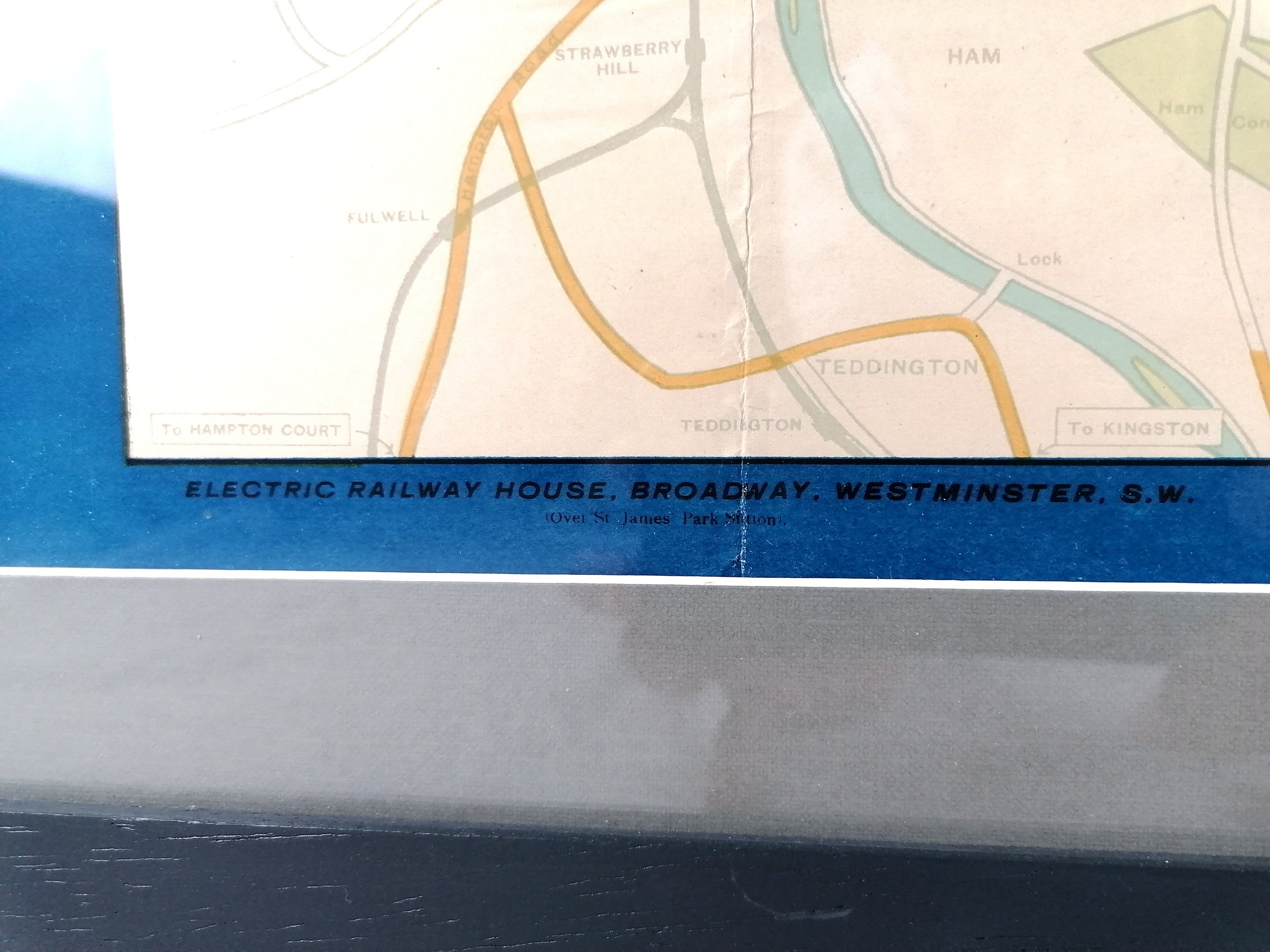
Printed by Johnson Riddle & Co Limited for Underground Railways Company of London Ltd. Colour lithograph on paper. Measures 30” x 24” . Print Code 209 - 1000 - 27.6.17. Presented in a custom frame with museum grade ArtGlass (UV protection). Available Framed of Unframed. Condition: Excellent. Some minor restoration/strengthening to the rear of the map which is not visible from the front. Folds as issued.
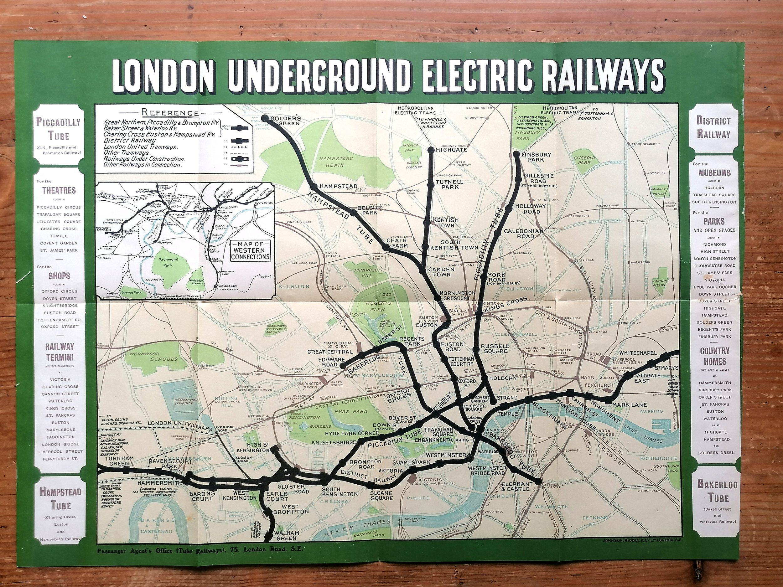
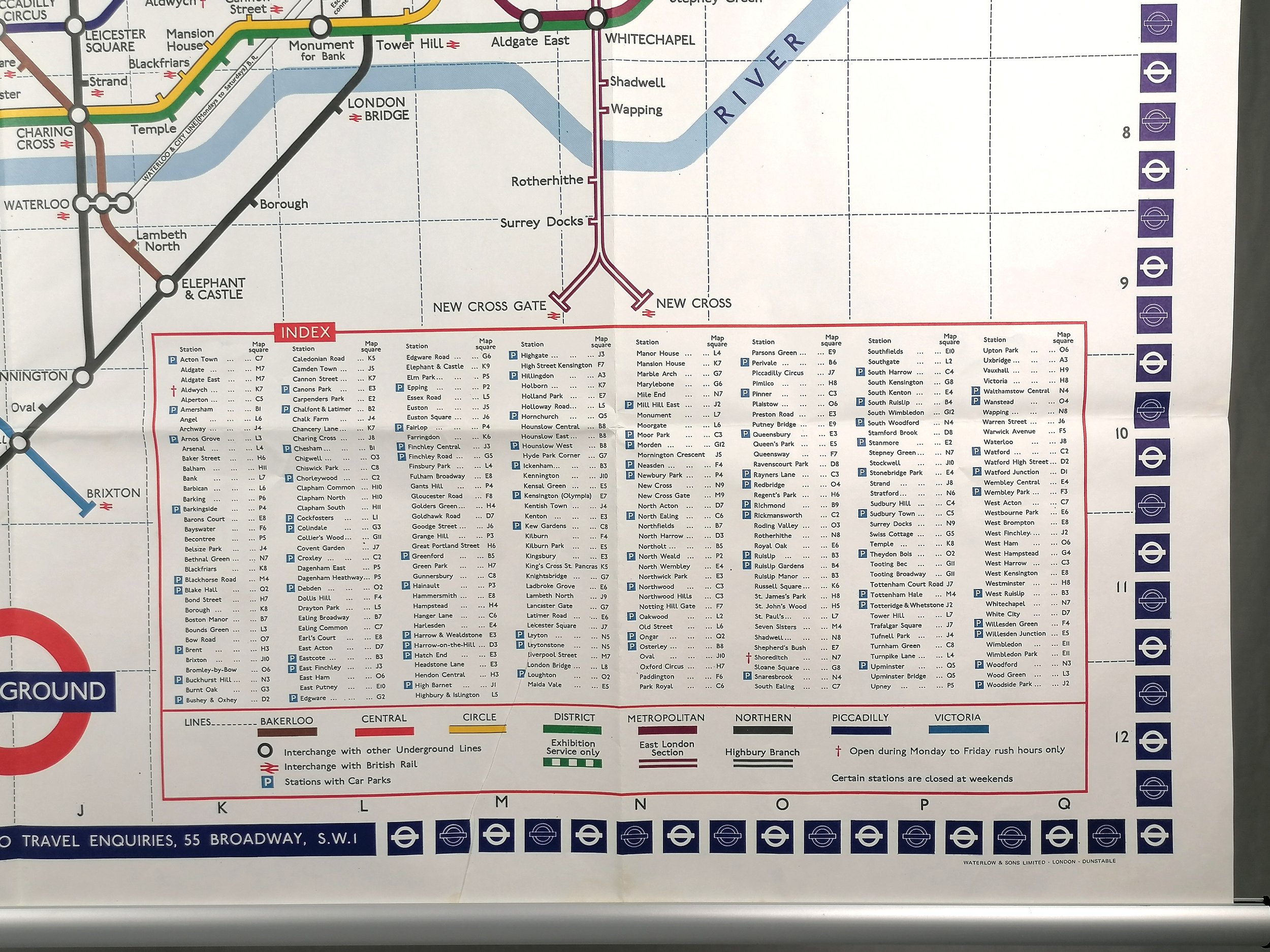
This wonderful WWI station map for the London Underground is the earliest example we have ever seen for sale. These large format maps were displayed in station entrances, ticket halls, walkways and platforms. This is a remarkable survivor in fabulous condition.
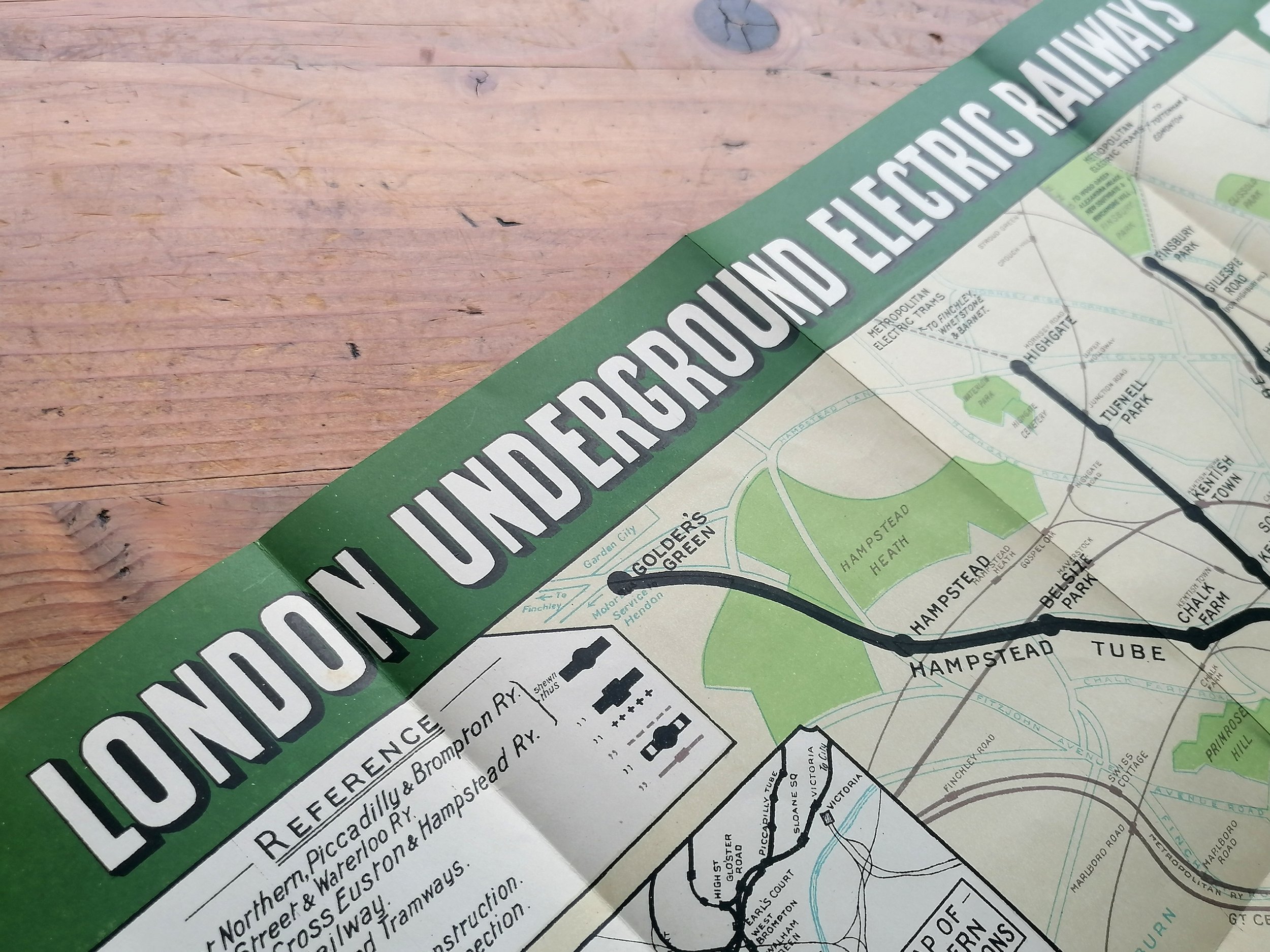
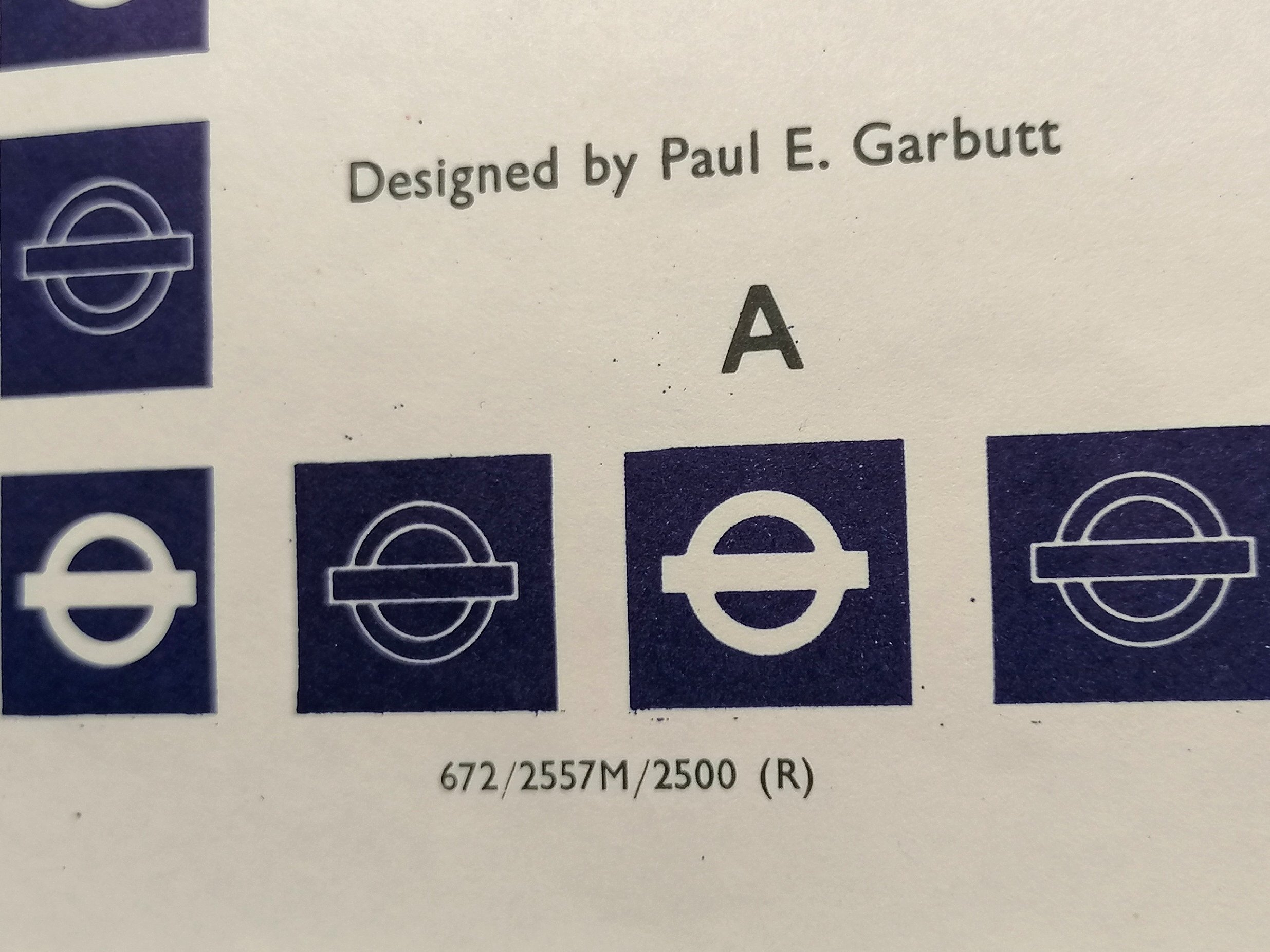
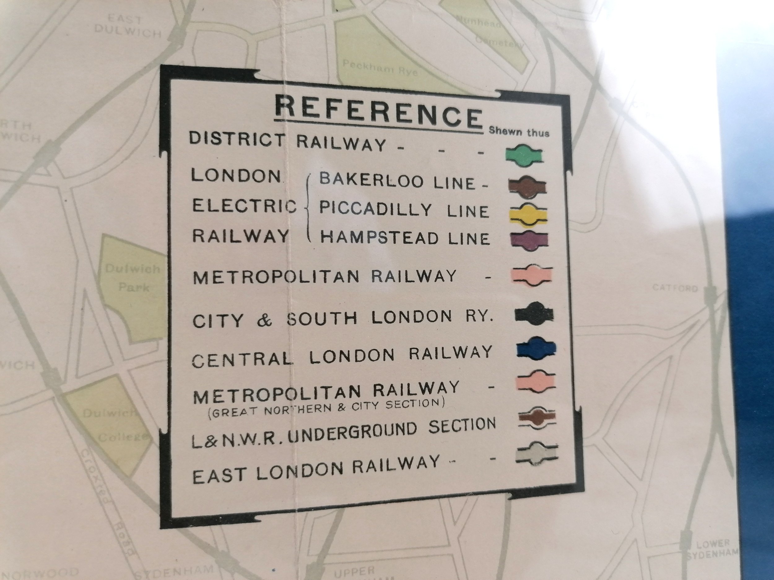
Unified maps, both pocket size and station posters, started to appear from 1908 following an agreement between the separate underground railway companies to present themselves as a single network and under a common ‘UndergrounD’ brand. In 1916, the Johnston Sans typeface was introduced and remains a core part of the visual identity of the Underground to this day. This poster carries one of the earliest examples of the Johnston ‘UndergrounD’ workmark.
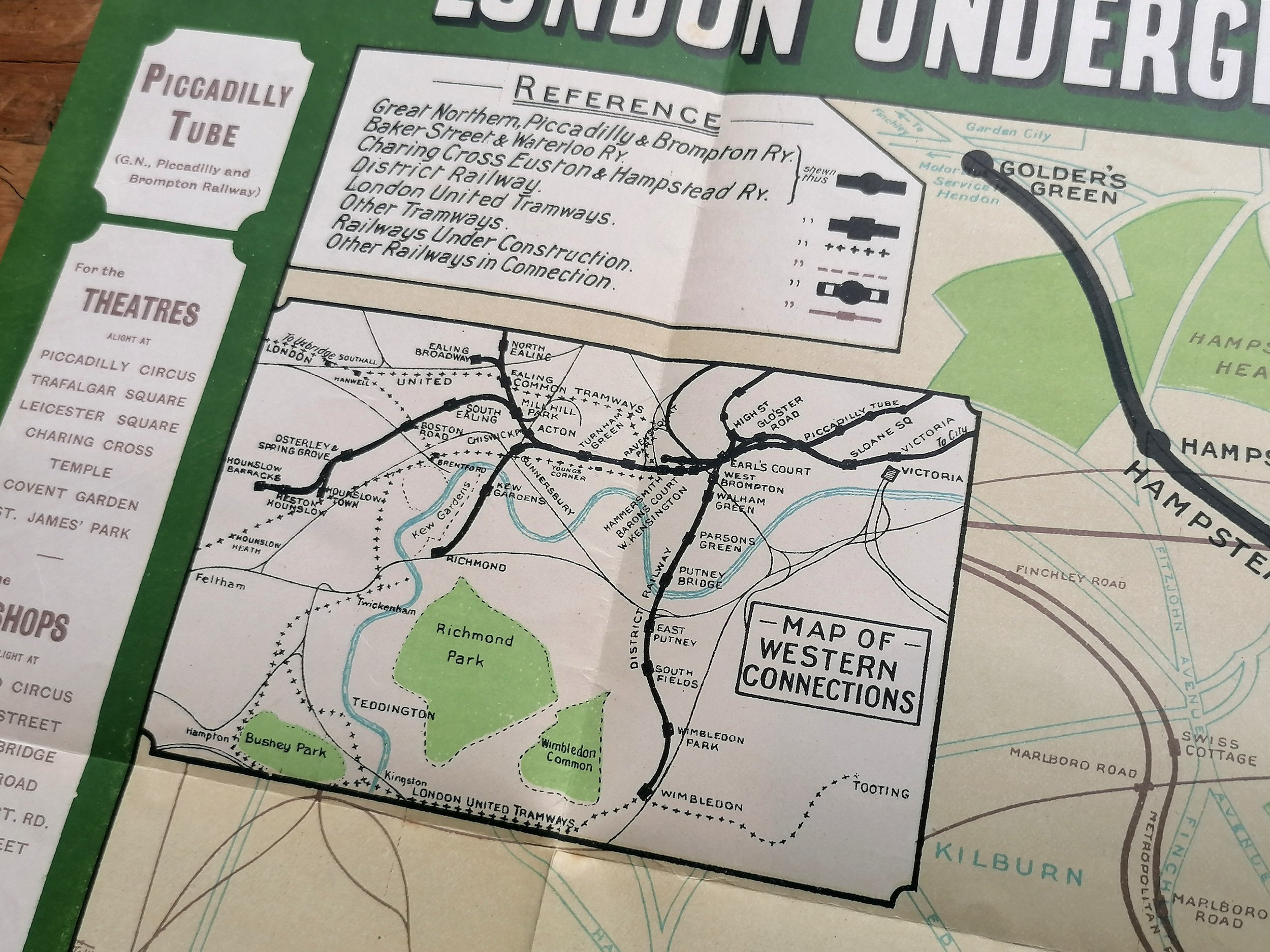
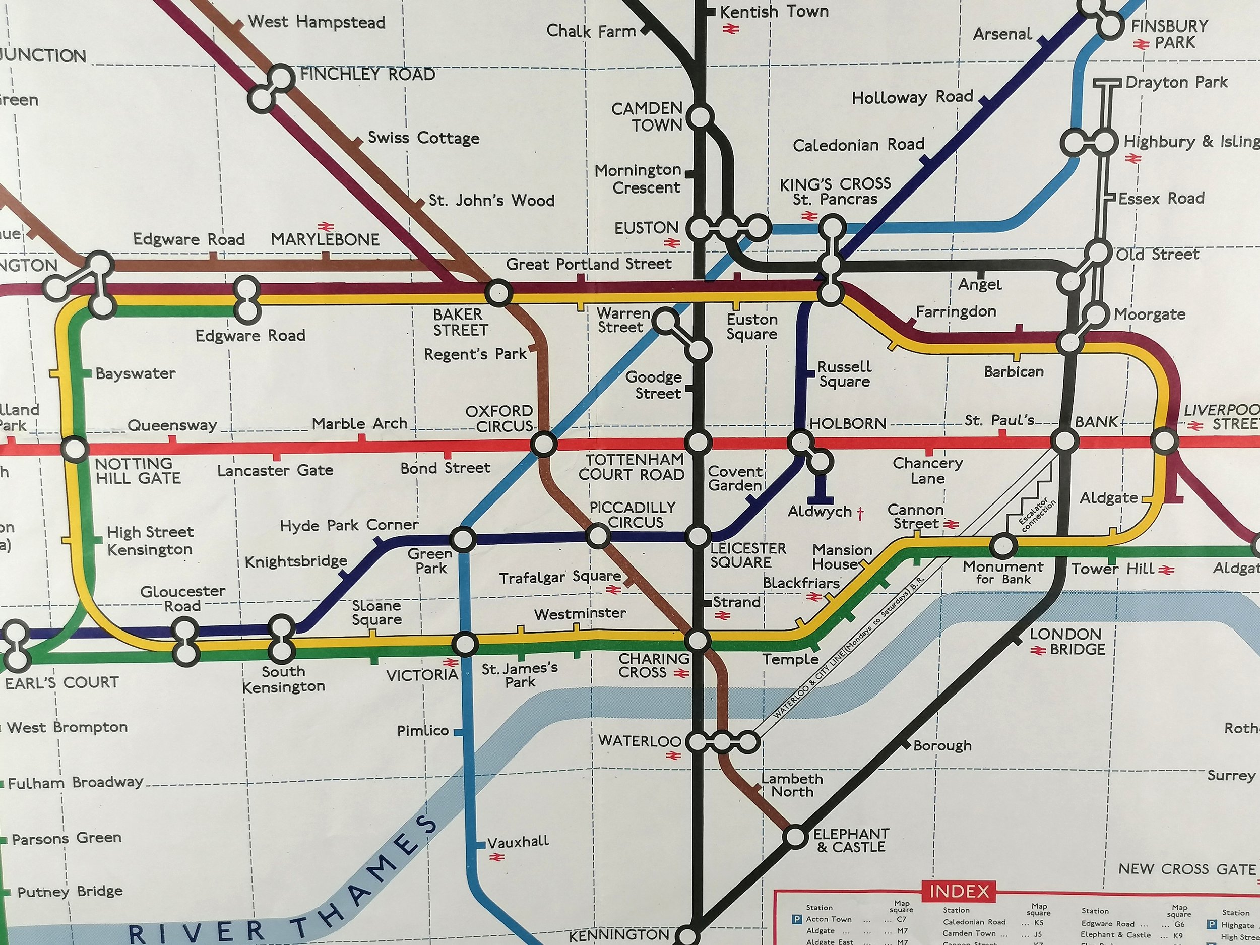
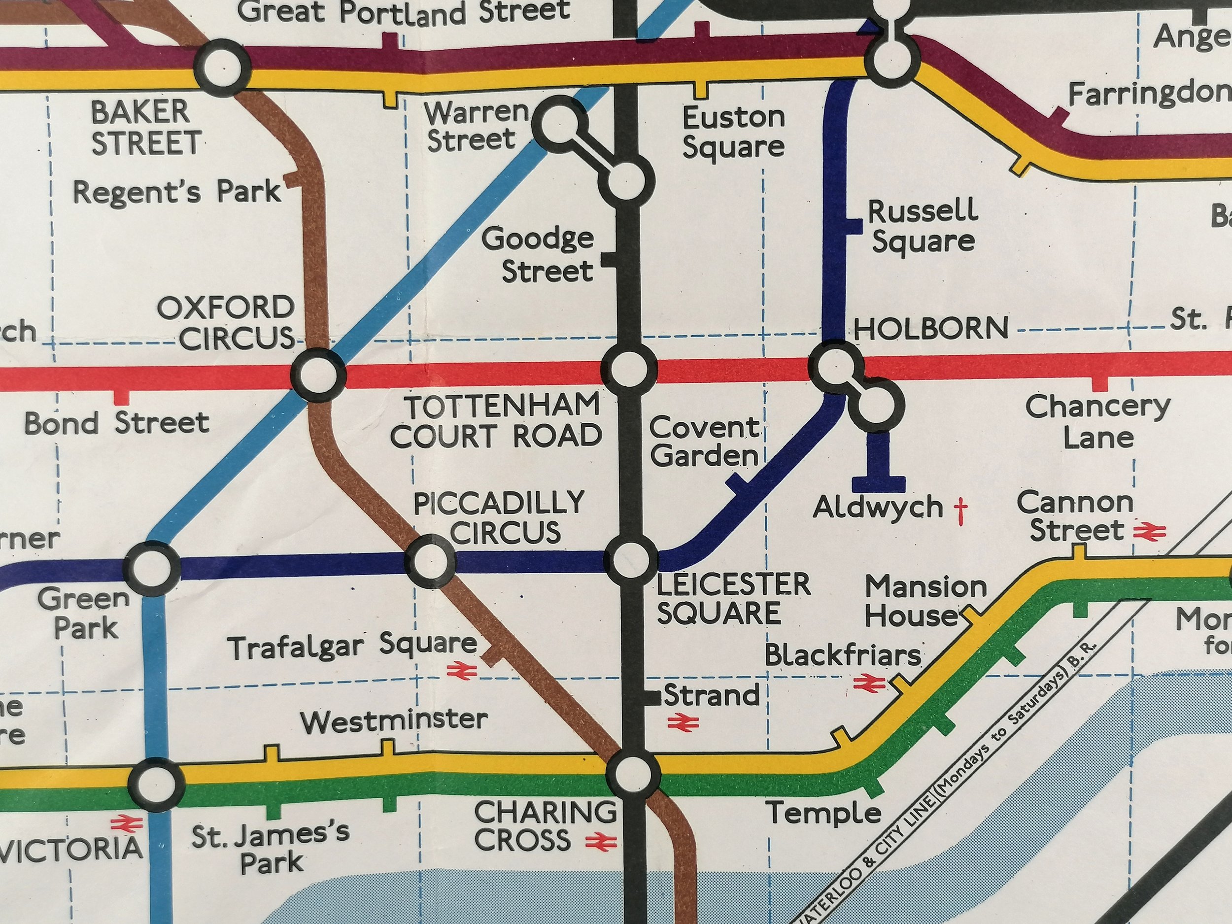
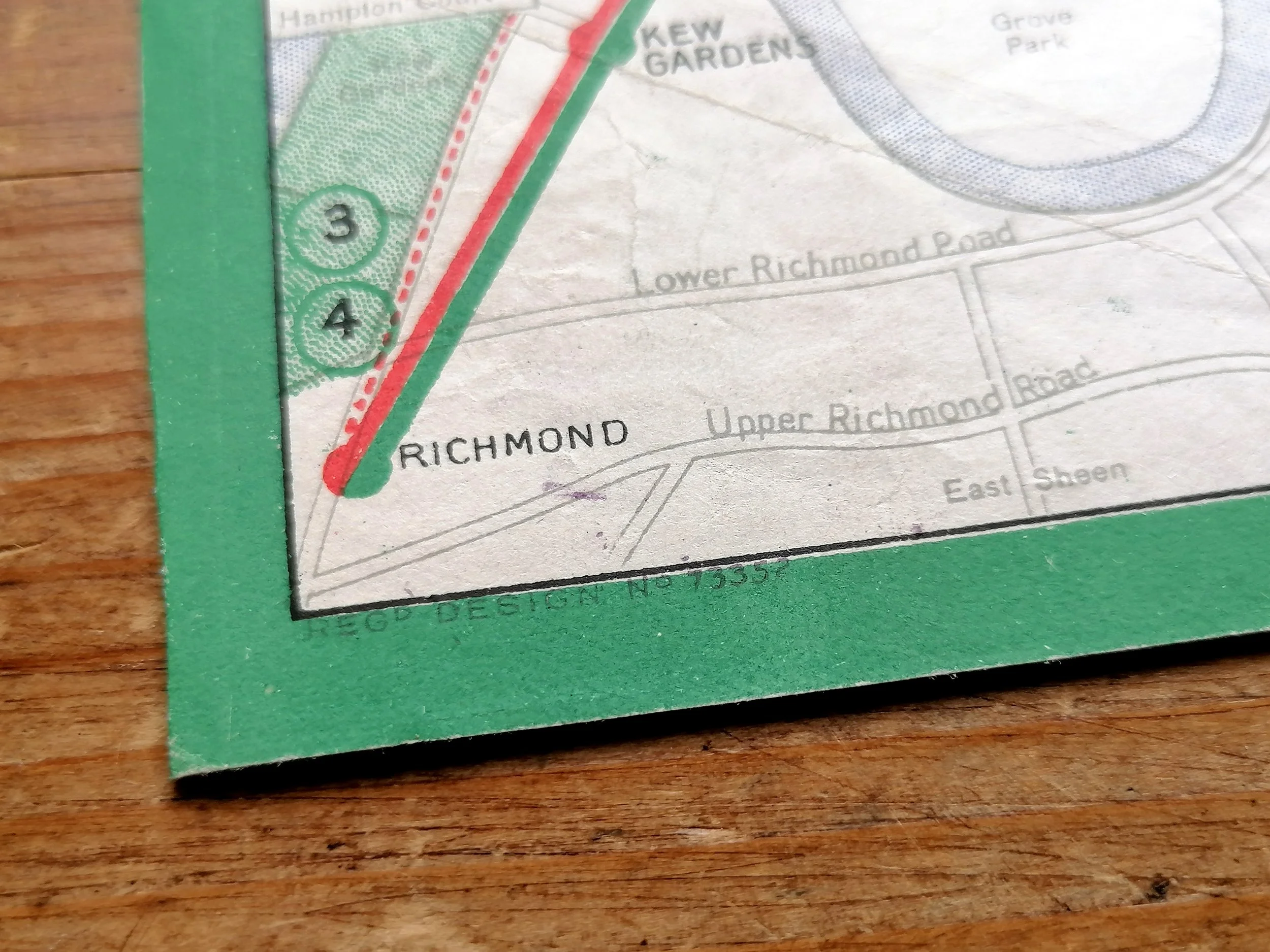
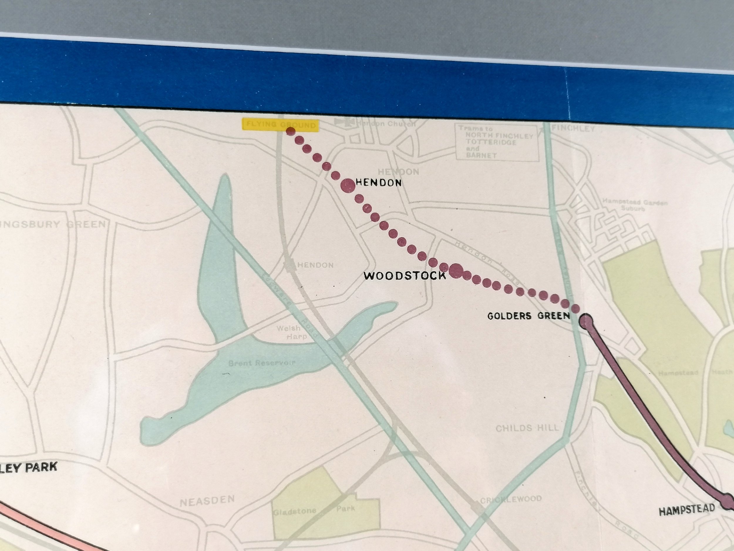
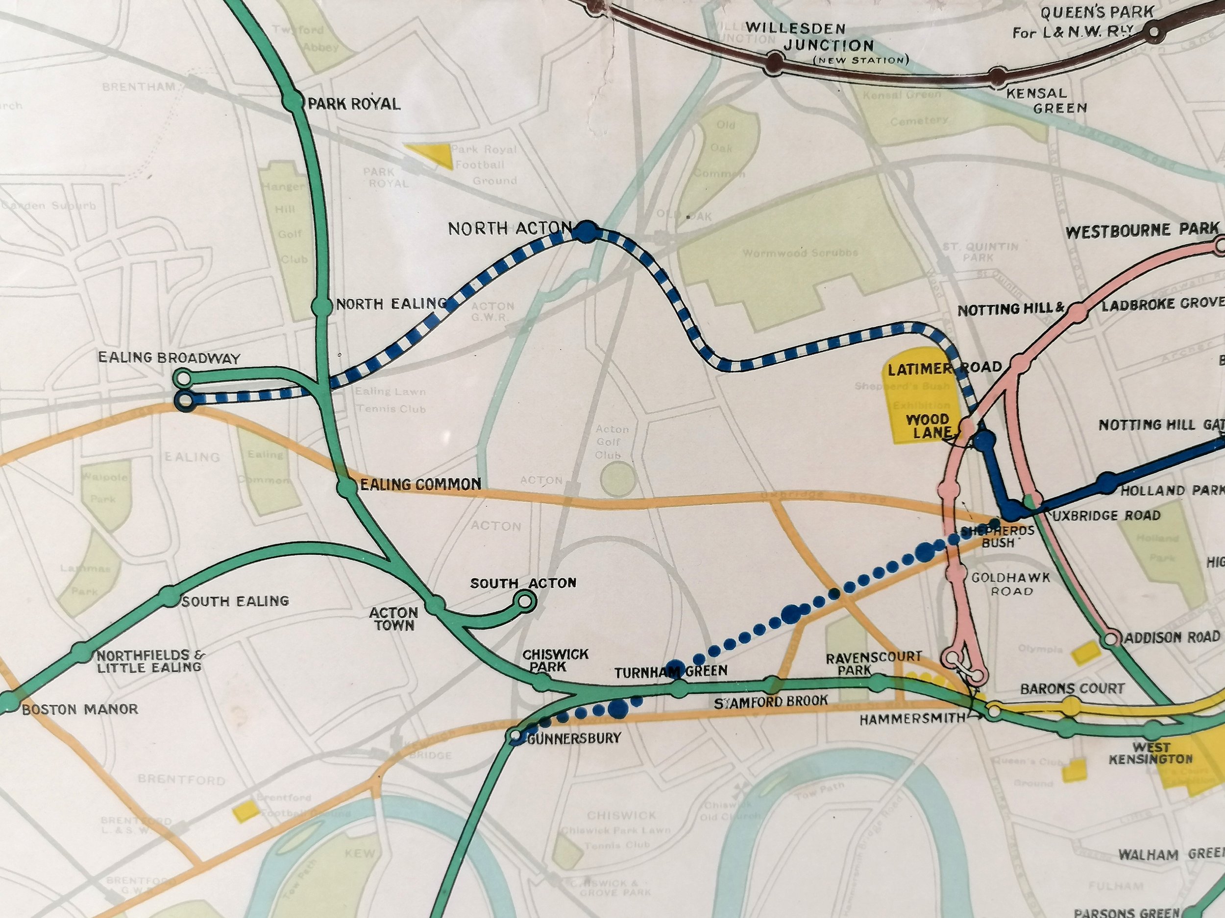
Despite the austerities of war, a number of intended extension projects feature on this map, some of which were never completed (eg. The Central London Railway extension from Shepherds Bush to Gunnersbury). Unlike later maps, there is a high degree of background detail, showing roads, green spaces, water bodies and large exhibition grounds (yellow). To add another layer of complexity, Tramway routes and connections are also shown.
Free UK Delivery. Only available Unframed for international delivery and a quote can be provided upon request.
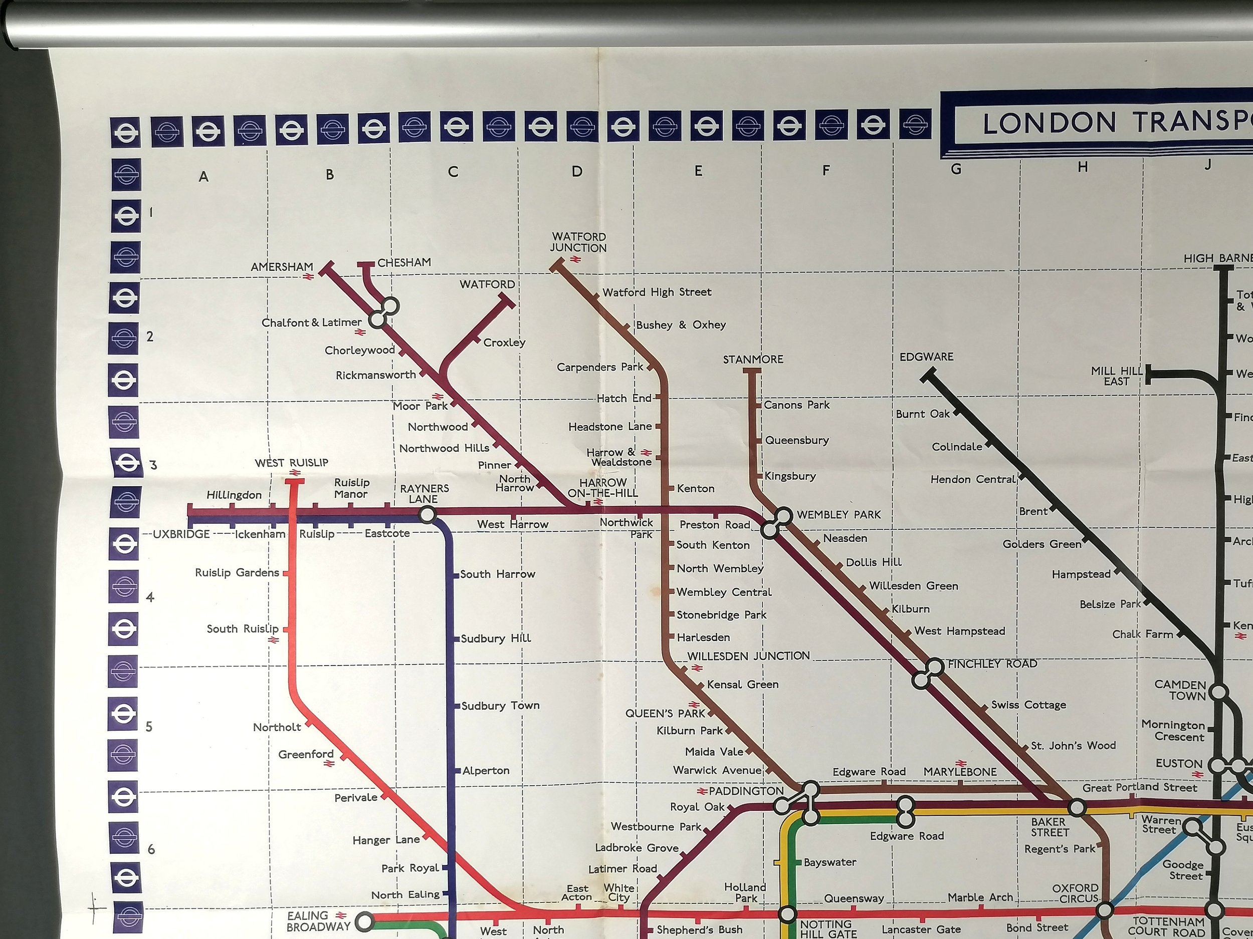
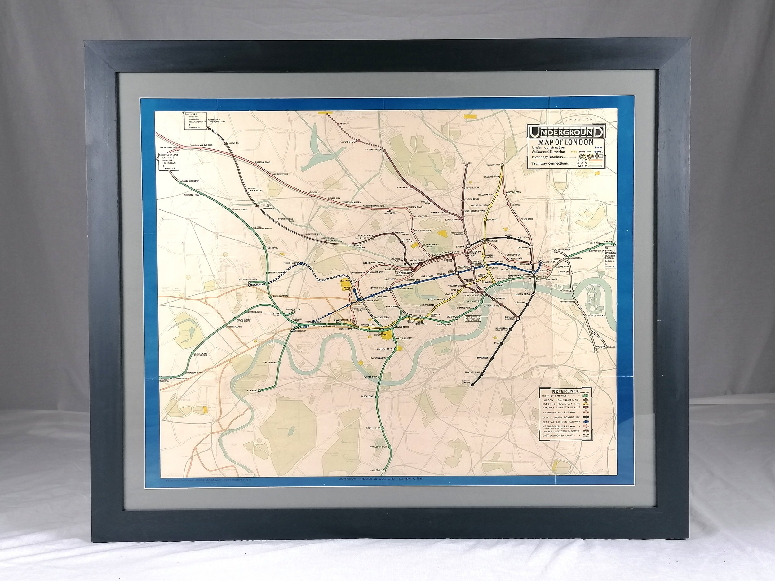
Underground Map of London
Printed by Johnson Riddle & Co Limited for Underground Railways Company of London Ltd. Colour lithograph on paper. Measures 30” x 24” . Print Code 209 - 1000 - 27.6.17. Presented in a custom frame with museum grade ArtGlass (UV protection). Available Framed of Unframed. Condition: Excellent. Some minor restoration/strengthening to the rear of the map which is not visible from the front. Folds as issued.
This wonderful WWI station map for the London Underground is the earliest example we have ever seen for sale. These large format maps were displayed in station entrances, ticket halls, walkways and platforms. This is a remarkable survivor in fabulous condition.
Unified maps, both pocket size and station posters, started to appear from 1908 following an agreement between the separate underground railway companies to present themselves as a single network and under a common ‘UndergrounD’ brand. In 1916, the Johnston Sans typeface was introduced and remains a core part of the visual identity of the Underground to this day. This poster carries one of the earliest examples of the Johnston ‘UndergrounD’ workmark.
Despite the austerities of war, a number of intended extension projects feature on this map, some of which were never completed (eg. The Central London Railway extension from Shepherds Bush to Gunnersbury). Unlike later maps, there is a high degree of background detail, showing roads, green spaces, water bodies and large exhibition grounds (yellow). To add another layer of complexity, Tramway routes and connections are also shown.
Free UK Delivery. Only available Unframed for international delivery and a quote can be provided upon request.
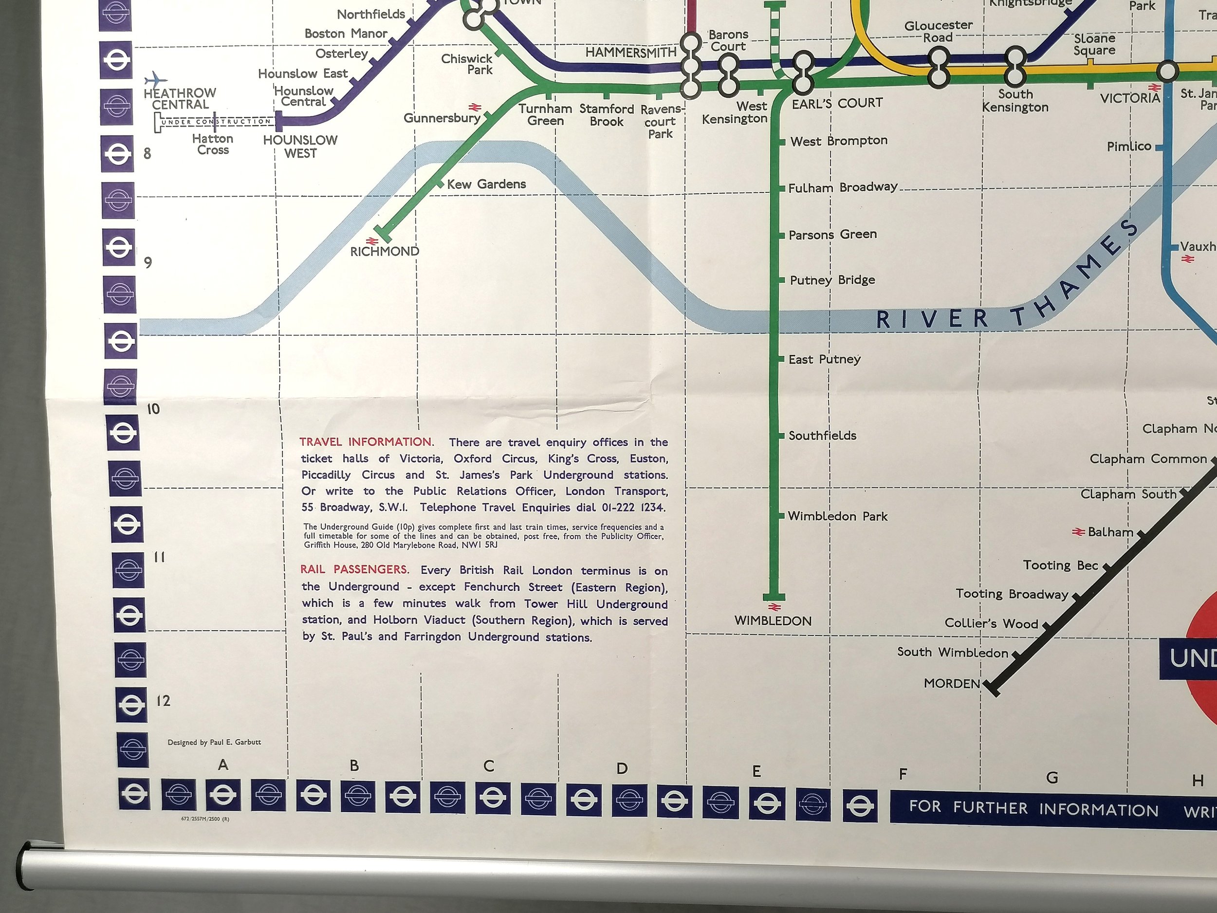
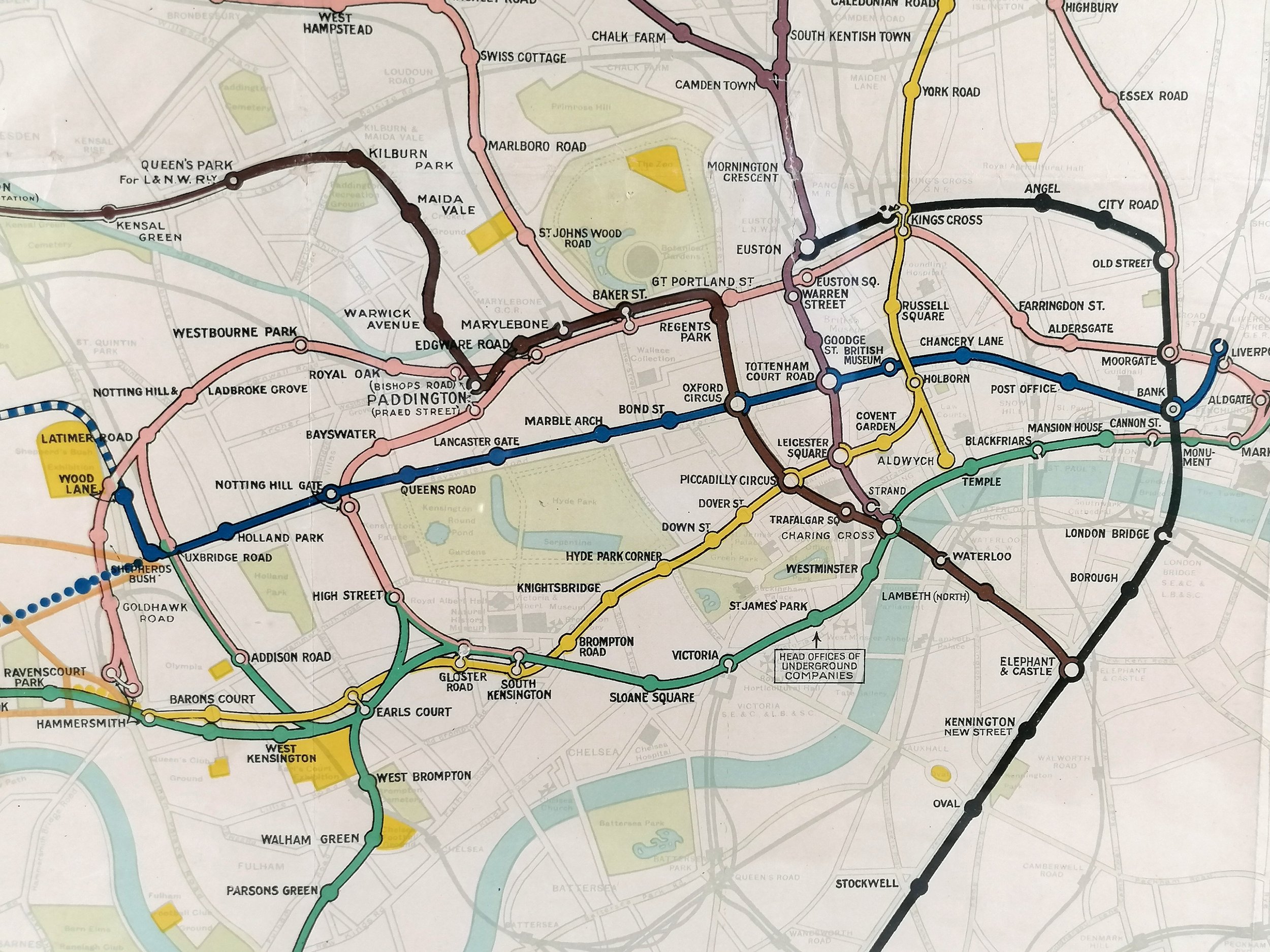
Underground Map of London
Printed by Johnson Riddle & Co Limited for Underground Railways Company of London Ltd. Colour lithograph on paper. Measures 30” x 24” . Print Code 209 - 1000 - 27.6.17. Presented in a custom frame with museum grade ArtGlass (UV protection). Available Framed of Unframed. Condition: Excellent. Some minor restoration/strengthening to the rear of the map which is not visible from the front. Folds as issued.
This wonderful WWI station map for the London Underground is the earliest example we have ever seen for sale. These large format maps were displayed in station entrances, ticket halls, walkways and platforms. This is a remarkable survivor in fabulous condition.
Unified maps, both pocket size and station posters, started to appear from 1908 following an agreement between the separate underground railway companies to present themselves as a single network and under a common ‘UndergrounD’ brand. In 1916, the Johnston Sans typeface was introduced and remains a core part of the visual identity of the Underground to this day. This poster carries one of the earliest examples of the Johnston ‘UndergrounD’ workmark.
Despite the austerities of war, a number of intended extension projects feature on this map, some of which were never completed (eg. The Central London Railway extension from Shepherds Bush to Gunnersbury). Unlike later maps, there is a high degree of background detail, showing roads, green spaces, water bodies and large exhibition grounds (yellow). To add another layer of complexity, Tramway routes and connections are also shown.
Free UK Delivery. Only available Unframed for international delivery and a quote can be provided upon request.